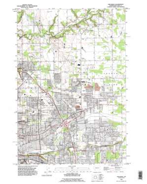
Orchards Topo Map Washington
To zoom in, hover over the map of Orchards
USGS Topo Quad 45122f5 - 1:24,000 scale
| Topo Map Name: | Orchards |
| USGS Topo Quad ID: | 45122f5 |
| Print Size: | ca. 21 1/4" wide x 27" high |
| Southeast Coordinates: | 45.625° N latitude / 122.5° W longitude |
| Map Center Coordinates: | 45.6875° N latitude / 122.5625° W longitude |
| U.S. State: | WA |
| Filename: | o45122f5.jpg |
| Download Map JPG Image: | Orchards topo map 1:24,000 scale |
| Map Type: | Topographic |
| Topo Series: | 7.5´ |
| Map Scale: | 1:24,000 |
| Source of Map Images: | United States Geological Survey (USGS) |
| Alternate Map Versions: |
Orchards WA 1954, updated 1956 Download PDF Buy paper map Orchards WA 1961, updated 1961 Download PDF Buy paper map Orchards WA 1961, updated 1972 Download PDF Buy paper map Orchards WA 1961, updated 1977 Download PDF Buy paper map Orchards WA 1961, updated 1980 Download PDF Buy paper map Orchards WA 1975, updated 1977 Download PDF Buy paper map Orchards WA 1990, updated 1995 Download PDF Buy paper map Orchards WA 2011 Download PDF Buy paper map Orchards WA 2013 Download PDF Buy paper map |
1:24,000 Topo Quads surrounding Orchards
> Back to 45122e1 at 1:100,000 scale
> Back to 45122a1 at 1:250,000 scale
> Back to U.S. Topo Maps home
Orchards topo map: Gazetteer
Orchards: Airports
Clark County Airport elevation 84m 275′Orchards: Crossings
Interchange 30 elevation 59m 193′Interchange 32 elevation 77m 252′
Orchards: Dams
Salmon Spring Pond Dam elevation 61m 200′Orchards: Flats
Fourth Plains elevation 86m 282′Orchards: Populated Places
Barberton elevation 75m 246′Brush Prairie elevation 92m 301′
Burton elevation 71m 232′
Burton Homes elevation 66m 216′
Evergreen elevation 96m 314′
Five Corners elevation 65m 213′
Homan elevation 65m 213′
Orchards elevation 70m 229′
Saint John elevation 78m 255′
Sifton elevation 68m 223′
Union elevation 87m 285′
Walnut Grove elevation 83m 272′
Orchards: Post Offices
Brush Prairie Post Office elevation 92m 301′Vancouver Post Office elevation 54m 177′
Orchards: Reservoirs
Salmon Creek Pond elevation 61m 200′Orchards: Streams
Curtin Creek elevation 51m 167′Weaver Creek elevation 65m 213′
Orchards digital topo map on disk
Buy this Orchards topo map showing relief, roads, GPS coordinates and other geographical features, as a high-resolution digital map file on DVD:


