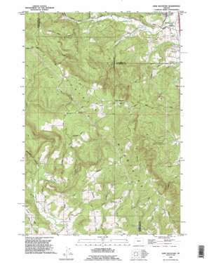
Dixie Mountain Topo Map Oregon
To zoom in, hover over the map of Dixie Mountain
USGS Topo Quad 45122f8 - 1:24,000 scale
| Topo Map Name: | Dixie Mountain |
| USGS Topo Quad ID: | 45122f8 |
| Print Size: | ca. 21 1/4" wide x 27" high |
| Southeast Coordinates: | 45.625° N latitude / 122.875° W longitude |
| Map Center Coordinates: | 45.6875° N latitude / 122.9375° W longitude |
| U.S. State: | OR |
| Filename: | o45122f8.jpg |
| Download Map JPG Image: | Dixie Mountain topo map 1:24,000 scale |
| Map Type: | Topographic |
| Topo Series: | 7.5´ |
| Map Scale: | 1:24,000 |
| Source of Map Images: | United States Geological Survey (USGS) |
| Alternate Map Versions: |
Dixie Mountain OR 1953, updated 1956 Download PDF Buy paper map Dixie Mountain OR 1961, updated 1961 Download PDF Buy paper map Dixie Mountain OR 1961, updated 1971 Download PDF Buy paper map Dixie Mountain OR 1961, updated 1978 Download PDF Buy paper map Dixie Mountain OR 1961, updated 1986 Download PDF Buy paper map Dixie Mountain OR 1990, updated 1995 Download PDF Buy paper map Dixie Mountain OR 2011 Download PDF Buy paper map Dixie Mountain OR 2014 Download PDF Buy paper map |
1:24,000 Topo Quads surrounding Dixie Mountain
> Back to 45122e1 at 1:100,000 scale
> Back to 45122a1 at 1:250,000 scale
> Back to U.S. Topo Maps home
Dixie Mountain topo map: Gazetteer
Dixie Mountain: Dams
Howard Schmidt Dam elevation 384m 1259′Kay Dam elevation 114m 374′
Van Raden Dam elevation 184m 603′
Dixie Mountain: Parks
Mason Hill Park elevation 289m 948′Dixie Mountain: Populated Places
South Scappoose elevation 21m 68′Dixie Mountain: Reservoirs
Alderwood Lake Reservoir elevation 167m 547′Howard Schmidt Reservoir elevation 384m 1259′
John Place Reservoir elevation 340m 1115′
Kay Reservoir elevation 114m 374′
Nitchman Reservoir elevation 60m 196′
Van Raden Reservoir elevation 184m 603′
Dixie Mountain: Streams
Coal Creek elevation 19m 62′Crabapple Creek elevation 14m 45′
East Fork McKay Creek elevation 75m 246′
Gourlay Creek elevation 77m 252′
Lazy Creek elevation 97m 318′
Mud Creek elevation 48m 157′
Neil Creek elevation 74m 242′
Patterson Creek elevation 14m 45′
Raymond Creek elevation 25m 82′
Salt Creek elevation 48m 157′
Wolf Creek elevation 64m 209′
Dixie Mountain: Summits
Dixie Mountain elevation 490m 1607′Dixie Mountain: Valleys
Brunswick Canyon elevation 90m 295′Dutch Canyon elevation 100m 328′
Dixie Mountain digital topo map on disk
Buy this Dixie Mountain topo map showing relief, roads, GPS coordinates and other geographical features, as a high-resolution digital map file on DVD:


