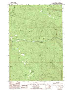
Dole Topo Map Washington
To zoom in, hover over the map of Dole
USGS Topo Quad 45122g3 - 1:24,000 scale
| Topo Map Name: | Dole |
| USGS Topo Quad ID: | 45122g3 |
| Print Size: | ca. 21 1/4" wide x 27" high |
| Southeast Coordinates: | 45.75° N latitude / 122.25° W longitude |
| Map Center Coordinates: | 45.8125° N latitude / 122.3125° W longitude |
| U.S. State: | WA |
| Filename: | o45122g3.jpg |
| Download Map JPG Image: | Dole topo map 1:24,000 scale |
| Map Type: | Topographic |
| Topo Series: | 7.5´ |
| Map Scale: | 1:24,000 |
| Source of Map Images: | United States Geological Survey (USGS) |
| Alternate Map Versions: |
Dole WA 1986, updated 1986 Download PDF Buy paper map Dole WA 1986, updated 1994 Download PDF Buy paper map Dole WA 2000, updated 2003 Download PDF Buy paper map Dole WA 2011 Download PDF Buy paper map Dole WA 2014 Download PDF Buy paper map |
| FStopo: | US Forest Service topo Dole is available: Download FStopo PDF Download FStopo TIF |
1:24,000 Topo Quads surrounding Dole
> Back to 45122e1 at 1:100,000 scale
> Back to 45122a1 at 1:250,000 scale
> Back to U.S. Topo Maps home
Dole topo map: Gazetteer
Dole: Dams
Yacolt Reservoir Dam elevation 279m 915′Dole: Falls
Horseshoe Falls elevation 242m 793′Dole: Parks
Wormald State Park elevation 339m 1112′Dole: Populated Places
Dole elevation 285m 935′Dole: Reservoirs
Yacolt Reservoir elevation 279m 915′Dole: Streams
Anaconda Creek elevation 274m 898′Big Creek elevation 317m 1040′
Cedar Creek elevation 245m 803′
Cold Creek elevation 328m 1076′
Copper Creek elevation 275m 902′
Coyote Creek elevation 325m 1066′
Jack Mountain Creek elevation 283m 928′
King Creek elevation 232m 761′
Niccolls Creek elevation 255m 836′
Reinhardt Creek elevation 248m 813′
Rock Creek elevation 189m 620′
Roger Creek elevation 203m 666′
Snass Creek elevation 314m 1030′
Dole: Summits
Jack Mountain elevation 858m 2814′Kloochman Butte elevation 774m 2539′
Dole digital topo map on disk
Buy this Dole topo map showing relief, roads, GPS coordinates and other geographical features, as a high-resolution digital map file on DVD:


