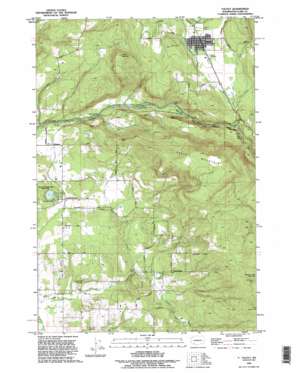
Yacolt Topo Map Washington
To zoom in, hover over the map of Yacolt
USGS Topo Quad 45122g4 - 1:24,000 scale
| Topo Map Name: | Yacolt |
| USGS Topo Quad ID: | 45122g4 |
| Print Size: | ca. 21 1/4" wide x 27" high |
| Southeast Coordinates: | 45.75° N latitude / 122.375° W longitude |
| Map Center Coordinates: | 45.8125° N latitude / 122.4375° W longitude |
| U.S. State: | WA |
| Filename: | o45122g4.jpg |
| Download Map JPG Image: | Yacolt topo map 1:24,000 scale |
| Map Type: | Topographic |
| Topo Series: | 7.5´ |
| Map Scale: | 1:24,000 |
| Source of Map Images: | United States Geological Survey (USGS) |
| Alternate Map Versions: |
Yacolt WA 1971, updated 1973 Download PDF Buy paper map Yacolt WA 1971, updated 1986 Download PDF Buy paper map Yacolt WA 1990, updated 1995 Download PDF Buy paper map Yacolt WA 2011 Download PDF Buy paper map Yacolt WA 2013 Download PDF Buy paper map |
1:24,000 Topo Quads surrounding Yacolt
> Back to 45122e1 at 1:100,000 scale
> Back to 45122a1 at 1:250,000 scale
> Back to U.S. Topo Maps home
Yacolt topo map: Gazetteer
Yacolt: Airports
Cedars North Airpark elevation 91m 298′Yacolt: Dams
Homola Dam elevation 167m 547′Yacolt: Falls
Lucia Falls elevation 127m 416′Moulton Falls elevation 158m 518′
Salmon Falls elevation 146m 479′
Yacolt: Lakes
Battle Ground Lake elevation 155m 508′Yacolt: Parks
Battle Ground State Park elevation 155m 508′Moulton Falls Park elevation 255m 836′
Yacolt: Populated Places
Alpine elevation 244m 800′Crawford elevation 146m 479′
Heisson elevation 134m 439′
Lucia elevation 149m 488′
Moulton elevation 190m 623′
Venersborg elevation 155m 508′
Yacolt elevation 217m 711′
Yacolt: Streams
Basket Creek elevation 138m 452′Big Tree Creek elevation 160m 524′
Little Salmon Creek elevation 117m 383′
Rock Creek elevation 110m 360′
Yacolt Creek elevation 186m 610′
Yacolt: Summits
Bells Mountain elevation 660m 2165′Gravel Point elevation 158m 518′
Spotted Deer Mountain elevation 594m 1948′
Yacolt Mountain elevation 536m 1758′
Yacolt: Tunnels
Multon Falls Tunnel elevation 202m 662′Yacolt digital topo map on disk
Buy this Yacolt topo map showing relief, roads, GPS coordinates and other geographical features, as a high-resolution digital map file on DVD:


