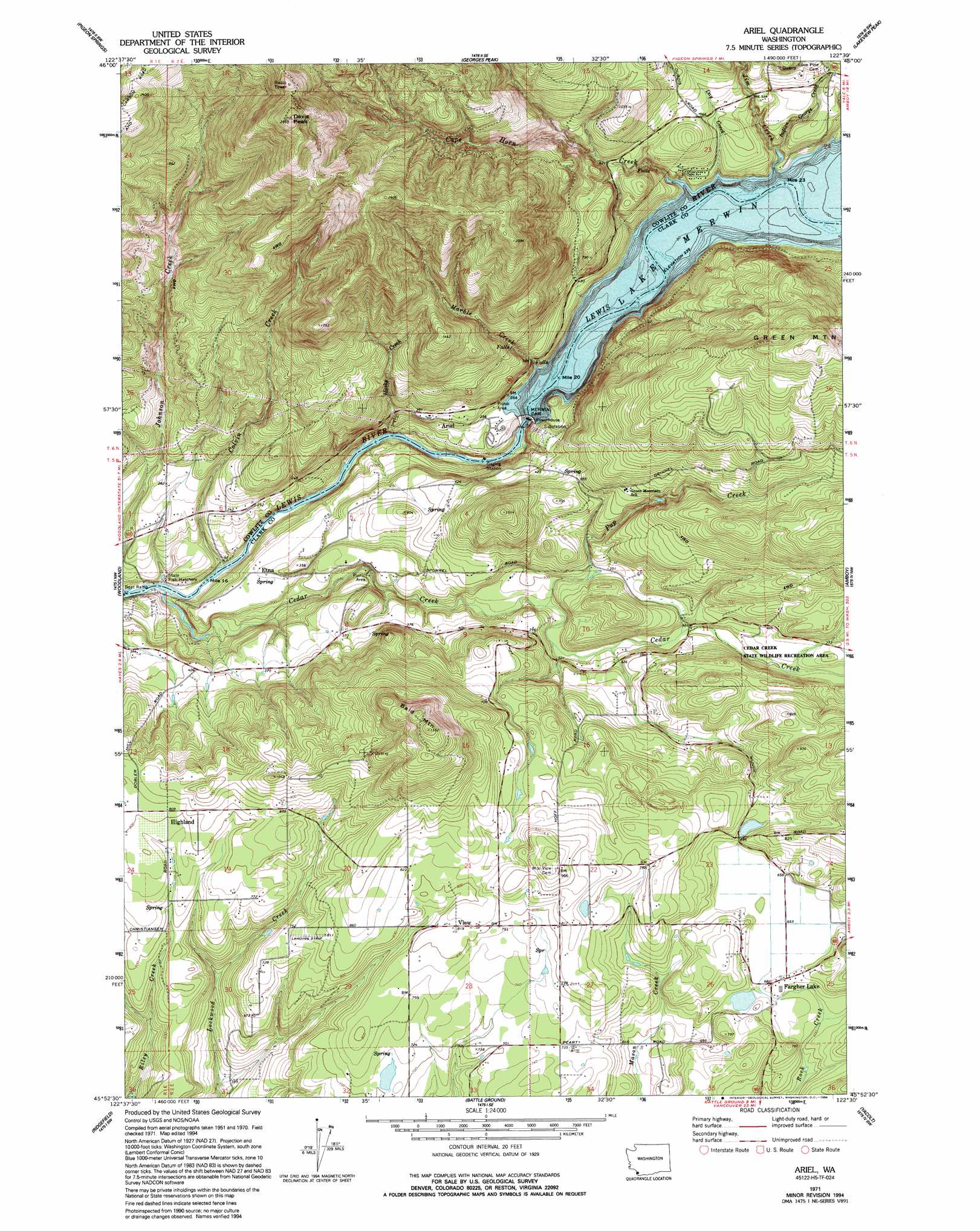
Ariel Topo Map Washington
To zoom in, hover over the map of Ariel
USGS Topo Quad 45122h5 - 1:24,000 scale
| Topo Map Name: | Ariel |
| USGS Topo Quad ID: | 45122h5 |
| Print Size: | ca. 21 1/4" wide x 27" high |
| Southeast Coordinates: | 45.875° N latitude / 122.5° W longitude |
| Map Center Coordinates: | 45.9375° N latitude / 122.5625° W longitude |
| U.S. State: | WA |
| Filename: | o45122h5.jpg |
| Download Map JPG Image: | Ariel topo map 1:24,000 scale |
| Map Type: | Topographic |
| Topo Series: | 7.5´ |
| Map Scale: | 1:24,000 |
| Source of Map Images: | United States Geological Survey (USGS) |
| Alternate Map Versions: |
Ariel WA 1971, updated 1973 Download PDF Buy paper map Ariel WA 1971, updated 1994 Download PDF Buy paper map Ariel WA 2011 Download PDF Buy paper map Ariel WA 2013 Download PDF Buy paper map |
1:24,000 Topo Quads surrounding Ariel
Mount Brynion |
Hemlock Pass |
Wolf Point |
Elk Mountain |
Goat Mountain |
Kalama |
Woolford Creek |
Georges Peak |
Lakeview Peak |
Cougar |
Deer Island |
Woodland |
Ariel |
Amboy |
Yale Dam |
Saint Helens |
Ridgefield |
Battle Ground |
Yacolt |
Dole |
Sauvie Island |
Vancouver |
Orchards |
Lacamas Creek |
Larch Mountain |
> Back to 45122e1 at 1:100,000 scale
> Back to 45122a1 at 1:250,000 scale
> Back to U.S. Topo Maps home
Ariel topo map: Gazetteer
Ariel: Airports
La Center View-Air Airport elevation 238m 780′McClellan Field elevation 259m 849′
Ariel: Dams
Colvin Creek Dam elevation 19m 62′Elmer Dam elevation 248m 813′
Erickson Dam elevation 203m 666′
Fargher Pond Dam elevation 212m 695′
Merwin Dam elevation 43m 141′
Tsugawa Brothers Reservoir Dam elevation 216m 708′
Ariel: Lakes
Fargher Pond elevation 203m 666′Ariel: Parks
Cedar Creek State Wildlife Recreation Area elevation 172m 564′Ariel: Populated Places
Ariel elevation 106m 347′Cedarville elevation 116m 380′
Dayton elevation 93m 305′
Etna elevation 91m 298′
Fargher Lake elevation 207m 679′
Hall elevation 206m 675′
Highland elevation 247m 810′
Ariel: Reservoirs
Fargher Pond elevation 212m 695′Lake Merwin elevation 44m 144′
Tsugawa Brothers Reservoir elevation 216m 708′
Ariel: Streams
Cape Horn Creek elevation 79m 259′Cedar Creek elevation 12m 39′
Colvin Creek elevation 11m 36′
Day Creek elevation 76m 249′
Husky Creek elevation 27m 88′
Indian George Creek elevation 85m 278′
Jim Creek elevation 74m 242′
Marble Creek elevation 86m 282′
Pup Creek elevation 79m 259′
Ariel: Summits
Bald Mountain elevation 471m 1545′Davis Peak elevation 888m 2913′
Reid Mountain elevation 731m 2398′
Ariel digital topo map on disk
Buy this Ariel topo map showing relief, roads, GPS coordinates and other geographical features, as a high-resolution digital map file on DVD: