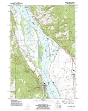
Deer Island Topo Map Washington
To zoom in, hover over the map of Deer Island
USGS Topo Quad 45122h7 - 1:24,000 scale
| Topo Map Name: | Deer Island |
| USGS Topo Quad ID: | 45122h7 |
| Print Size: | ca. 21 1/4" wide x 27" high |
| Southeast Coordinates: | 45.875° N latitude / 122.75° W longitude |
| Map Center Coordinates: | 45.9375° N latitude / 122.8125° W longitude |
| U.S. States: | WA, OR |
| Filename: | o45122h7.jpg |
| Download Map JPG Image: | Deer Island topo map 1:24,000 scale |
| Map Type: | Topographic |
| Topo Series: | 7.5´ |
| Map Scale: | 1:24,000 |
| Source of Map Images: | United States Geological Survey (USGS) |
| Alternate Map Versions: |
Deer Island OR 1954, updated 1956 Download PDF Buy paper map Deer Island OR 1954, updated 1971 Download PDF Buy paper map Deer Island OR 1954, updated 1985 Download PDF Buy paper map Deer Island OR 1990, updated 1995 Download PDF Buy paper map Deer Island OR 2011 Download PDF Buy paper map Deer Island OR 2014 Download PDF Buy paper map |
1:24,000 Topo Quads surrounding Deer Island
> Back to 45122e1 at 1:100,000 scale
> Back to 45122a1 at 1:250,000 scale
> Back to U.S. Topo Maps home
Deer Island topo map: Gazetteer
Deer Island: Bars
Hunter Bar elevation 1m 3′Deer Island: Capes
Ahle Point elevation 9m 29′Deer Island Point elevation 3m 9′
Deer Island: Channels
Bybee Ledge Channel elevation 0m 0′Columbia City Channel elevation 2m 6′
Kalama Upper Range elevation 0m 0′
Kalama Upper Range elevation 0m 0′
Martin Island Channel elevation 2m 6′
Martin Island Channel elevation 0m 0′
Multnomah Channel elevation 2m 6′
Saint Helens Range elevation 0m 0′
Deer Island: Cliffs
Martin Bluff elevation 32m 104′Deer Island: Dams
Lloyd Hill Dam elevation 184m 603′Deer Island: Guts
Benham Slough elevation 4m 13′Daves Slough elevation 4m 13′
Deer Island Slough elevation 4m 13′
Goerig Slough elevation 4m 13′
Wallace Slough elevation 4m 13′
Deer Island: Islands
Burke Island elevation 2m 6′Deer Island elevation 3m 9′
Goat Island elevation 4m 13′
Martin Island elevation 2m 6′
Deer Island: Lakes
Adams Lake elevation 3m 9′Box Lake elevation 3m 9′
Cottonwood Lake elevation 3m 9′
Horsepasture Lake elevation 4m 13′
Lake Adams elevation 4m 13′
Muckle Lake elevation 4m 13′
Oak Ridge Lake elevation 4m 13′
Resting Lake elevation 3m 9′
Swan Lake elevation 3m 9′
Thorn Lake elevation 4m 13′
Deer Island: Parks
Carolyn King Memorial Park elevation 93m 305′Datis City Park elevation 4m 13′
Harvard City Park elevation 40m 131′
Jim Bundy Memorial Park elevation 64m 209′
Pixie Park elevation 6m 19′
Ruth Rose Richardson Park elevation 18m 59′
Deer Island: Populated Places
Caples elevation 4m 13′Caples Landing elevation 2m 6′
Columbia City elevation 15m 49′
Deer Island elevation 17m 55′
Deer Island: Post Offices
Columbia City Post Office elevation 15m 49′Deer Island Post Office elevation 17m 55′
Hunters Post Office (historical) elevation 4m 13′
Deer Island: Reservoirs
Lake Koinenia elevation 184m 603′Deer Island: Streams
Adams Creek elevation 4m 13′Burke Creek elevation 1m 3′
Burke Slough elevation 0m 0′
Burris Creek elevation 3m 9′
Bybee Creek elevation 7m 22′
Canyon Creek elevation 8m 26′
Harrie Creek elevation 4m 13′
Martin Slough elevation 0m 0′
McBride Creek elevation 1m 3′
Merrill Creek elevation 6m 19′
Mill Creek elevation 3m 9′
Schoolhouse Creek elevation 4m 13′
Tide Creek elevation 1m 3′
Deer Island: Summits
Maple Hill elevation 246m 807′Deer Island digital topo map on disk
Buy this Deer Island topo map showing relief, roads, GPS coordinates and other geographical features, as a high-resolution digital map file on DVD:


