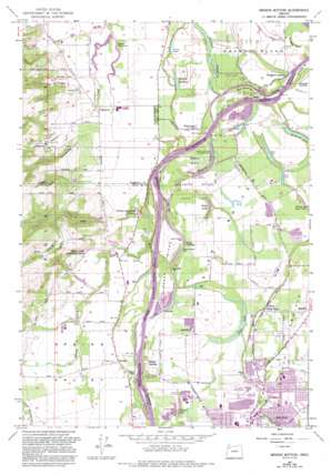
Mission Bottom Topo Map Oregon
To zoom in, hover over the map of Mission Bottom
USGS Topo Quad 45123a1 - 1:24,000 scale
| Topo Map Name: | Mission Bottom |
| USGS Topo Quad ID: | 45123a1 |
| Print Size: | ca. 21 1/4" wide x 27" high |
| Southeast Coordinates: | 45° N latitude / 123° W longitude |
| Map Center Coordinates: | 45.0625° N latitude / 123.0625° W longitude |
| U.S. State: | OR |
| Filename: | o45123a1.jpg |
| Download Map JPG Image: | Mission Bottom topo map 1:24,000 scale |
| Map Type: | Topographic |
| Topo Series: | 7.5´ |
| Map Scale: | 1:24,000 |
| Source of Map Images: | United States Geological Survey (USGS) |
| Alternate Map Versions: |
Mission Bottom OR 1957, updated 1958 Download PDF Buy paper map Mission Bottom OR 1957, updated 1972 Download PDF Buy paper map Mission Bottom OR 1957, updated 1986 Download PDF Buy paper map Mission Bottom OR 1957, updated 1993 Download PDF Buy paper map Mission Bottom OR 2011 Download PDF Buy paper map Mission Bottom OR 2014 Download PDF Buy paper map |
1:24,000 Topo Quads surrounding Mission Bottom
> Back to 45123a1 at 1:100,000 scale
> Back to 45122a1 at 1:250,000 scale
> Back to U.S. Topo Maps home
Mission Bottom topo map: Gazetteer
Mission Bottom: Airports
Finney Lake Airport elevation 34m 111′Mission Bottom: Bars
Darrow Bar elevation 32m 104′Eldriedge Bar elevation 29m 95′
Lincoln Bar elevation 33m 108′
Lincoln Rocks elevation 32m 104′
Lone Tree Bar elevation 38m 124′
Lower Martine Bar elevation 28m 91′
Lower Simon Bar elevation 29m 95′
Matheny Bar elevation 31m 101′
Matheny Bar elevation 29m 95′
McCall Bar elevation 34m 111′
McCloskie Bar elevation 33m 108′
Spongs Bar elevation 36m 118′
Union Bar elevation 29m 95′
Upper Martine Bar elevation 26m 85′
Upper Simon Bar elevation 32m 104′
Wheatland Bar elevation 27m 88′
Windsor Bar elevation 29m 95′
Mission Bottom: Bends
Mission Bottom elevation 36m 118′Snaggy Bend elevation 29m 95′
Mission Bottom: Channels
Darrow Chute elevation 32m 104′Windsor Island Reach elevation 32m 104′
Mission Bottom: Dams
Keene Dam elevation 44m 144′Wheatland Dam (historical) elevation 29m 95′
Mission Bottom: Flats
Beaver Island elevation 34m 111′Mission Bottom: Islands
Windsor Island elevation 31m 101′Mission Bottom: Lakes
Aquatic Gardens elevation 31m 101′Clear Lake elevation 34m 111′
Curry Lake elevation 31m 101′
Deep Lake elevation 30m 98′
Finney and Egan Lake elevation 30m 98′
Goose Lake elevation 30m 98′
Mission Lake elevation 31m 101′
Ryan Lake elevation 33m 108′
Willow Lake elevation 37m 121′
Mission Bottom: Parks
Jason Lee Mission Historical Marker elevation 32m 104′Maud Williamson State Park elevation 51m 167′
Northridge Park elevation 38m 124′
Northside County Park elevation 48m 157′
Spongs Landing County Park elevation 41m 134′
Wilark County Park elevation 43m 141′
Willamette Mission State Park elevation 35m 114′
Mission Bottom: Populated Places
Clear Lake elevation 60m 196′Hopewell elevation 50m 164′
Lakebrook elevation 38m 124′
Lincoln elevation 54m 177′
Wheatland elevation 36m 118′
Mission Bottom: Post Offices
Hopewell Post Office (historical) elevation 50m 164′Lincoln Post Office (historical) elevation 54m 177′
Spring Valley Post Office (historical) elevation 68m 223′
Valfontis Post Office (historical) elevation 42m 137′
Wheatland Post Office (historical) elevation 36m 118′
Mission Bottom: Ranges
Eola Hills elevation 251m 823′Mission Bottom: Reservoirs
Case Reservoirs elevation 49m 160′Goffrier Pond elevation 56m 183′
Hills Reservoir elevation 50m 164′
Janzen Reservoir elevation 43m 141′
Keene Reservoir elevation 44m 144′
Nygren Reservoir elevation 53m 173′
Polvi Reservoir elevation 55m 180′
Schindler Reservoir elevation 62m 203′
Stephens Reservoir elevation 43m 141′
Mission Bottom: Ridges
Jerusalem Hill elevation 95m 311′Mission Bottom: Streams
Canyon Creek elevation 53m 173′Claggett Creek elevation 34m 111′
King Creek elevation 37m 121′
Labish Creek elevation 36m 118′
Patterson Creek elevation 29m 95′
Spring Valley Creek elevation 29m 95′
Walker Creek elevation 49m 160′
Mission Bottom: Valleys
Spring Valley elevation 37m 121′Mission Bottom digital topo map on disk
Buy this Mission Bottom topo map showing relief, roads, GPS coordinates and other geographical features, as a high-resolution digital map file on DVD:


