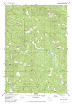
Trask Mountain Topo Map Oregon
To zoom in, hover over the map of Trask Mountain
USGS Topo Quad 45123c4 - 1:24,000 scale
| Topo Map Name: | Trask Mountain |
| USGS Topo Quad ID: | 45123c4 |
| Print Size: | ca. 21 1/4" wide x 27" high |
| Southeast Coordinates: | 45.25° N latitude / 123.375° W longitude |
| Map Center Coordinates: | 45.3125° N latitude / 123.4375° W longitude |
| U.S. State: | OR |
| Filename: | o45123c4.jpg |
| Download Map JPG Image: | Trask Mountain topo map 1:24,000 scale |
| Map Type: | Topographic |
| Topo Series: | 7.5´ |
| Map Scale: | 1:24,000 |
| Source of Map Images: | United States Geological Survey (USGS) |
| Alternate Map Versions: |
Trask Mtn OR 1979, updated 1980 Download PDF Buy paper map Trask Mtn OR 1979, updated 1992 Download PDF Buy paper map Trask Mountain OR 2011 Download PDF Buy paper map Trask Mountain OR 2014 Download PDF Buy paper map |
1:24,000 Topo Quads surrounding Trask Mountain
> Back to 45123a1 at 1:100,000 scale
> Back to 45122a1 at 1:250,000 scale
> Back to U.S. Topo Maps home
Trask Mountain topo map: Gazetteer
Trask Mountain: Dams
McGuire Dam elevation 566m 1856′Trask Mountain: Flats
Elk Flat elevation 744m 2440′Walker Flat (historical) elevation 577m 1893′
Trask Mountain: Lakes
Meadow Lake elevation 549m 1801′Trask Mountain: Parks
Dovre Peak Wayside elevation 494m 1620′Trask Mountain: Reservoirs
McGuire Reservoir elevation 566m 1856′Such Joja Reservoir elevation 609m 1998′
Walker Creek Reservoir elevation 555m 1820′
Trask Mountain: Streams
Cedar Creek elevation 488m 1601′Fan Creek elevation 364m 1194′
Ginger Creek elevation 463m 1519′
Maroney Creek elevation 191m 626′
Murphy Camp Creek elevation 404m 1325′
Perkins Creek elevation 261m 856′
Steep Creek elevation 425m 1394′
Walker Creek elevation 544m 1784′
Trask Mountain: Summits
Bald Mountain elevation 932m 3057′Ball Bearing Hill elevation 701m 2299′
Sheridan Peak elevation 943m 3093′
Snap Point elevation 760m 2493′
Trask Mountain elevation 1040m 3412′
Trask Mountain digital topo map on disk
Buy this Trask Mountain topo map showing relief, roads, GPS coordinates and other geographical features, as a high-resolution digital map file on DVD:


