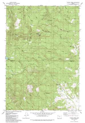
Turner Creek Topo Map Oregon
To zoom in, hover over the map of Turner Creek
USGS Topo Quad 45123d3 - 1:24,000 scale
| Topo Map Name: | Turner Creek |
| USGS Topo Quad ID: | 45123d3 |
| Print Size: | ca. 21 1/4" wide x 27" high |
| Southeast Coordinates: | 45.375° N latitude / 123.25° W longitude |
| Map Center Coordinates: | 45.4375° N latitude / 123.3125° W longitude |
| U.S. State: | OR |
| Filename: | o45123d3.jpg |
| Download Map JPG Image: | Turner Creek topo map 1:24,000 scale |
| Map Type: | Topographic |
| Topo Series: | 7.5´ |
| Map Scale: | 1:24,000 |
| Source of Map Images: | United States Geological Survey (USGS) |
| Alternate Map Versions: |
Turner Creek OR 1979, updated 1980 Download PDF Buy paper map Turner Creek OR 1979, updated 1980 Download PDF Buy paper map Turner Creek OR 2011 Download PDF Buy paper map Turner Creek OR 2014 Download PDF Buy paper map |
1:24,000 Topo Quads surrounding Turner Creek
> Back to 45123a1 at 1:100,000 scale
> Back to 45122a1 at 1:250,000 scale
> Back to U.S. Topo Maps home
Turner Creek topo map: Gazetteer
Turner Creek: Dams
Turner Creek Dam elevation 451m 1479′Turner Creek: Falls
Haines Falls elevation 178m 583′Lee Falls elevation 121m 396′
Little Lee Falls elevation 93m 305′
Turner Creek: Parks
Menefee County Park elevation 123m 403′Turner Creek: Reservoirs
Hillsboro Reservoir elevation 182m 597′Turner Creek Reservoir elevation 451m 1479′
Yamhill Reservoir elevation 140m 459′
Turner Creek: Ridges
Blind Cabin Ridge elevation 708m 2322′Hagerty Ridge elevation 383m 1256′
Homestead Ridge elevation 282m 925′
Turner Creek: Streams
East Fork Sain Creek elevation 208m 682′Hawn Creek elevation 74m 242′
Hay Creek elevation 100m 328′
Lee Creek elevation 217m 711′
Mathieu Creek elevation 303m 994′
Patten Creek elevation 216m 708′
Roaring Creek elevation 81m 265′
Severt Creek elevation 118m 387′
Sunday Creek elevation 279m 915′
Wildwood Creek elevation 90m 295′
Turner Creek: Summits
Tuttle Point elevation 620m 2034′Turner Creek digital topo map on disk
Buy this Turner Creek topo map showing relief, roads, GPS coordinates and other geographical features, as a high-resolution digital map file on DVD:


