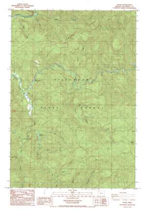
Trask Topo Map Oregon
To zoom in, hover over the map of Trask
USGS Topo Quad 45123d5 - 1:24,000 scale
| Topo Map Name: | Trask |
| USGS Topo Quad ID: | 45123d5 |
| Print Size: | ca. 21 1/4" wide x 27" high |
| Southeast Coordinates: | 45.375° N latitude / 123.5° W longitude |
| Map Center Coordinates: | 45.4375° N latitude / 123.5625° W longitude |
| U.S. State: | OR |
| Filename: | o45123d5.jpg |
| Download Map JPG Image: | Trask topo map 1:24,000 scale |
| Map Type: | Topographic |
| Topo Series: | 7.5´ |
| Map Scale: | 1:24,000 |
| Source of Map Images: | United States Geological Survey (USGS) |
| Alternate Map Versions: |
Trask OR 1984, updated 1984 Download PDF Buy paper map Trask OR 2011 Download PDF Buy paper map Trask OR 2014 Download PDF Buy paper map |
1:24,000 Topo Quads surrounding Trask
> Back to 45123a1 at 1:100,000 scale
> Back to 45122a1 at 1:250,000 scale
> Back to U.S. Topo Maps home
Trask topo map: Gazetteer
Trask: Channels
Narrows elevation 60m 196′The Crawdad Hole elevation 96m 314′
Trask: Parks
Trask County Park elevation 116m 380′Wilson River Highway Forest State Park elevation 69m 226′
Trask: Post Offices
Illingworth Post Office (historical) elevation 76m 249′Trask: Ridges
Hembre Ridge elevation 876m 2874′Trask: Streams
Alder Creek elevation 62m 203′Bales Creek elevation 215m 705′
Bark Shanty Creek elevation 144m 472′
Bear Creek elevation 59m 193′
Bill Creek elevation 201m 659′
Blue Bus Creek elevation 116m 380′
East Fork South Fork Trask River elevation 124m 406′
Edwards Creek elevation 128m 419′
Elk Creek elevation 246m 807′
Fall Creek elevation 83m 272′
Hembre Creek elevation 142m 465′
Joyce Creek elevation 184m 603′
Michael Creek elevation 250m 820′
North Fork Trask River elevation 83m 272′
Pigeon Creek elevation 223m 731′
Scotch Creek elevation 262m 859′
South Fork Trask River elevation 86m 282′
Trask: Summits
Ginsberg Point elevation 823m 2700′Trask digital topo map on disk
Buy this Trask topo map showing relief, roads, GPS coordinates and other geographical features, as a high-resolution digital map file on DVD:


