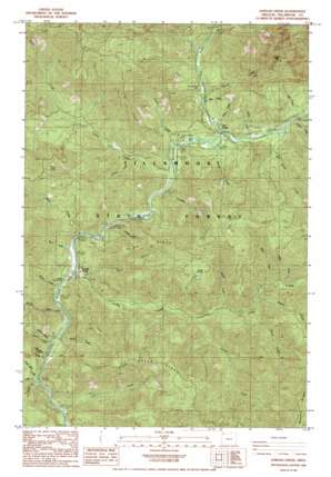
Jordan Creek Topo Map Oregon
To zoom in, hover over the map of Jordan Creek
USGS Topo Quad 45123e5 - 1:24,000 scale
| Topo Map Name: | Jordan Creek |
| USGS Topo Quad ID: | 45123e5 |
| Print Size: | ca. 21 1/4" wide x 27" high |
| Southeast Coordinates: | 45.5° N latitude / 123.5° W longitude |
| Map Center Coordinates: | 45.5625° N latitude / 123.5625° W longitude |
| U.S. State: | OR |
| Filename: | o45123e5.jpg |
| Download Map JPG Image: | Jordan Creek topo map 1:24,000 scale |
| Map Type: | Topographic |
| Topo Series: | 7.5´ |
| Map Scale: | 1:24,000 |
| Source of Map Images: | United States Geological Survey (USGS) |
| Alternate Map Versions: |
Jordan Creek OR 1984, updated 1984 Download PDF Buy paper map Jordan Creek OR 2011 Download PDF Buy paper map Jordan Creek OR 2014 Download PDF Buy paper map |
1:24,000 Topo Quads surrounding Jordan Creek
> Back to 45123e1 at 1:100,000 scale
> Back to 45122a1 at 1:250,000 scale
> Back to U.S. Topo Maps home
Jordan Creek topo map: Gazetteer
Jordan Creek: Falls
Wilson Falls elevation 139m 456′Jordan Creek: Lakes
Archer Pond elevation 619m 2030′Jordan Creek: Parks
Diamond Mill OHV Staging Area elevation 207m 679′Jones Creek Campground elevation 172m 564′
Jordan Creek OHV Staging Area elevation 161m 528′
Smith Homestead elevation 161m 528′
Wilson River Picnic Ground (historical) elevation 162m 531′
Jordan Creek: Populated Places
Jordan Creek elevation 123m 403′Jordan Creek: Post Offices
Lee's Camp Post Office (historical) elevation 190m 623′Wilson Post Office (historical) elevation 213m 698′
Jordan Creek: Reservoirs
Ryan Creek Reservoir elevation 142m 465′Jordan Creek: Ridges
Ax Ridge elevation 521m 1709′Fox Creek Ridge elevation 686m 2250′
Jordan Creek: Streams
Ben Smith Creek elevation 188m 616′Bend Creek elevation 280m 918′
Bridge Creek elevation 122m 400′
Buck Creek elevation 135m 442′
Cedar Creek elevation 147m 482′
Combs Creek elevation 79m 259′
Dog Creek elevation 213m 698′
Eagle Creek elevation 91m 298′
Fox Creek elevation 73m 239′
Haines Creek elevation 83m 272′
Hann Creek elevation 249m 816′
Holm Creek elevation 101m 331′
Hoyt Creek elevation 112m 367′
Jones Creek elevation 156m 511′
Jordan Creek elevation 112m 367′
Keenig Creek elevation 98m 321′
Lehmam Creek elevation 176m 577′
Lester Creek elevation 220m 721′
Luebke Creek elevation 142m 465′
Max Creek elevation 230m 754′
Moore Creek elevation 209m 685′
Muesial Creek elevation 117m 383′
North Fork Wilson River elevation 171m 561′
Pennock Creek elevation 108m 354′
Phelps Creek elevation 259m 849′
Rhem Creek elevation 86m 282′
Rhinehart Creek elevation 278m 912′
Runyon Creek elevation 171m 561′
Ryan Creek elevation 107m 351′
Sargent Creek elevation 218m 715′
Scotty Creek elevation 180m 590′
South Fork Jordan Creek elevation 177m 580′
South Wolf Creek elevation 94m 308′
Spaur Creek elevation 208m 682′
Stanley Creek elevation 102m 334′
West Fork North Fork Wilson River elevation 233m 764′
Wolf Creek elevation 113m 370′
Jordan Creek: Summits
Diamond Hill elevation 487m 1597′Kings Mountain elevation 976m 3202′
Wolf Point elevation 743m 2437′
Jordan Creek digital topo map on disk
Buy this Jordan Creek topo map showing relief, roads, GPS coordinates and other geographical features, as a high-resolution digital map file on DVD:


