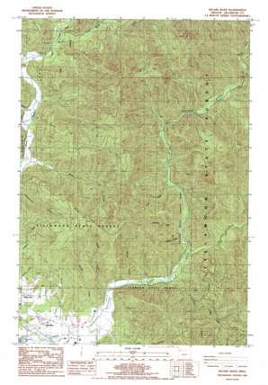
Kilchis River Topo Map Oregon
To zoom in, hover over the map of Kilchis River
USGS Topo Quad 45123e7 - 1:24,000 scale
| Topo Map Name: | Kilchis River |
| USGS Topo Quad ID: | 45123e7 |
| Print Size: | ca. 21 1/4" wide x 27" high |
| Southeast Coordinates: | 45.5° N latitude / 123.75° W longitude |
| Map Center Coordinates: | 45.5625° N latitude / 123.8125° W longitude |
| U.S. State: | OR |
| Filename: | o45123e7.jpg |
| Download Map JPG Image: | Kilchis River topo map 1:24,000 scale |
| Map Type: | Topographic |
| Topo Series: | 7.5´ |
| Map Scale: | 1:24,000 |
| Source of Map Images: | United States Geological Survey (USGS) |
| Alternate Map Versions: |
Kilchis River OR 1985, updated 1985 Download PDF Buy paper map Kilchis River OR 2011 Download PDF Buy paper map Kilchis River OR 2014 Download PDF Buy paper map |
1:24,000 Topo Quads surrounding Kilchis River
> Back to 45123e1 at 1:100,000 scale
> Back to 45122a1 at 1:250,000 scale
> Back to U.S. Topo Maps home
Kilchis River topo map: Gazetteer
Kilchis River: Cliffs
Tilden Bluffs elevation 590m 1935′Kilchis River: Parks
Kilchis River County Park elevation 32m 104′Kilchis River: Populated Places
Idaville elevation 13m 42′Kilchis River: Post Offices
Idaville Post Office (historical) elevation 13m 42′Riverdale Post Office (historical) elevation 10m 32′
Kilchis River: Reservoirs
Coal Creek Reservoir elevation 67m 219′Kilchis River: Streams
Blue Star Creek elevation 78m 255′Clear Creek elevation 19m 62′
Clinton Creek elevation 31m 101′
Coal Creek elevation 7m 22′
Diamond Creek elevation 57m 187′
Dietz Creek elevation 94m 308′
Gilmore Creek elevation 27m 88′
Hathaway Slough elevation 2m 6′
Iris Creek elevation 41m 134′
Jody Creek elevation 75m 246′
Little South Fork Kilchis River elevation 20m 65′
Mapes Creek elevation 39m 127′
Minich Creek elevation 10m 32′
Moss Creek elevation 6m 19′
Murphy Creek elevation 7m 22′
Myrtle Creek elevation 14m 45′
North Fork Kilchis River elevation 95m 311′
Pipe Creek elevation 48m 157′
Prouty Creek elevation 48m 157′
Purcell Creek elevation 107m 351′
Roller Creek elevation 34m 111′
Sam Downs Creek elevation 86m 282′
School Creek elevation 429m 1407′
Sharp Creek elevation 37m 121′
Shirley Creek elevation 36m 118′
Slide Creek elevation 76m 249′
South Fork Kilchis River elevation 95m 311′
Spruce Creek elevation 35m 114′
Stuart Creek elevation 27m 88′
Thomas Creek elevation 34m 111′
Tilden Creek elevation 67m 219′
Tilton Creek elevation 79m 259′
Vaughn Creek elevation 4m 13′
Waldron Creek elevation 23m 75′
Washout Creek elevation 29m 95′
Watertank Creek elevation 24m 78′
Whitney Creek elevation 85m 278′
Kilchis River: Summits
Doty Hill elevation 587m 1925′Kilchis River: Valleys
Aiken Canyon elevation 95m 311′Zigzag Canyon elevation 94m 308′
Kilchis River digital topo map on disk
Buy this Kilchis River topo map showing relief, roads, GPS coordinates and other geographical features, as a high-resolution digital map file on DVD:


