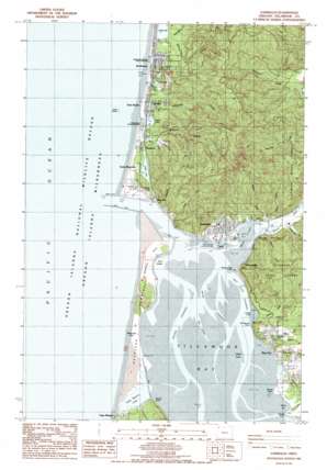
Garibaldi Topo Map Oregon
To zoom in, hover over the map of Garibaldi
USGS Topo Quad 45123e8 - 1:24,000 scale
| Topo Map Name: | Garibaldi |
| USGS Topo Quad ID: | 45123e8 |
| Print Size: | ca. 21 1/4" wide x 27" high |
| Southeast Coordinates: | 45.5° N latitude / 123.875° W longitude |
| Map Center Coordinates: | 45.5625° N latitude / 123.9375° W longitude |
| U.S. State: | OR |
| Filename: | o45123e8.jpg |
| Download Map JPG Image: | Garibaldi topo map 1:24,000 scale |
| Map Type: | Topographic |
| Topo Series: | 7.5´ |
| Map Scale: | 1:24,000 |
| Source of Map Images: | United States Geological Survey (USGS) |
| Alternate Map Versions: |
Garibaldi OR 1985, updated 1985 Download PDF Buy paper map Garibaldi OR 1985, updated 1985 Download PDF Buy paper map Garibaldi OR 2011 Download PDF Buy paper map Garibaldi OR 2014 Download PDF Buy paper map |
1:24,000 Topo Quads surrounding Garibaldi
Arch Cape |
Soapstone Lake |
Hamlet |
||
Nehalem |
Foley Peak |
Cook Creek |
||
Garibaldi |
Kilchis River |
Cedar Butte |
||
Netarts |
Tillamook |
The Peninsula |
||
Sand Lake |
Beaver |
Blaine |
> Back to 45123e1 at 1:100,000 scale
> Back to 45122a1 at 1:250,000 scale
> Back to U.S. Topo Maps home
Garibaldi topo map: Gazetteer
Garibaldi: Arches
Twin Rocks Arch elevation 0m 0′Garibaldi: Bars
Kilchis Flat elevation 0m 0′Sibley Sands elevation 0m 0′
Garibaldi: Bays
Crab Harbor elevation 0m 0′Larson Cove elevation 1m 3′
Miami Cove elevation 0m 0′
Tillamook Bay elevation 0m 0′
Garibaldi: Capes
Bayocean Peninsula elevation 3m 9′Goose Point elevation 2m 6′
Hobsonville Point elevation 14m 45′
Kilchis Point elevation 1m 3′
Kincheloe Point elevation 14m 45′
Pitcher Point elevation 1m 3′
Sandstone Point elevation 31m 101′
Garibaldi: Channels
Bay City Channel elevation 0m 0′Main Channel elevation 0m 0′
Seal Channel elevation 0m 0′
South Channel elevation 0m 0′
Garibaldi: Dams
Kilchis River Jetty elevation 0m 0′North Jetty elevation 0m 0′
South Jetty elevation 1m 3′
Garibaldi: Islands
Crab Rock elevation 0m 0′Painted Rock elevation 35m 114′
Sow and Pigs elevation 0m 0′
Twin Rocks elevation 0m 0′
Garibaldi: Lakes
Cape Meares Lake elevation 2m 6′Clear Lake elevation 5m 16′
Hidden Lake elevation 7m 22′
Lake Lytle elevation 3m 9′
Lake Marie elevation 7m 22′
Seaview Lake elevation 7m 22′
Smith Lake elevation 5m 16′
Spring Lake elevation 4m 13′
Garibaldi: Levees
Bayocean Dike elevation 3m 9′Middle Channel Dike elevation 0m 0′
Garibaldi: Parks
Al Griffin Memorial Park elevation 7m 22′Barview County Park elevation 4m 13′
Bay City Forest Park elevation 13m 42′
Bayocean Peninsula County Park elevation 3m 9′
Rockaway Beach City Park elevation 2m 6′
Rockaway Beach State Park elevation 1m 3′
Seaview City Park elevation 6m 19′
Stanger Memorial VFW Park elevation 7m 22′
Twin Rocks County Park elevation 2m 6′
Twin Rocks State Park elevation 2m 6′
Garibaldi: Populated Places
Barnegat (historical) elevation 29m 95′Barview elevation 11m 36′
Bay City elevation 11m 36′
Bayocean (historical) elevation 4m 13′
Garibaldi elevation 9m 29′
Hobsonville elevation 38m 124′
Rockaway Beach elevation 7m 22′
Saltair (historical) elevation 5m 16′
Twin Rocks elevation 6m 19′
Garibaldi: Post Offices
Bar View Post Office (historical) elevation 19m 62′Barnegat Post Office (historical) elevation 29m 95′
Bay City Post Office elevation 11m 36′
Bayocean Post Office (historical) elevation 4m 13′
Garibaldi Post Office elevation 9m 29′
Hobsonville Post Office (historical) elevation 38m 124′
Lake Lytle Post Office (historical) elevation 5m 16′
Rockaway Beach Post Office elevation 6m 19′
Twin Rocks Post Office (historical) elevation 6m 19′
Garibaldi: Reservoirs
Bay City Reservoir elevation 35m 114′Electric Creek Reservoir elevation 59m 193′
Struby Creek Reservoir elevation 69m 226′
Garibaldi: Ridges
Captain Gray Mountain elevation 377m 1236′Garibaldi: Streams
Baxter Creek elevation 1m 3′Brimmer Creek elevation 13m 42′
Coleman Creek elevation 2m 6′
Doty Creek elevation 2m 6′
Eck Creek elevation 3m 9′
Electric Creek elevation 12m 39′
Heitmiller Creek elevation 3m 9′
Hobson Creek elevation 9m 29′
Illingsworth Creek elevation 6m 19′
Jacoby Creek elevation 12m 39′
Joe Champion Creek elevation 1m 3′
Larson Creek elevation 6m 19′
Lifesaving Creek elevation 6m 19′
Miami River elevation 2m 6′
Patterson Creek elevation 6m 19′
Peterson Creek elevation 17m 55′
Rock Creek elevation 8m 26′
Saltair Creek elevation 3m 9′
Smith Creek elevation 8m 26′
Spring Creek elevation 6m 19′
Steinhilber Creek elevation 4m 13′
Struby Creek elevation 5m 16′
Watseco Creek elevation 3m 9′
Garibaldi: Summits
Green Hill elevation 101m 331′Garibaldi digital topo map on disk
Buy this Garibaldi topo map showing relief, roads, GPS coordinates and other geographical features, as a high-resolution digital map file on DVD:


