Rogers Peak Topo Map Oregon
To zoom in, hover over the map of Rogers Peak
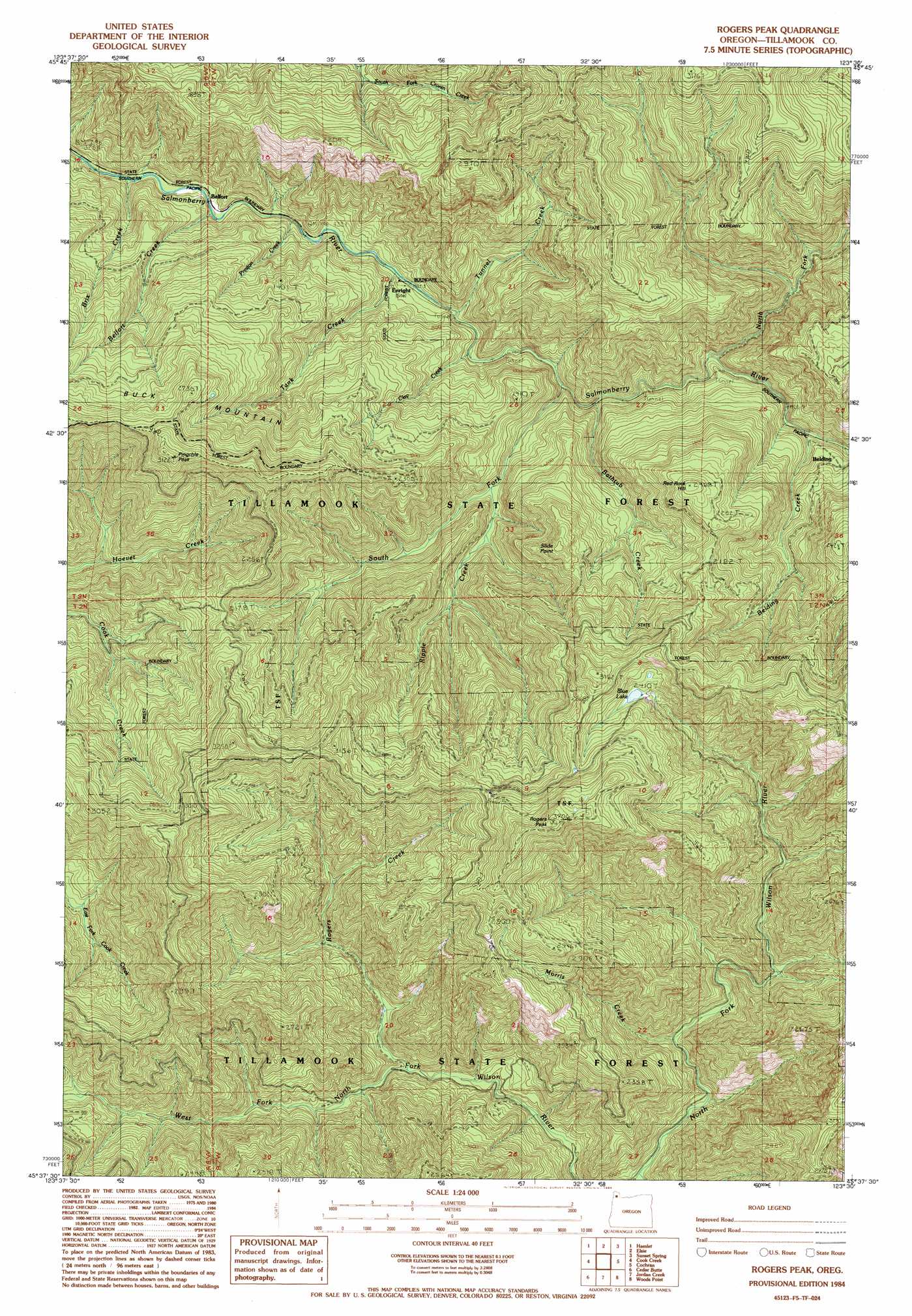
USGS Topo Quad 45123f5 - 1:24,000 scale
| Topo Map Name: | Rogers Peak |
| USGS Topo Quad ID: | 45123f5 |
| Print Size: | ca. 21 1/4" wide x 27" high |
| Southeast Coordinates: | 45.625° N latitude / 123.5° W longitude |
| Map Center Coordinates: | 45.6875° N latitude / 123.5625° W longitude |
| U.S. State: | OR |
| Filename: | o45123f5.jpg |
| Download Map JPG Image: | Rogers Peak topo map 1:24,000 scale |
| Map Type: | Topographic |
| Topo Series: | 7.5´ |
| Map Scale: | 1:24,000 |
| Source of Map Images: | United States Geological Survey (USGS) |
| Alternate Map Versions: |
Rogers Peak OR 1984, updated 1984 Download PDF Buy paper map Rogers Peak OR 2011 Download PDF Buy paper map Rogers Peak OR 2014 Download PDF Buy paper map |
1:24,000 Topo Quads surrounding Rogers Peak
Necanicum Junction |
Saddle Mountain |
Vinemaple |
Sager Creek |
Birkenfeld |
Soapstone Lake |
Hamlet |
Elsie |
Sunset Spring |
Clear Creek |
Foley Peak |
Cook Creek |
Rogers Peak |
Cochran |
Timber |
Kilchis River |
Cedar Butte |
Jordan Creek |
Wood Point |
Roaring Creek |
Tillamook |
The Peninsula |
Trask |
Gobblers Knob |
Turner Creek |
> Back to 45123e1 at 1:100,000 scale
> Back to 45122a1 at 1:250,000 scale
> Back to U.S. Topo Maps home
Rogers Peak topo map: Gazetteer
Rogers Peak: Lakes
Blue Lake elevation 734m 2408′Rogers Peak: Populated Places
Enright elevation 156m 511′Rogers Peak: Post Offices
Enright Post Office (historical) elevation 156m 511′Rogers Peak: Streams
Bathtub Creek elevation 218m 715′Belding Creek elevation 249m 816′
Belfort Creek elevation 111m 364′
Brix Creek elevation 98m 321′
Clay Creek elevation 159m 521′
Forks Creek elevation 290m 951′
Morris Creek elevation 554m 1817′
North Fork Salmonberry River elevation 219m 718′
Preston Creek elevation 122m 400′
Rogers Creek elevation 376m 1233′
South Fork Salmonberry River elevation 180m 590′
Tank Creek elevation 138m 452′
Tunnel Creek elevation 169m 554′
Rogers Peak: Summits
Belding Point elevation 725m 2378′Buck Mountain elevation 944m 3097′
Pinochle Peak elevation 944m 3097′
Red Rock Hill elevation 743m 2437′
Rogers Peak elevation 1115m 3658′
Slide Point elevation 674m 2211′
Rogers Peak digital topo map on disk
Buy this Rogers Peak topo map showing relief, roads, GPS coordinates and other geographical features, as a high-resolution digital map file on DVD: