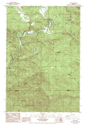
Elsie Topo Map Oregon
To zoom in, hover over the map of Elsie
USGS Topo Quad 45123g5 - 1:24,000 scale
| Topo Map Name: | Elsie |
| USGS Topo Quad ID: | 45123g5 |
| Print Size: | ca. 21 1/4" wide x 27" high |
| Southeast Coordinates: | 45.75° N latitude / 123.5° W longitude |
| Map Center Coordinates: | 45.8125° N latitude / 123.5625° W longitude |
| U.S. State: | OR |
| Filename: | o45123g5.jpg |
| Download Map JPG Image: | Elsie topo map 1:24,000 scale |
| Map Type: | Topographic |
| Topo Series: | 7.5´ |
| Map Scale: | 1:24,000 |
| Source of Map Images: | United States Geological Survey (USGS) |
| Alternate Map Versions: |
Elsie OR 1984, updated 1984 Download PDF Buy paper map Elsie OR 2011 Download PDF Buy paper map Elsie OR 2014 Download PDF Buy paper map |
1:24,000 Topo Quads surrounding Elsie
> Back to 45123e1 at 1:100,000 scale
> Back to 45122a1 at 1:250,000 scale
> Back to U.S. Topo Maps home
Elsie topo map: Gazetteer
Elsie: Falls
Little Falls elevation 91m 298′Elsie: Lakes
Bloom Lake elevation 468m 1535′Lost Lake elevation 450m 1476′
Spruce Run Lake elevation 310m 1017′
Elsie: Parks
Howard Rierson Spruce Run County Park elevation 116m 380′Nehalem County Park elevation 256m 839′
Elsie: Populated Places
Elsie elevation 134m 439′Lukarilla elevation 118m 387′
Mishawaka elevation 168m 551′
Elsie: Post Offices
Elsie Post Office (historical) elevation 134m 439′Mishawaka Post Office (historical) elevation 132m 433′
Elsie: Ridges
Four Seven Ridge elevation 434m 1423′Elsie: Streams
Big Creek elevation 134m 439′Cedar Creek elevation 169m 554′
George Creek elevation 105m 344′
Gold Creek elevation 137m 449′
Humbug Creek elevation 110m 360′
Larsen Creek elevation 122m 400′
Lost Lake Creek elevation 102m 334′
McClure Creek elevation 123m 403′
Middle Fork Cronin Creek elevation 134m 439′
North Fork Cronin Creek elevation 98m 321′
North Fork Quartz Creek elevation 302m 990′
Osweg Creek elevation 120m 393′
Quartz Creek elevation 116m 380′
South Fork Cronin Creek elevation 140m 459′
South Fork Quartz Creek elevation 302m 990′
South Fork Spruce Run Creek elevation 214m 702′
Spruce Run Creek elevation 95m 311′
Elsie: Summits
Flat Iron Mountain elevation 684m 2244′Elsie: Valleys
Nehalem Valley elevation 125m 410′Elsie digital topo map on disk
Buy this Elsie topo map showing relief, roads, GPS coordinates and other geographical features, as a high-resolution digital map file on DVD:


