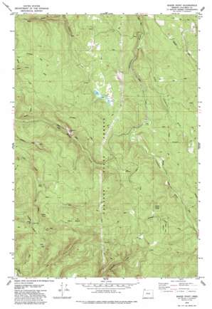
Baker Point Topo Map Oregon
To zoom in, hover over the map of Baker Point
USGS Topo Quad 45123h1 - 1:24,000 scale
| Topo Map Name: | Baker Point |
| USGS Topo Quad ID: | 45123h1 |
| Print Size: | ca. 21 1/4" wide x 27" high |
| Southeast Coordinates: | 45.875° N latitude / 123° W longitude |
| Map Center Coordinates: | 45.9375° N latitude / 123.0625° W longitude |
| U.S. State: | OR |
| Filename: | o45123h1.jpg |
| Download Map JPG Image: | Baker Point topo map 1:24,000 scale |
| Map Type: | Topographic |
| Topo Series: | 7.5´ |
| Map Scale: | 1:24,000 |
| Source of Map Images: | United States Geological Survey (USGS) |
| Alternate Map Versions: |
Baker Point OR 1979, updated 1979 Download PDF Buy paper map Baker Point OR 1979, updated 1986 Download PDF Buy paper map Baker Point OR 2011 Download PDF Buy paper map Baker Point OR 2014 Download PDF Buy paper map |
1:24,000 Topo Quads surrounding Baker Point
> Back to 45123e1 at 1:100,000 scale
> Back to 45122a1 at 1:250,000 scale
> Back to U.S. Topo Maps home
Baker Point topo map: Gazetteer
Baker Point: Lakes
Fish Ponds elevation 324m 1062′Baker Point: Mines
Oak Ranch Pit elevation 339m 1112′Baker Point: Parks
Camp Wilkerson elevation 350m 1148′Chandler Nature Park elevation 387m 1269′
Deepwood Estate elevation 303m 994′
Baker Point: Reservoirs
Titus Pond elevation 434m 1423′Baker Point: Streams
Lava Creek elevation 242m 793′Little Clatskanie River elevation 189m 620′
Baker Point: Summits
Baker Point elevation 570m 1870′Mount Cedara elevation 569m 1866′
Baker Point digital topo map on disk
Buy this Baker Point topo map showing relief, roads, GPS coordinates and other geographical features, as a high-resolution digital map file on DVD:


