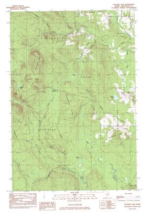
Packard Lake Topo Map Maine
To zoom in, hover over the map of Packard Lake
USGS Topo Quad 46067d8 - 1:24,000 scale
| Topo Map Name: | Packard Lake |
| USGS Topo Quad ID: | 46067d8 |
| Print Size: | ca. 21 1/4" wide x 27" high |
| Southeast Coordinates: | 46.375° N latitude / 67.875° W longitude |
| Map Center Coordinates: | 46.4375° N latitude / 67.9375° W longitude |
| U.S. State: | ME |
| Filename: | o46067d8.jpg |
| Download Map JPG Image: | Packard Lake topo map 1:24,000 scale |
| Map Type: | Topographic |
| Topo Series: | 7.5´ |
| Map Scale: | 1:24,000 |
| Source of Map Images: | United States Geological Survey (USGS) |
| Alternate Map Versions: |
Bridgewater NW ME 1975, updated 1981 Download PDF Buy paper map Packard Lake ME 1984, updated 1984 Download PDF Buy paper map Packard Lake ME 2011 Download PDF Buy paper map Packard Lake ME 2014 Download PDF Buy paper map |
1:24,000 Topo Quads surrounding Packard Lake
> Back to 46067a1 at 1:100,000 scale
> Back to 46066a1 at 1:250,000 scale
> Back to U.S. Topo Maps home
Packard Lake topo map: Gazetteer
Packard Lake: Lakes
Ketchum Lake elevation 279m 915′Packard Lake elevation 166m 544′
Packard Lake: Ridges
Chandler Ridge elevation 263m 862′Collins Ridge elevation 333m 1092′
Packard Lake: Streams
Advent Brook elevation 157m 515′Aker Brook elevation 182m 597′
Burnt Brook elevation 173m 567′
Dunn Brook elevation 185m 606′
Gin Brook elevation 150m 492′
Jimson Brook elevation 198m 649′
Morehouse Brook elevation 193m 633′
Number Nine Stream elevation 165m 541′
Rideout Brook elevation 216m 708′
Split Brook elevation 195m 639′
Packard Lake: Summits
Estabrook Hill elevation 238m 780′Nineteen Mountain elevation 355m 1164′
Packard Hill elevation 175m 574′
Packard Lake: Swamps
Advent Swamp elevation 222m 728′Packard Lake: Trails
Sweets Trail elevation 214m 702′Packard Lake digital topo map on disk
Buy this Packard Lake topo map showing relief, roads, GPS coordinates and other geographical features, as a high-resolution digital map file on DVD:
Maine, New Hampshire, Rhode Island & Eastern Massachusetts
Buy digital topo maps: Maine, New Hampshire, Rhode Island & Eastern Massachusetts


