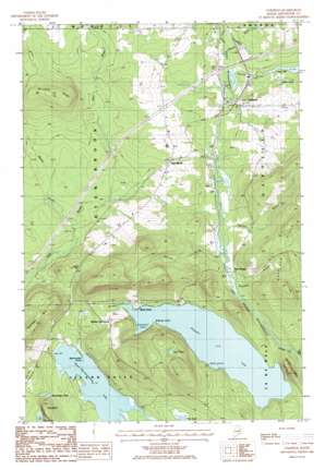
Oakfield Topo Map Maine
To zoom in, hover over the map of Oakfield
USGS Topo Quad 46068a2 - 1:24,000 scale
| Topo Map Name: | Oakfield |
| USGS Topo Quad ID: | 46068a2 |
| Print Size: | ca. 21 1/4" wide x 27" high |
| Southeast Coordinates: | 46° N latitude / 68.125° W longitude |
| Map Center Coordinates: | 46.0625° N latitude / 68.1875° W longitude |
| U.S. State: | ME |
| Filename: | o46068a2.jpg |
| Download Map JPG Image: | Oakfield topo map 1:24,000 scale |
| Map Type: | Topographic |
| Topo Series: | 7.5´ |
| Map Scale: | 1:24,000 |
| Source of Map Images: | United States Geological Survey (USGS) |
| Alternate Map Versions: |
Smyrna Mills SW ME 1975, updated 1980 Download PDF Buy paper map Oakfield ME 1986, updated 1986 Download PDF Buy paper map Oakfield ME 2011 Download PDF Buy paper map Oakfield ME 2014 Download PDF Buy paper map |
1:24,000 Topo Quads surrounding Oakfield
> Back to 46068a1 at 1:100,000 scale
> Back to 46068a1 at 1:250,000 scale
> Back to U.S. Topo Maps home
Oakfield topo map: Gazetteer
Oakfield: Bays
Dinsmore Cove elevation 163m 534′Pea Cove elevation 130m 426′
Pratt Cove elevation 132m 433′
Sand Cove elevation 164m 538′
Oakfield: Capes
Beaverdam Point elevation 131m 429′Birch Point elevation 165m 541′
Whitney Point elevation 176m 577′
Oakfield: Cliffs
The Bluff elevation 164m 538′Oakfield: Crossings
Interchange 60 elevation 170m 557′Oakfield: Lakes
Clark Pond elevation 174m 570′Long Lake elevation 170m 557′
Lost Pond elevation 241m 790′
Morgridge Pond elevation 133m 436′
Pleasant Lake elevation 163m 534′
Upper Mattawamkeag Lake elevation 131m 429′
Oakfield: Populated Places
Dyer Brook elevation 201m 659′Oakfield elevation 189m 620′
Walker Settlement elevation 185m 606′
Oakfield: Ridges
DeLette Ridge elevation 301m 987′Oakfield: Streams
Battle Brook elevation 155m 508′Colbroth Brook elevation 169m 554′
Downing Brook elevation 161m 528′
Huntley Brook elevation 163m 534′
Moose Brook elevation 163m 534′
Thomas Brook elevation 164m 538′
Oakfield: Summits
Oakfield Hills elevation 370m 1213′Outlet Mountain elevation 242m 793′
Oakfield digital topo map on disk
Buy this Oakfield topo map showing relief, roads, GPS coordinates and other geographical features, as a high-resolution digital map file on DVD:
Maine, New Hampshire, Rhode Island & Eastern Massachusetts
Buy digital topo maps: Maine, New Hampshire, Rhode Island & Eastern Massachusetts


