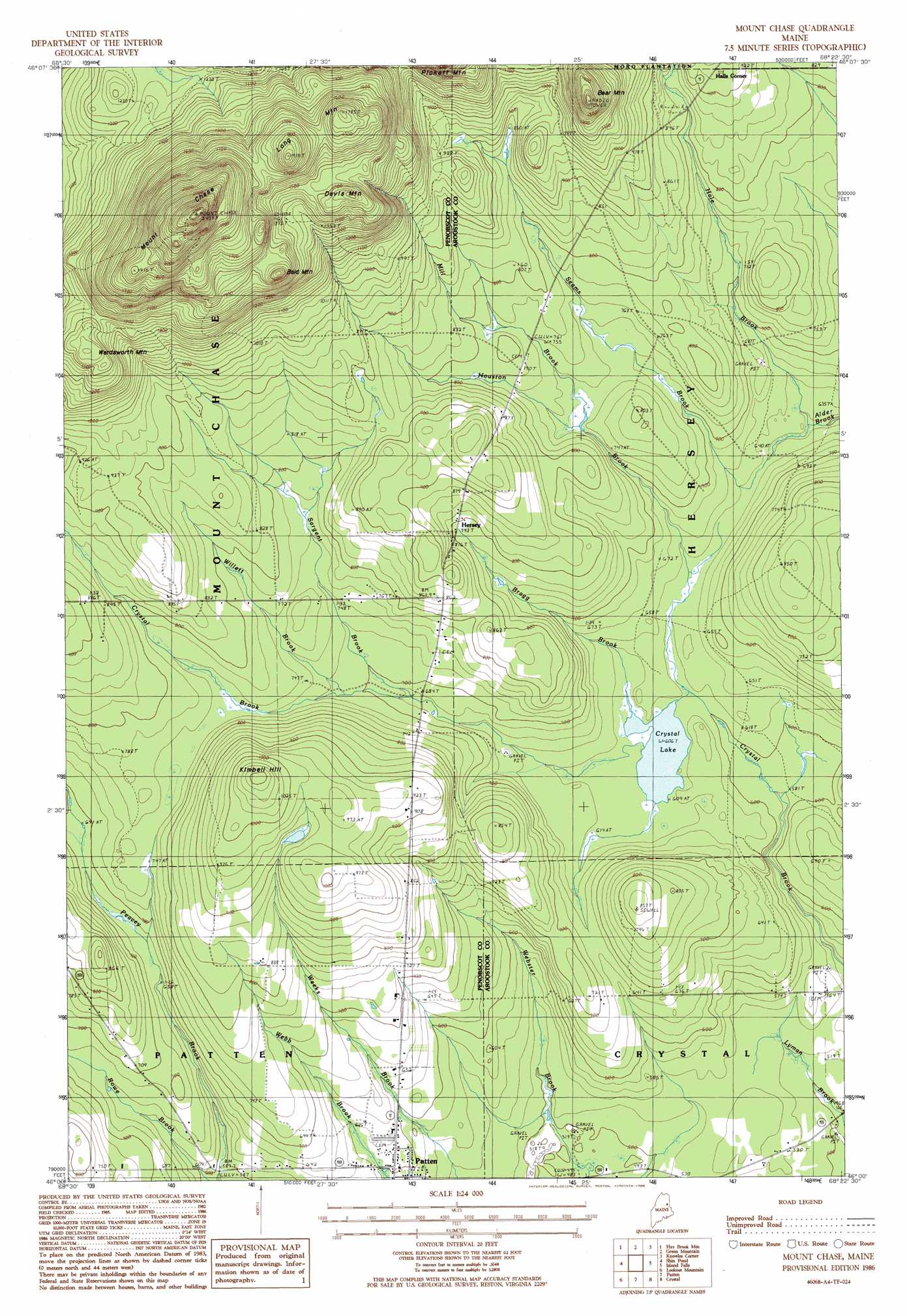
Mount Chase Topo Map Maine
To zoom in, hover over the map of Mount Chase
USGS Topo Quad 46068a4 - 1:24,000 scale
| Topo Map Name: | Mount Chase |
| USGS Topo Quad ID: | 46068a4 |
| Print Size: | ca. 21 1/4" wide x 27" high |
| Southeast Coordinates: | 46° N latitude / 68.375° W longitude |
| Map Center Coordinates: | 46.0625° N latitude / 68.4375° W longitude |
| U.S. State: | ME |
| Filename: | o46068a4.jpg |
| Download Map JPG Image: | Mount Chase topo map 1:24,000 scale |
| Map Type: | Topographic |
| Topo Series: | 7.5´ |
| Map Scale: | 1:24,000 |
| Source of Map Images: | United States Geological Survey (USGS) |
| Alternate Map Versions: |
Island Falls SW ME 1975, updated 1980 Download PDF Buy paper map Mount Chase ME 1986, updated 1986 Download PDF Buy paper map Mount Chase ME 2011 Download PDF Buy paper map Mount Chase ME 2014 Download PDF Buy paper map |
1:24,000 Topo Quads surrounding Mount Chase
Grand Lake Seboeis |
La Pomkeag Lake |
Umcolcus Lake |
Mcnally Ridge |
Saint Croix Lake |
Hay Lake |
Hay Brook Mountain |
Green Mountain |
Knowles Corner |
Smyrna Mills |
Bowlin Brook |
Shin Pond |
Mount Chase |
Island Falls |
Oakfield |
Deasey Mountain |
Lookout Mountain |
Patten |
Crystal |
Mattawamkeag Lake |
Whetstone Mountain |
Stacyville |
Benedicta |
Monarda |
Wytopitlock Lake |
> Back to 46068a1 at 1:100,000 scale
> Back to 46068a1 at 1:250,000 scale
> Back to U.S. Topo Maps home
Mount Chase topo map: Gazetteer
Mount Chase: Dams
Peasley Brook Dam elevation 180m 590′Mount Chase: Lakes
Crystal Lake elevation 185m 606′Mount Chase: Populated Places
Halls Corner elevation 280m 918′Hersey elevation 241m 790′
Mount Chase: Reservoirs
Peasley Brook elevation 180m 590′Mount Chase: Streams
Bragg Brook elevation 186m 610′Hale Brook elevation 193m 633′
Houston Brook elevation 187m 613′
Mill Brook elevation 223m 731′
Rowe Brook elevation 182m 597′
Sargent Brook elevation 206m 675′
Seams Brook elevation 191m 626′
Willett Brook elevation 216m 708′
Mount Chase: Summits
Bald Mountain elevation 490m 1607′Bear Mountain elevation 377m 1236′
Davis Mountain elevation 469m 1538′
Kimball Hill elevation 337m 1105′
Long Mountain elevation 557m 1827′
Mount Chase elevation 736m 2414′
Wardsworth Mountain elevation 412m 1351′
Mount Chase digital topo map on disk
Buy this Mount Chase topo map showing relief, roads, GPS coordinates and other geographical features, as a high-resolution digital map file on DVD:
Maine, New Hampshire, Rhode Island & Eastern Massachusetts
Buy digital topo maps: Maine, New Hampshire, Rhode Island & Eastern Massachusetts