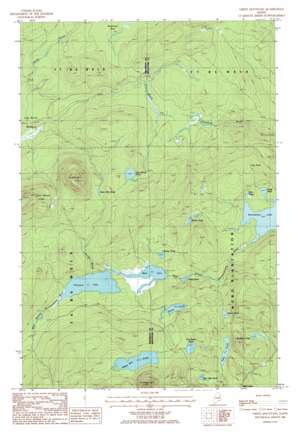
Green Mountain Topo Map Maine
To zoom in, hover over the map of Green Mountain
USGS Topo Quad 46068b4 - 1:24,000 scale
| Topo Map Name: | Green Mountain |
| USGS Topo Quad ID: | 46068b4 |
| Print Size: | ca. 21 1/4" wide x 27" high |
| Southeast Coordinates: | 46.125° N latitude / 68.375° W longitude |
| Map Center Coordinates: | 46.1875° N latitude / 68.4375° W longitude |
| U.S. State: | ME |
| Filename: | o46068b4.jpg |
| Download Map JPG Image: | Green Mountain topo map 1:24,000 scale |
| Map Type: | Topographic |
| Topo Series: | 7.5´ |
| Map Scale: | 1:24,000 |
| Source of Map Images: | United States Geological Survey (USGS) |
| Alternate Map Versions: |
Island Falls NW ME 1975, updated 1980 Download PDF Buy paper map Green Mountain ME 1986, updated 1986 Download PDF Buy paper map Green Mountain ME 2011 Download PDF Buy paper map Green Mountain ME 2014 Download PDF Buy paper map |
1:24,000 Topo Quads surrounding Green Mountain
> Back to 46068a1 at 1:100,000 scale
> Back to 46068a1 at 1:250,000 scale
> Back to U.S. Topo Maps home
Green Mountain topo map: Gazetteer
Green Mountain: Lakes
Bear Mountain Pond elevation 294m 964′Bradford Pond elevation 289m 948′
Chase Pond elevation 207m 679′
Duck Pond elevation 236m 774′
Gilman Pond elevation 245m 803′
Grass Pond elevation 283m 928′
Green Mountain Pond elevation 351m 1151′
Green Pond elevation 294m 964′
Hale Pond elevation 284m 931′
Huntley Pond elevation 268m 879′
Lane Brook Pond elevation 347m 1138′
Lost Pond elevation 263m 862′
Mud Lake elevation 249m 816′
Pickett Mountain Pond elevation 318m 1043′
Pleasant Lake elevation 249m 816′
Rock Pond elevation 221m 725′
Tote Road Pond elevation 307m 1007′
Green Mountain: Summits
Green Mountain elevation 510m 1673′Lane Brook Hills elevation 452m 1482′
Pickett Mountain elevation 474m 1555′
Green Mountain: Swamps
Lane Brook Meadows elevation 263m 862′Wadleigh Bog elevation 297m 974′
Green Mountain digital topo map on disk
Buy this Green Mountain topo map showing relief, roads, GPS coordinates and other geographical features, as a high-resolution digital map file on DVD:
Maine, New Hampshire, Rhode Island & Eastern Massachusetts
Buy digital topo maps: Maine, New Hampshire, Rhode Island & Eastern Massachusetts


