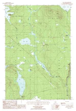
Hay Lake Topo Map Maine
To zoom in, hover over the map of Hay Lake
USGS Topo Quad 46068b6 - 1:24,000 scale
| Topo Map Name: | Hay Lake |
| USGS Topo Quad ID: | 46068b6 |
| Print Size: | ca. 21 1/4" wide x 27" high |
| Southeast Coordinates: | 46.125° N latitude / 68.625° W longitude |
| Map Center Coordinates: | 46.1875° N latitude / 68.6875° W longitude |
| U.S. State: | ME |
| Filename: | o46068b6.jpg |
| Download Map JPG Image: | Hay Lake topo map 1:24,000 scale |
| Map Type: | Topographic |
| Topo Series: | 7.5´ |
| Map Scale: | 1:24,000 |
| Source of Map Images: | United States Geological Survey (USGS) |
| Alternate Map Versions: |
Shin Pond NW ME 1975, updated 1980 Download PDF Buy paper map Hay Lake ME 1986, updated 1986 Download PDF Buy paper map Hay Lake ME 2011 Download PDF Buy paper map Hay Lake ME 2014 Download PDF Buy paper map |
1:24,000 Topo Quads surrounding Hay Lake
> Back to 46068a1 at 1:100,000 scale
> Back to 46068a1 at 1:250,000 scale
> Back to U.S. Topo Maps home
Hay Lake topo map: Gazetteer
Hay Lake: Cliffs
Godfrey Pitch elevation 173m 567′Grand Pitch elevation 159m 521′
Owls Head elevation 247m 810′
Hay Lake: Dams
Sawtelle Deadwater Dam elevation 189m 620′Hay Lake: Falls
Sawtelle Falls elevation 183m 600′Hay Lake: Lakes
Hay Lake elevation 201m 659′Hobart Pond elevation 236m 774′
Little Mud Pond elevation 195m 639′
Moose Pond elevation 236m 774′
Mud Pond elevation 194m 636′
Snowshoe Lake elevation 219m 718′
Soper Logan elevation 205m 672′
Hay Lake: Reservoirs
Santelle Deadwater elevation 194m 636′Sawtelle Deadwater elevation 189m 620′
Hay Lake: Streams
Hay Brook elevation 192m 629′Little Hay Brook elevation 194m 636′
Sawtelle Brook elevation 157m 515′
Scraggy Brook elevation 194m 636′
Shin Brook elevation 148m 485′
Soper Brook elevation 194m 636′
West Branch Sawtelle Brook elevation 204m 669′
Hay Lake: Summits
Hay Mountain elevation 335m 1099′Snowshoe Mountain elevation 399m 1309′
Hay Lake: Trails
Matagamon Tote Road elevation 199m 652′Snowshoe Lake Road elevation 231m 757′
Hay Lake digital topo map on disk
Buy this Hay Lake topo map showing relief, roads, GPS coordinates and other geographical features, as a high-resolution digital map file on DVD:
Maine, New Hampshire, Rhode Island & Eastern Massachusetts
Buy digital topo maps: Maine, New Hampshire, Rhode Island & Eastern Massachusetts


