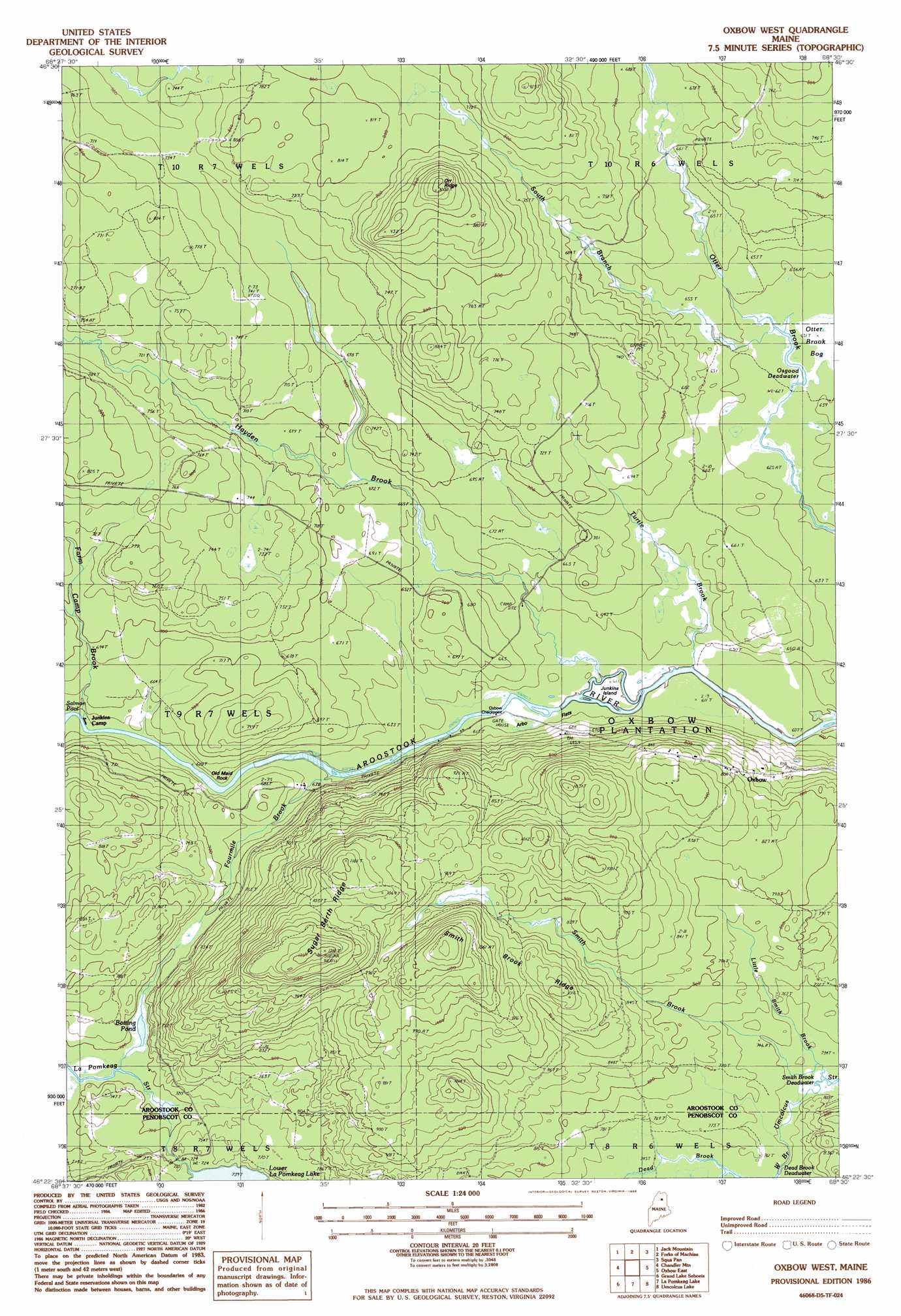
Oxbow West Topo Map Maine
To zoom in, hover over the map of Oxbow West
USGS Topo Quad 46068d5 - 1:24,000 scale
| Topo Map Name: | Oxbow West |
| USGS Topo Quad ID: | 46068d5 |
| Print Size: | ca. 21 1/4" wide x 27" high |
| Southeast Coordinates: | 46.375° N latitude / 68.5° W longitude |
| Map Center Coordinates: | 46.4375° N latitude / 68.5625° W longitude |
| U.S. State: | ME |
| Filename: | o46068d5.jpg |
| Download Map JPG Image: | Oxbow West topo map 1:24,000 scale |
| Map Type: | Topographic |
| Topo Series: | 7.5´ |
| Map Scale: | 1:24,000 |
| Source of Map Images: | United States Geological Survey (USGS) |
| Alternate Map Versions: |
Grand Lake Seboeis NE ME 1975, updated 1981 Download PDF Buy paper map Oxbow West ME 1986, updated 1986 Download PDF Buy paper map Oxbow West ME 2011 Download PDF Buy paper map Oxbow West ME 2014 Download PDF Buy paper map |
1:24,000 Topo Quads surrounding Oxbow West
Big Machias Lake |
Greenlaw Pond |
Little Machias Lake |
Ashland |
York Ridge |
Round Mountain |
Jack Mountain |
Forks Of Machias |
Squa Pan |
Squa Pan Lake West |
Middle Brook Mountain |
Chandler Mountain |
Oxbow West |
Oxbow East |
Griswold |
Millinocket Lake East |
Grand Lake Seboeis |
La Pomkeag Lake |
Umcolcus Lake |
Mcnally Ridge |
Trout Brook Mountain |
Hay Lake |
Hay Brook Mountain |
Green Mountain |
Knowles Corner |
> Back to 46068a1 at 1:100,000 scale
> Back to 46068a1 at 1:250,000 scale
> Back to U.S. Topo Maps home
Oxbow West topo map: Gazetteer
Oxbow West: Flats
Arbo Flats elevation 187m 613′Oxbow West: Islands
Junkins Island elevation 184m 603′Oxbow West: Lakes
Botting Pond elevation 211m 692′Osgood Deadwater elevation 191m 626′
Smith Brook Deadwater elevation 223m 731′
Oxbow West: Pillars
Old Maid Rock elevation 197m 646′Oxbow West: Rapids
Bastc Rips elevation 188m 616′Oxbow West: Ridges
Orr Ridge elevation 305m 1000′Smith Brook Ridge elevation 293m 961′
Sugar Berth Ridge elevation 367m 1204′
Oxbow West: Streams
Dead Brook elevation 228m 748′Farm Camp Brook elevation 194m 636′
Fourmile Brook elevation 191m 626′
Hayden Brook elevation 183m 600′
Little Smith Brook elevation 224m 734′
Smith Brook elevation 224m 734′
South Branch Otter Brook elevation 192m 629′
Turtle Brook elevation 184m 603′
Oxbow West digital topo map on disk
Buy this Oxbow West topo map showing relief, roads, GPS coordinates and other geographical features, as a high-resolution digital map file on DVD:
Maine, New Hampshire, Rhode Island & Eastern Massachusetts
Buy digital topo maps: Maine, New Hampshire, Rhode Island & Eastern Massachusetts