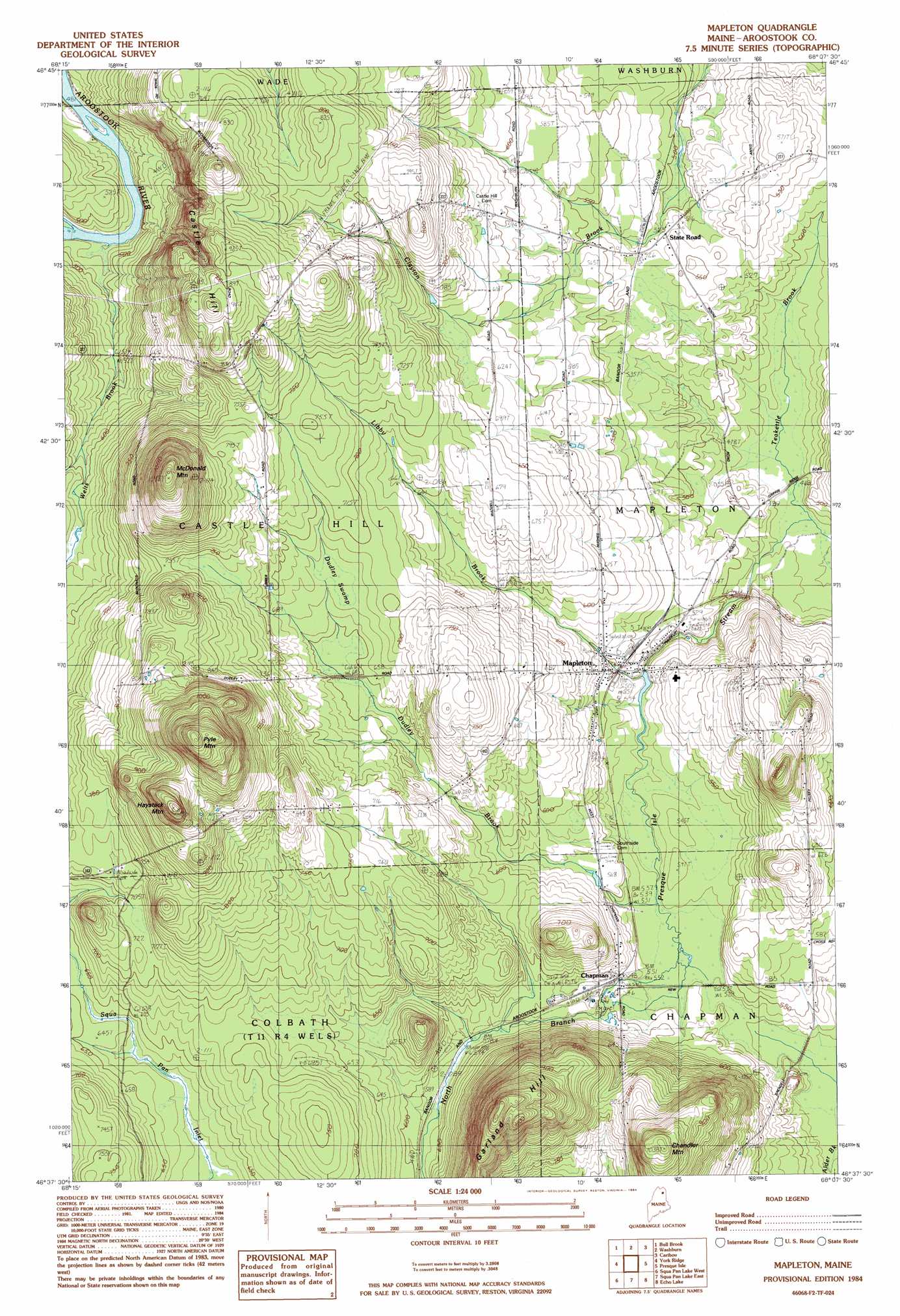
Mapleton Topo Map Maine
To zoom in, hover over the map of Mapleton
USGS Topo Quad 46068f2 - 1:24,000 scale
| Topo Map Name: | Mapleton |
| USGS Topo Quad ID: | 46068f2 |
| Print Size: | ca. 21 1/4" wide x 27" high |
| Southeast Coordinates: | 46.625° N latitude / 68.125° W longitude |
| Map Center Coordinates: | 46.6875° N latitude / 68.1875° W longitude |
| U.S. State: | ME |
| Filename: | o46068f2.jpg |
| Download Map JPG Image: | Mapleton topo map 1:24,000 scale |
| Map Type: | Topographic |
| Topo Series: | 7.5´ |
| Map Scale: | 1:24,000 |
| Source of Map Images: | United States Geological Survey (USGS) |
| Alternate Map Versions: |
Presque Isle NW ME 1975, updated 1981 Download PDF Buy paper map Mapleton ME 1984, updated 1984 Download PDF Buy paper map Mapleton ME 2011 Download PDF Buy paper map Mapleton ME 2014 Download PDF Buy paper map |
1:24,000 Topo Quads surrounding Mapleton
Mcclusky Lake |
Hanford |
Mud Lake |
New Sweden |
Fort Fairfield Nw |
Portage Lake East |
Bull Brook |
Washburn |
Caribou |
Goodwin |
Ashland |
York Ridge |
Mapleton |
Presque Isle |
Easton |
Squa Pan |
Squa Pan Lake West |
Squa Pan Lake East |
Echo Lake |
Westfield |
Oxbow East |
Griswold |
Spinney Brook |
Number Nine Lake |
Packard Lake |
> Back to 46068e1 at 1:100,000 scale
> Back to 46068a1 at 1:250,000 scale
> Back to U.S. Topo Maps home
Mapleton topo map: Gazetteer
Mapleton: Dams
Mapleton Dam elevation 157m 515′Mapleton: Populated Places
Chapman elevation 173m 567′Mapleton elevation 172m 564′
State Road elevation 156m 511′
Mapleton: Streams
Dudley Brook elevation 160m 524′Libby Brook elevation 162m 531′
Teakettle Brook elevation 142m 465′
Welts Brook elevation 140m 459′
Mapleton: Summits
Castle Hill elevation 292m 958′Chandler Mountain elevation 314m 1030′
Garland Hill elevation 351m 1151′
Haystack Mountain elevation 348m 1141′
McDonald Mountain elevation 346m 1135′
Pyle Mountain elevation 385m 1263′
Mapleton: Swamps
Dudley Swamp elevation 207m 679′Mapleton digital topo map on disk
Buy this Mapleton topo map showing relief, roads, GPS coordinates and other geographical features, as a high-resolution digital map file on DVD:
Maine, New Hampshire, Rhode Island & Eastern Massachusetts
Buy digital topo maps: Maine, New Hampshire, Rhode Island & Eastern Massachusetts