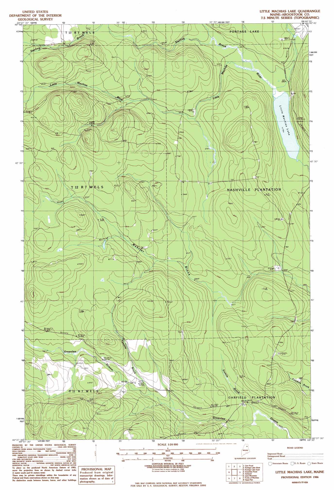
Little Machias Lake Topo Map Maine
To zoom in, hover over the map of Little Machias Lake
USGS Topo Quad 46068f5 - 1:24,000 scale
| Topo Map Name: | Little Machias Lake |
| USGS Topo Quad ID: | 46068f5 |
| Print Size: | ca. 21 1/4" wide x 27" high |
| Southeast Coordinates: | 46.625° N latitude / 68.5° W longitude |
| Map Center Coordinates: | 46.6875° N latitude / 68.5625° W longitude |
| U.S. State: | ME |
| Filename: | o46068f5.jpg |
| Download Map JPG Image: | Little Machias Lake topo map 1:24,000 scale |
| Map Type: | Topographic |
| Topo Series: | 7.5´ |
| Map Scale: | 1:24,000 |
| Source of Map Images: | United States Geological Survey (USGS) |
| Alternate Map Versions: |
Greenlaw NE ME 1975, updated 1981 Download PDF Buy paper map Little Machias Lake ME 1986, updated 1986 Download PDF Buy paper map Little Machias Lake ME 2011 Download PDF Buy paper map Little Machias Lake ME 2014 Download PDF Buy paper map |
1:24,000 Topo Quads surrounding Little Machias Lake
Deboullie Pond |
Island Pond |
Winterville |
Mcclusky Lake |
Hanford |
Fish River Lake |
Carr Pond |
Portage Lake West |
Portage Lake East |
Bull Brook |
Big Machias Lake |
Greenlaw Pond |
Little Machias Lake |
Ashland |
York Ridge |
Round Mountain |
Jack Mountain |
Forks Of Machias |
Squa Pan |
Squa Pan Lake West |
Middle Brook Mountain |
Chandler Mountain |
Oxbow West |
Oxbow East |
Griswold |
> Back to 46068e1 at 1:100,000 scale
> Back to 46068a1 at 1:250,000 scale
> Back to U.S. Topo Maps home
Little Machias Lake topo map: Gazetteer
Little Machias Lake: Lakes
Little Machias Lake elevation 178m 583′Little Machias Lake: Streams
Moosehorn Stream elevation 245m 803′Sixmile Brook elevation 188m 616′
Sterling Brook elevation 180m 590′
Tenmile Brook elevation 214m 702′
Little Machias Lake digital topo map on disk
Buy this Little Machias Lake topo map showing relief, roads, GPS coordinates and other geographical features, as a high-resolution digital map file on DVD:
Maine, New Hampshire, Rhode Island & Eastern Massachusetts
Buy digital topo maps: Maine, New Hampshire, Rhode Island & Eastern Massachusetts