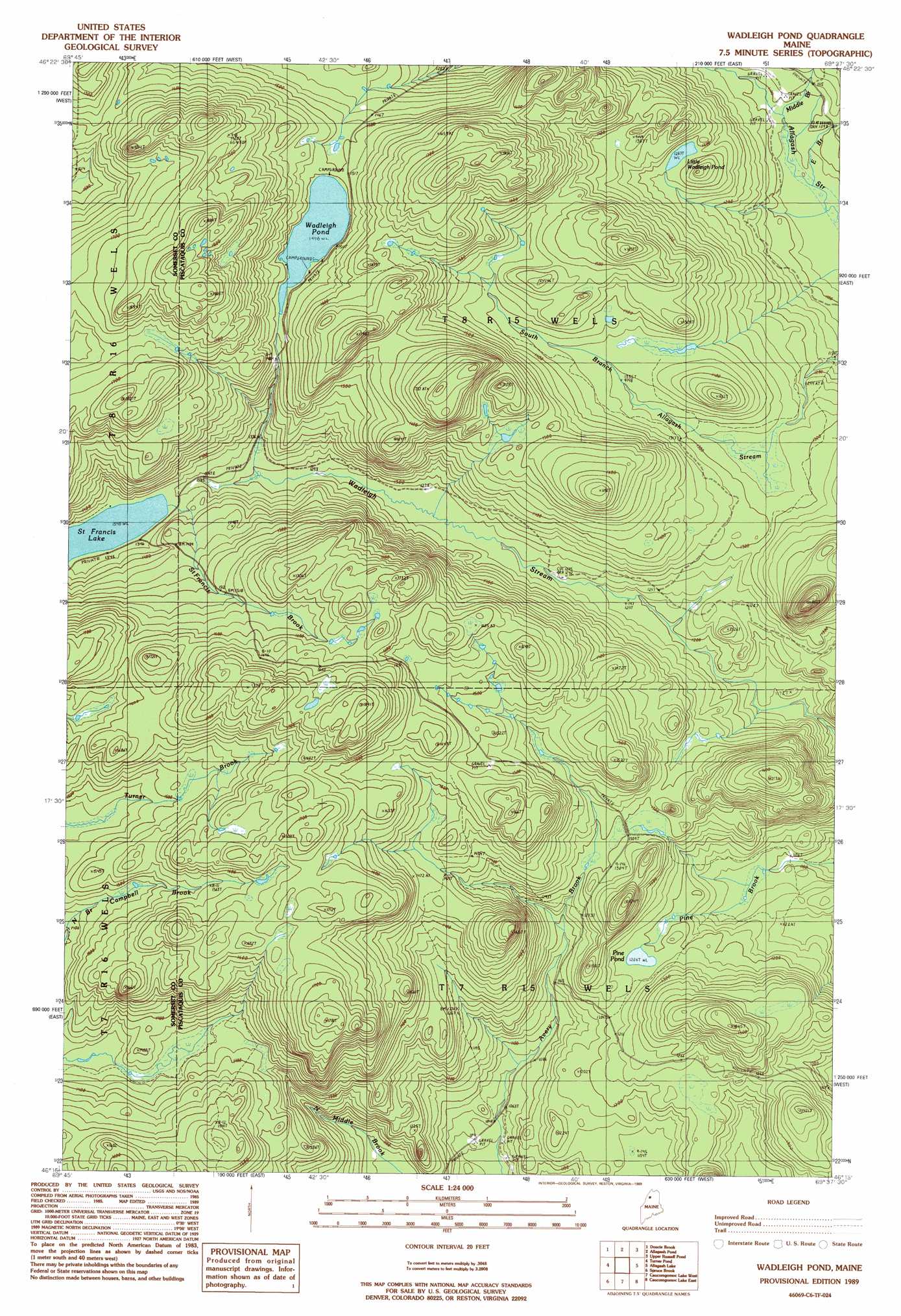
Wadleigh Pond Topo Map Maine
To zoom in, hover over the map of Wadleigh Pond
USGS Topo Quad 46069c6 - 1:24,000 scale
| Topo Map Name: | Wadleigh Pond |
| USGS Topo Quad ID: | 46069c6 |
| Print Size: | ca. 21 1/4" wide x 27" high |
| Southeast Coordinates: | 46.25° N latitude / 69.625° W longitude |
| Map Center Coordinates: | 46.3125° N latitude / 69.6875° W longitude |
| U.S. State: | ME |
| Filename: | o46069c6.jpg |
| Download Map JPG Image: | Wadleigh Pond topo map 1:24,000 scale |
| Map Type: | Topographic |
| Topo Series: | 7.5´ |
| Map Scale: | 1:24,000 |
| Source of Map Images: | United States Geological Survey (USGS) |
| Alternate Map Versions: |
Wadleigh Pond ME 1989, updated 1989 Download PDF Buy paper map Wadleigh Pond ME 2011 Download PDF Buy paper map Wadleigh Pond ME 2014 Download PDF Buy paper map |
1:24,000 Topo Quads surrounding Wadleigh Pond
Eastman Brook |
Beaver Pond Se |
Fool Brook |
Clayton Lake |
Umaskis Lake West |
Baker Lake Nw |
Doucie Brook |
Allagash Pond |
Upper Russell Pond |
Clarkson Pond |
Baker Lake |
Turner Pond |
Wadleigh Pond |
Allagash Lake |
Tramway |
Saint John Pond Depot |
Spruce Brook |
Caucomgomoc Lake West |
Caucomgomoc Lake East |
Longley Pond |
Saint John Ponds |
Russell Mountain |
Bean Pot Pond |
Ragmuff Stream |
Chesuncook |
> Back to 46069a1 at 1:100,000 scale
> Back to 46068a1 at 1:250,000 scale
> Back to U.S. Topo Maps home
Wadleigh Pond topo map: Gazetteer
Wadleigh Pond: Lakes
Little Wadleigh Pond elevation 392m 1286′Pine Pond elevation 367m 1204′
Wadleigh Pond elevation 456m 1496′
Wadleigh Pond: Streams
East Branch Allagash Stream elevation 328m 1076′Middle Branch Allagash Stream elevation 329m 1079′
Middle Brook elevation 327m 1072′
Wadleigh Pond digital topo map on disk
Buy this Wadleigh Pond topo map showing relief, roads, GPS coordinates and other geographical features, as a high-resolution digital map file on DVD:
Maine, New Hampshire, Rhode Island & Eastern Massachusetts
Buy digital topo maps: Maine, New Hampshire, Rhode Island & Eastern Massachusetts