Clarkson Pond Topo Map Maine
To zoom in, hover over the map of Clarkson Pond
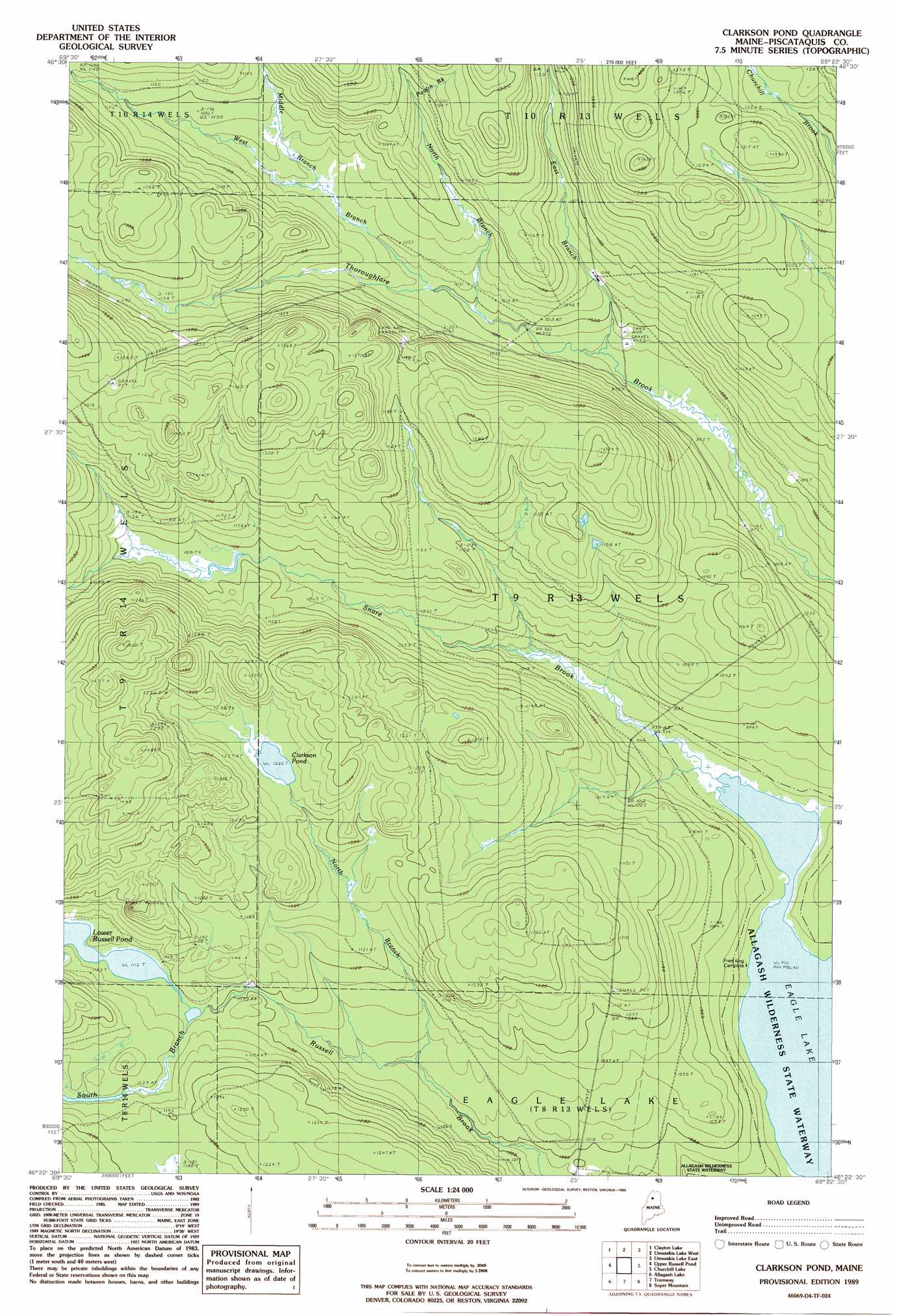
USGS Topo Quad 46069d4 - 1:24,000 scale
| Topo Map Name: | Clarkson Pond |
| USGS Topo Quad ID: | 46069d4 |
| Print Size: | ca. 21 1/4" wide x 27" high |
| Southeast Coordinates: | 46.375° N latitude / 69.375° W longitude |
| Map Center Coordinates: | 46.4375° N latitude / 69.4375° W longitude |
| U.S. State: | ME |
| Filename: | o46069d4.jpg |
| Download Map JPG Image: | Clarkson Pond topo map 1:24,000 scale |
| Map Type: | Topographic |
| Topo Series: | 7.5´ |
| Map Scale: | 1:24,000 |
| Source of Map Images: | United States Geological Survey (USGS) |
| Alternate Map Versions: |
Clarkson Pond ME 1989, updated 1989 Download PDF Buy paper map Clarkson Pond ME 2011 Download PDF Buy paper map Clarkson Pond ME 2014 Download PDF Buy paper map |
1:24,000 Topo Quads surrounding Clarkson Pond
Ninemile Bridge |
Ugh Lake |
Cunliffe Lake |
Cunliffe Islands |
First Musquacook Lake |
Fool Brook |
Clayton Lake |
Umaskis Lake West |
Umaskis Lake East |
Third Musquacook Lake |
Allagash Pond |
Upper Russell Pond |
Clarkson Pond |
Churchill Lake |
Spider Lake |
Wadleigh Pond |
Allagash Lake |
Tramway |
Soper Mountain |
Haymock Lake |
Caucomgomoc Lake West |
Caucomgomoc Lake East |
Longley Pond |
Mud Pond |
Telos Lake |
> Back to 46069a1 at 1:100,000 scale
> Back to 46068a1 at 1:250,000 scale
> Back to U.S. Topo Maps home
Clarkson Pond topo map: Gazetteer
Clarkson Pond: Lakes
Clarkson Pond elevation 373m 1223′Lower Russell Pond elevation 339m 1112′
Clarkson Pond: Streams
Branch of Thoroughfare Brook elevation 348m 1141′East Branch Thoroughfare Brook elevation 292m 958′
Middle Branch Thoroughfare Brook elevation 317m 1040′
North Branch Russell Brook elevation 311m 1020′
North Branch Thoroughfare Brook elevation 305m 1000′
Poulin Brook elevation 354m 1161′
Snare Brook elevation 283m 928′
South Branch Russell Brook elevation 338m 1108′
Thoroughfare Brook elevation 309m 1013′
West Branch Thoroughfare Brook elevation 305m 1000′
Clarkson Pond digital topo map on disk
Buy this Clarkson Pond topo map showing relief, roads, GPS coordinates and other geographical features, as a high-resolution digital map file on DVD:
Maine, New Hampshire, Rhode Island & Eastern Massachusetts
Buy digital topo maps: Maine, New Hampshire, Rhode Island & Eastern Massachusetts