Umaskis Lake East Topo Map Maine
To zoom in, hover over the map of Umaskis Lake East
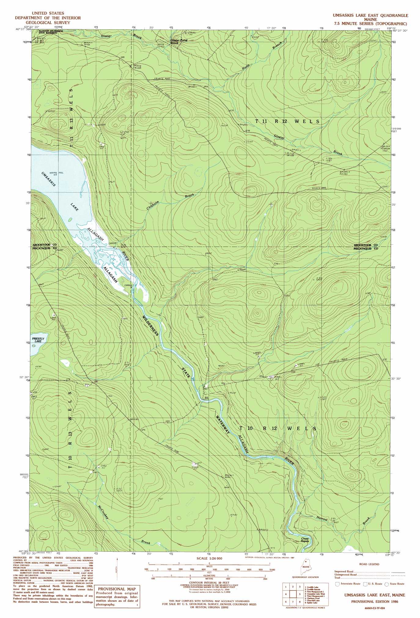
USGS Topo Quad 46069e3 - 1:24,000 scale
| Topo Map Name: | Umaskis Lake East |
| USGS Topo Quad ID: | 46069e3 |
| Print Size: | ca. 21 1/4" wide x 27" high |
| Southeast Coordinates: | 46.5° N latitude / 69.25° W longitude |
| Map Center Coordinates: | 46.5625° N latitude / 69.3125° W longitude |
| U.S. State: | ME |
| Filename: | o46069e3.jpg |
| Download Map JPG Image: | Umaskis Lake East topo map 1:24,000 scale |
| Map Type: | Topographic |
| Topo Series: | 7.5´ |
| Map Scale: | 1:24,000 |
| Source of Map Images: | United States Geological Survey (USGS) |
| Alternate Map Versions: |
Umsaskis Lake East ME 1986, updated 1987 Download PDF Buy paper map Umsaskis Lake East ME 2011 Download PDF Buy paper map Umsaskis Lake East ME 2014 Download PDF Buy paper map |
1:24,000 Topo Quads surrounding Umaskis Lake East
Seven Islands |
Blue Brook |
Round Pond |
Five Finger Brook |
Big Brook Lake |
Ugh Lake |
Cunliffe Lake |
Cunliffe Islands |
First Musquacook Lake |
Upper Mcnally Pond |
Clayton Lake |
Umaskis Lake West |
Umaskis Lake East |
Third Musquacook Lake |
Fifth Musquacook Lake |
Upper Russell Pond |
Clarkson Pond |
Churchill Lake |
Spider Lake |
Chase Lake |
Allagash Lake |
Tramway |
Soper Mountain |
Haymock Lake |
Beetle Mountain |
> Back to 46069e1 at 1:100,000 scale
> Back to 46068a1 at 1:250,000 scale
> Back to U.S. Topo Maps home
Umaskis Lake East topo map: Gazetteer
Umaskis Lake East: Streams
Glazier Pond Brook elevation 294m 964′Harrow Brook elevation 268m 879′
North Branch Glazier Brook elevation 312m 1023′
Umaskis Lake East: Trails
Chase Carry elevation 259m 849′Umaskis Lake East digital topo map on disk
Buy this Umaskis Lake East topo map showing relief, roads, GPS coordinates and other geographical features, as a high-resolution digital map file on DVD:
Maine, New Hampshire, Rhode Island & Eastern Massachusetts
Buy digital topo maps: Maine, New Hampshire, Rhode Island & Eastern Massachusetts