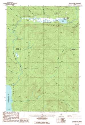
Clayton Lake Topo Map Maine
To zoom in, hover over the map of Clayton Lake
USGS Topo Quad 46069e5 - 1:24,000 scale
| Topo Map Name: | Clayton Lake |
| USGS Topo Quad ID: | 46069e5 |
| Print Size: | ca. 21 1/4" wide x 27" high |
| Southeast Coordinates: | 46.5° N latitude / 69.5° W longitude |
| Map Center Coordinates: | 46.5625° N latitude / 69.5625° W longitude |
| U.S. State: | ME |
| Filename: | o46069e5.jpg |
| Download Map JPG Image: | Clayton Lake topo map 1:24,000 scale |
| Map Type: | Topographic |
| Topo Series: | 7.5´ |
| Map Scale: | 1:24,000 |
| Source of Map Images: | United States Geological Survey (USGS) |
| Alternate Map Versions: |
Clayton Lake ME 1986, updated 1987 Download PDF Buy paper map Clayton Lake ME 2011 Download PDF Buy paper map Clayton Lake ME 2014 Download PDF Buy paper map |
1:24,000 Topo Quads surrounding Clayton Lake
> Back to 46069e1 at 1:100,000 scale
> Back to 46068a1 at 1:250,000 scale
> Back to U.S. Topo Maps home
Clayton Lake topo map: Gazetteer
Clayton Lake: Airports
Clayton Lake Strip elevation 345m 1131′Ilco Landing Area Seaplane Base elevation 316m 1036′
Clayton Lake: Lakes
Clayton Lake elevation 314m 1030′Clayton Lake: Populated Places
Clayton Lake elevation 322m 1056′Clayton Lake: Post Offices
Clayton Lake Post Office elevation 317m 1040′Clayton Lake: Streams
Boucher Brook elevation 368m 1207′Campbell Brook elevation 320m 1049′
Center Brook elevation 332m 1089′
Kelly Brook elevation 317m 1040′
Little Gilbert Brook elevation 317m 1040′
Mills Brook elevation 349m 1145′
Rider Brook elevation 347m 1138′
Clayton Lake digital topo map on disk
Buy this Clayton Lake topo map showing relief, roads, GPS coordinates and other geographical features, as a high-resolution digital map file on DVD:
Maine, New Hampshire, Rhode Island & Eastern Massachusetts
Buy digital topo maps: Maine, New Hampshire, Rhode Island & Eastern Massachusetts


