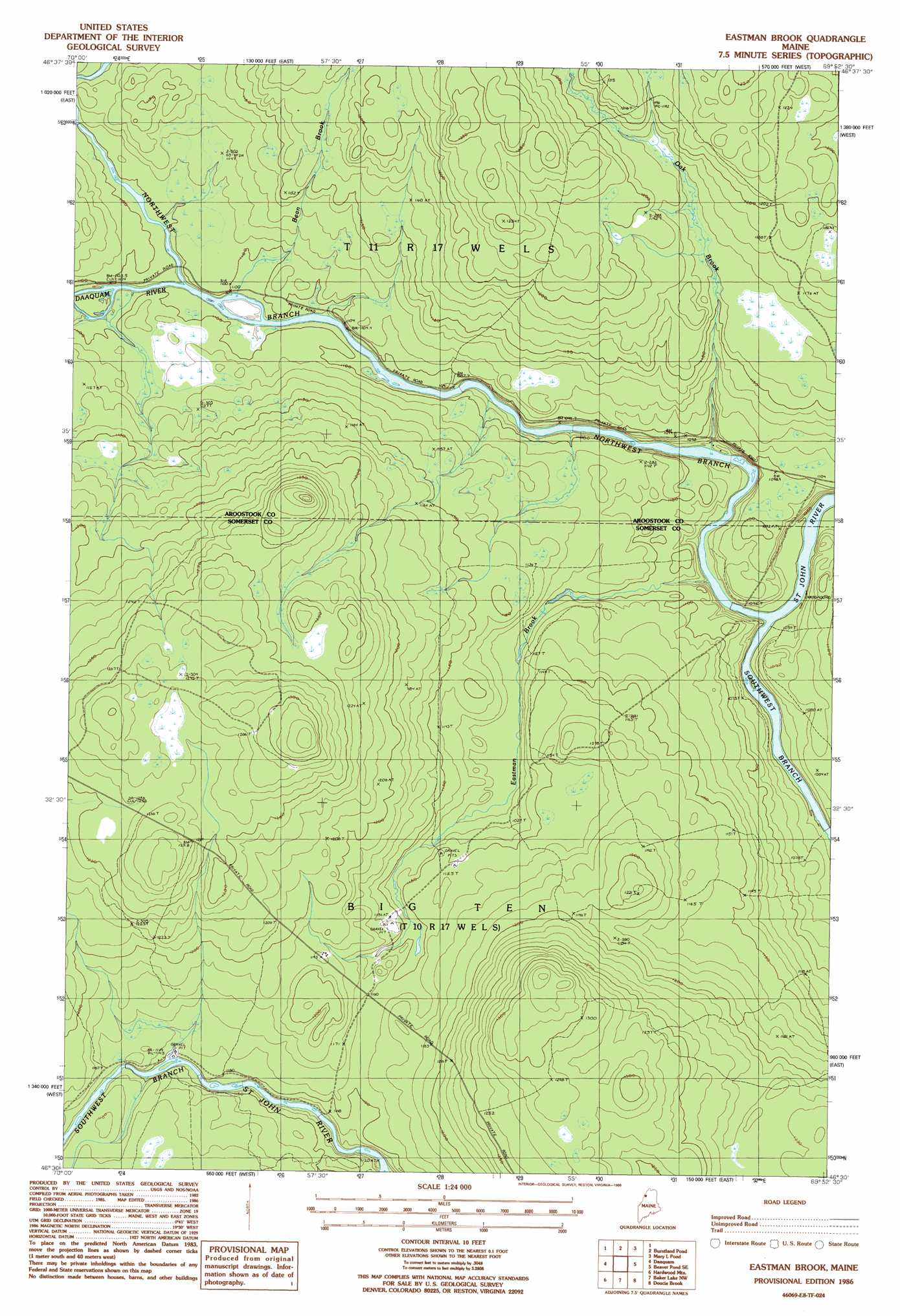
Eastman Brook Topo Map Maine
To zoom in, hover over the map of Eastman Brook
USGS Topo Quad 46069e8 - 1:24,000 scale
| Topo Map Name: | Eastman Brook |
| USGS Topo Quad ID: | 46069e8 |
| Print Size: | ca. 21 1/4" wide x 27" high |
| Southeast Coordinates: | 46.5° N latitude / 69.875° W longitude |
| Map Center Coordinates: | 46.5625° N latitude / 69.9375° W longitude |
| U.S. State: | ME |
| Filename: | o46069e8.jpg |
| Download Map JPG Image: | Eastman Brook topo map 1:24,000 scale |
| Map Type: | Topographic |
| Topo Series: | 7.5´ |
| Map Scale: | 1:24,000 |
| Source of Map Images: | United States Geological Survey (USGS) |
| Alternate Map Versions: |
Eastman Brook ME 1986, updated 1986 Download PDF Buy paper map Eastman Brook ME 2011 Download PDF Buy paper map Eastman Brook ME 2014 Download PDF Buy paper map |
1:24,000 Topo Quads surrounding Eastman Brook
Saint Adalbert |
Depot Lake |
Houlton Pond |
||
Burntland Pond |
Maryl Pond |
Ninemile Bridge |
||
Daaquam |
Eastman Brook |
Beaver Pond Se |
Fool Brook |
|
Hardwood Mountain |
Baker Lake Nw |
Doucie Brook |
Allagash Pond |
|
Hardwood Mountain Sw |
Hardwood Mountain Se |
Baker Lake |
Turner Pond |
Wadleigh Pond |
> Back to 46069e1 at 1:100,000 scale
> Back to 46068a1 at 1:250,000 scale
> Back to U.S. Topo Maps home
Eastman Brook topo map: Gazetteer
Eastman Brook: Streams
Beam Brook elevation 333m 1092′Daaquam River elevation 332m 1089′
Eastman Brook elevation 320m 1049′
Northwest Branch Saint John River elevation 319m 1046′
Oak Brook elevation 324m 1062′
Otter Brook elevation 336m 1102′
Southwest Branch Saint John River elevation 319m 1046′
Eastman Brook digital topo map on disk
Buy this Eastman Brook topo map showing relief, roads, GPS coordinates and other geographical features, as a high-resolution digital map file on DVD:
Maine, New Hampshire, Rhode Island & Eastern Massachusetts
Buy digital topo maps: Maine, New Hampshire, Rhode Island & Eastern Massachusetts