Maryl Pond Topo Map Maine
To zoom in, hover over the map of Maryl Pond
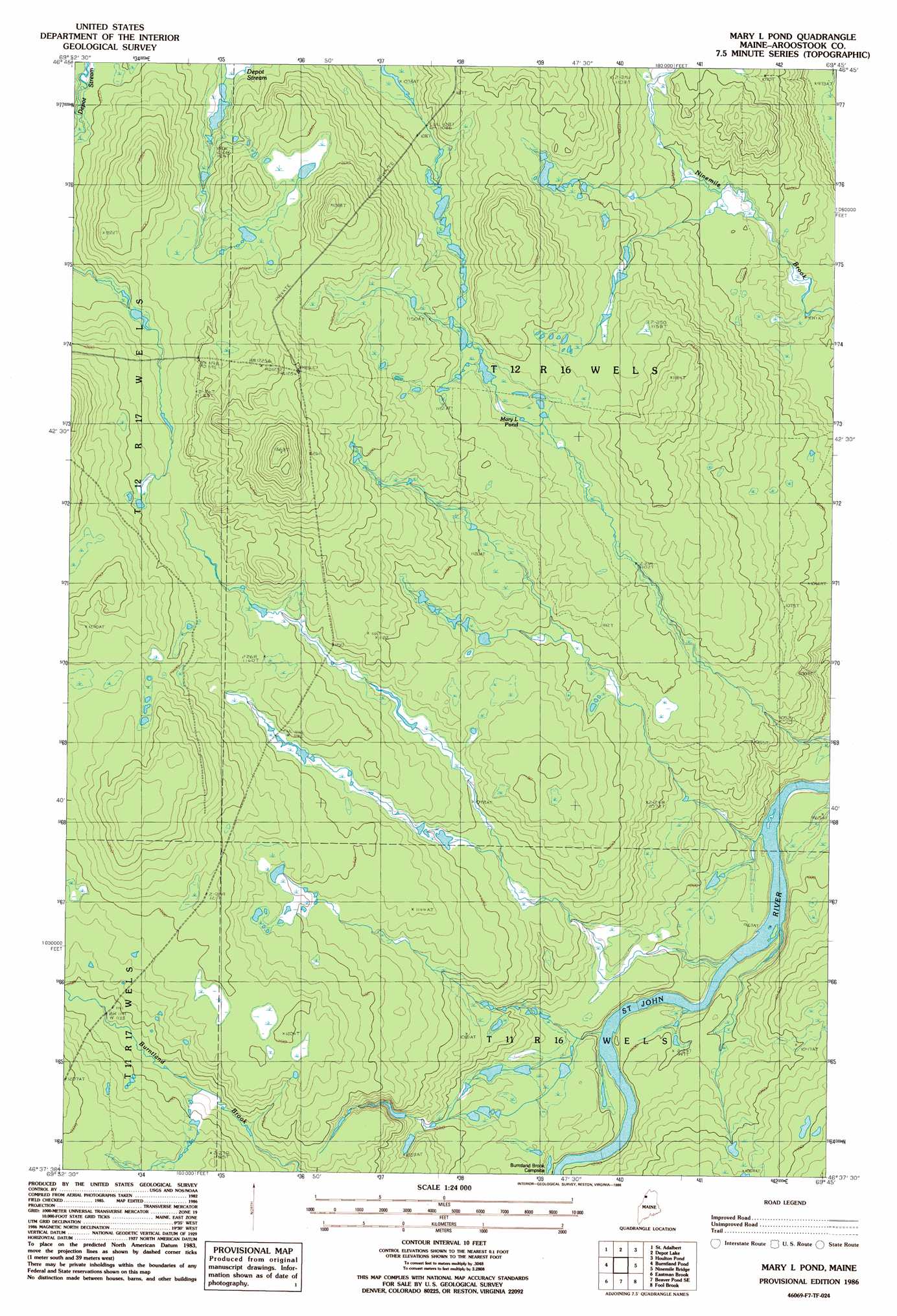
USGS Topo Quad 46069f7 - 1:24,000 scale
| Topo Map Name: | Maryl Pond |
| USGS Topo Quad ID: | 46069f7 |
| Print Size: | ca. 21 1/4" wide x 27" high |
| Southeast Coordinates: | 46.625° N latitude / 69.75° W longitude |
| Map Center Coordinates: | 46.6875° N latitude / 69.8125° W longitude |
| U.S. State: | ME |
| Filename: | o46069f7.jpg |
| Download Map JPG Image: | Maryl Pond topo map 1:24,000 scale |
| Map Type: | Topographic |
| Topo Series: | 7.5´ |
| Map Scale: | 1:24,000 |
| Source of Map Images: | United States Geological Survey (USGS) |
| Alternate Map Versions: |
Mary L Pond ME 1986, updated 1986 Download PDF Buy paper map Mary L Pond ME 2011 Download PDF Buy paper map Mary L Pond ME 2014 Download PDF Buy paper map |
1:24,000 Topo Quads surrounding Maryl Pond
Saint Pamphile |
Charles Pond |
Ninemile Deadwater |
||
Saint Adalbert |
Depot Lake |
Houlton Pond |
Seven Islands |
|
Burntland Pond |
Maryl Pond |
Ninemile Bridge |
Ugh Lake |
|
Daaquam |
Eastman Brook |
Beaver Pond Se |
Fool Brook |
Clayton Lake |
Hardwood Mountain |
Baker Lake Nw |
Doucie Brook |
Allagash Pond |
Upper Russell Pond |
> Back to 46069e1 at 1:100,000 scale
> Back to 46068a1 at 1:250,000 scale
> Back to U.S. Topo Maps home
Maryl Pond digital topo map on disk
Buy this Maryl Pond topo map showing relief, roads, GPS coordinates and other geographical features, as a high-resolution digital map file on DVD:
Maine, New Hampshire, Rhode Island & Eastern Massachusetts
Buy digital topo maps: Maine, New Hampshire, Rhode Island & Eastern Massachusetts