Houlton Pond Topo Map Maine
To zoom in, hover over the map of Houlton Pond
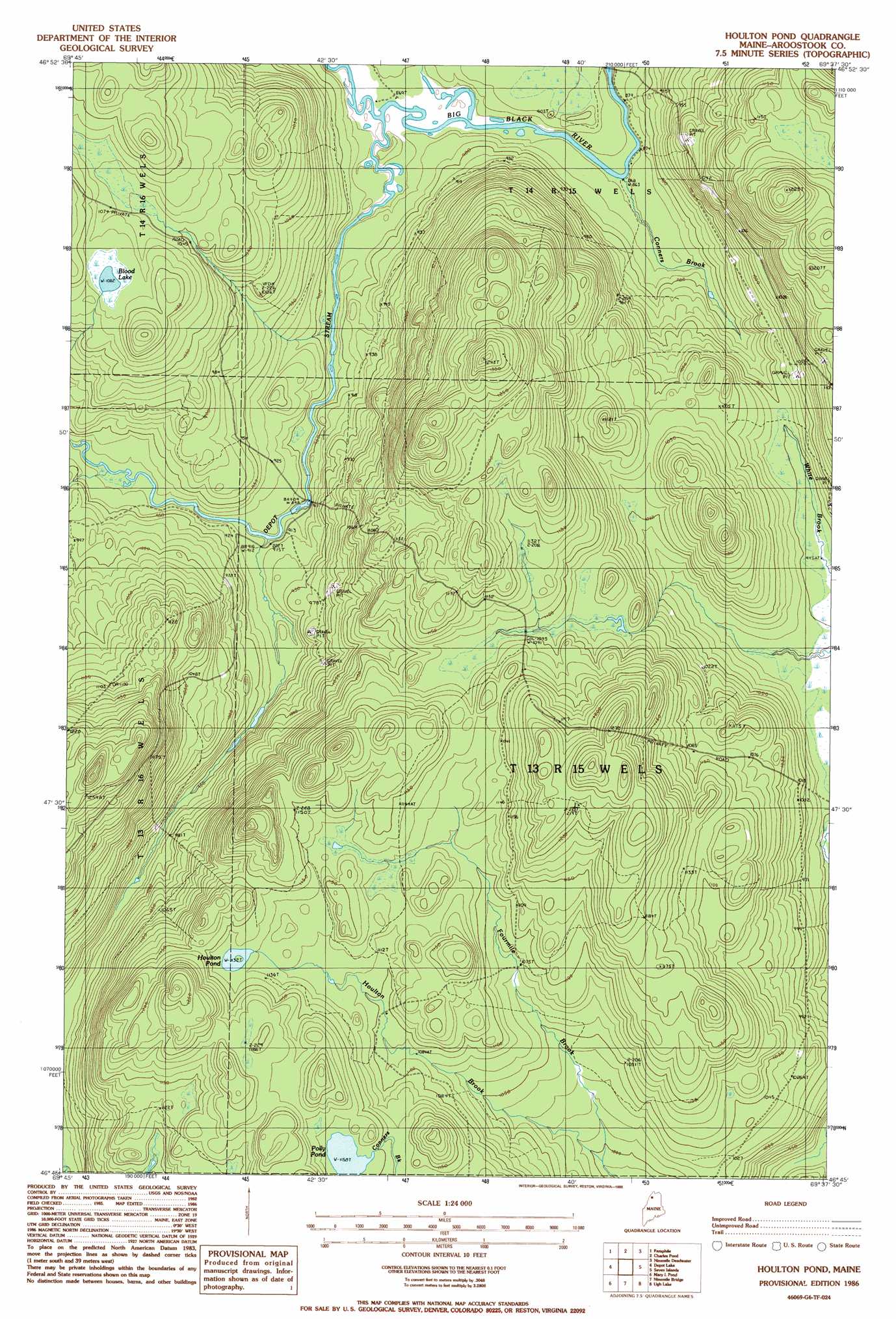
USGS Topo Quad 46069g6 - 1:24,000 scale
| Topo Map Name: | Houlton Pond |
| USGS Topo Quad ID: | 46069g6 |
| Print Size: | ca. 21 1/4" wide x 27" high |
| Southeast Coordinates: | 46.75° N latitude / 69.625° W longitude |
| Map Center Coordinates: | 46.8125° N latitude / 69.6875° W longitude |
| U.S. State: | ME |
| Filename: | o46069g6.jpg |
| Download Map JPG Image: | Houlton Pond topo map 1:24,000 scale |
| Map Type: | Topographic |
| Topo Series: | 7.5´ |
| Map Scale: | 1:24,000 |
| Source of Map Images: | United States Geological Survey (USGS) |
| Alternate Map Versions: |
Houlton Pond ME 1977, updated 1983 Download PDF Buy paper map Houlton Pond ME 1986, updated 1986 Download PDF Buy paper map Houlton Pond ME 2011 Download PDF Buy paper map Houlton Pond ME 2014 Download PDF Buy paper map |
1:24,000 Topo Quads surrounding Houlton Pond
Saint Omer |
East Lake Se |
Rocky Mountain Sw |
||
Saint Pamphile |
Charles Pond |
Ninemile Deadwater |
Big Black Rapids |
|
Saint Adalbert |
Depot Lake |
Houlton Pond |
Seven Islands |
Blue Brook |
Burntland Pond |
Maryl Pond |
Ninemile Bridge |
Ugh Lake |
Cunliffe Lake |
Eastman Brook |
Beaver Pond Se |
Fool Brook |
Clayton Lake |
Umaskis Lake West |
> Back to 46069e1 at 1:100,000 scale
> Back to 46068a1 at 1:250,000 scale
> Back to U.S. Topo Maps home
Houlton Pond topo map: Gazetteer
Houlton Pond: Lakes
Blood Lake elevation 330m 1082′Houlton Pond elevation 345m 1131′
Houlton Pond: Streams
Conners Brook elevation 265m 869′Depot Stream elevation 265m 869′
Fourmile Brook elevation 304m 997′
Houlton Pond digital topo map on disk
Buy this Houlton Pond topo map showing relief, roads, GPS coordinates and other geographical features, as a high-resolution digital map file on DVD:
Maine, New Hampshire, Rhode Island & Eastern Massachusetts
Buy digital topo maps: Maine, New Hampshire, Rhode Island & Eastern Massachusetts