Saint Adalbert Topo Map Maine
To zoom in, hover over the map of Saint Adalbert
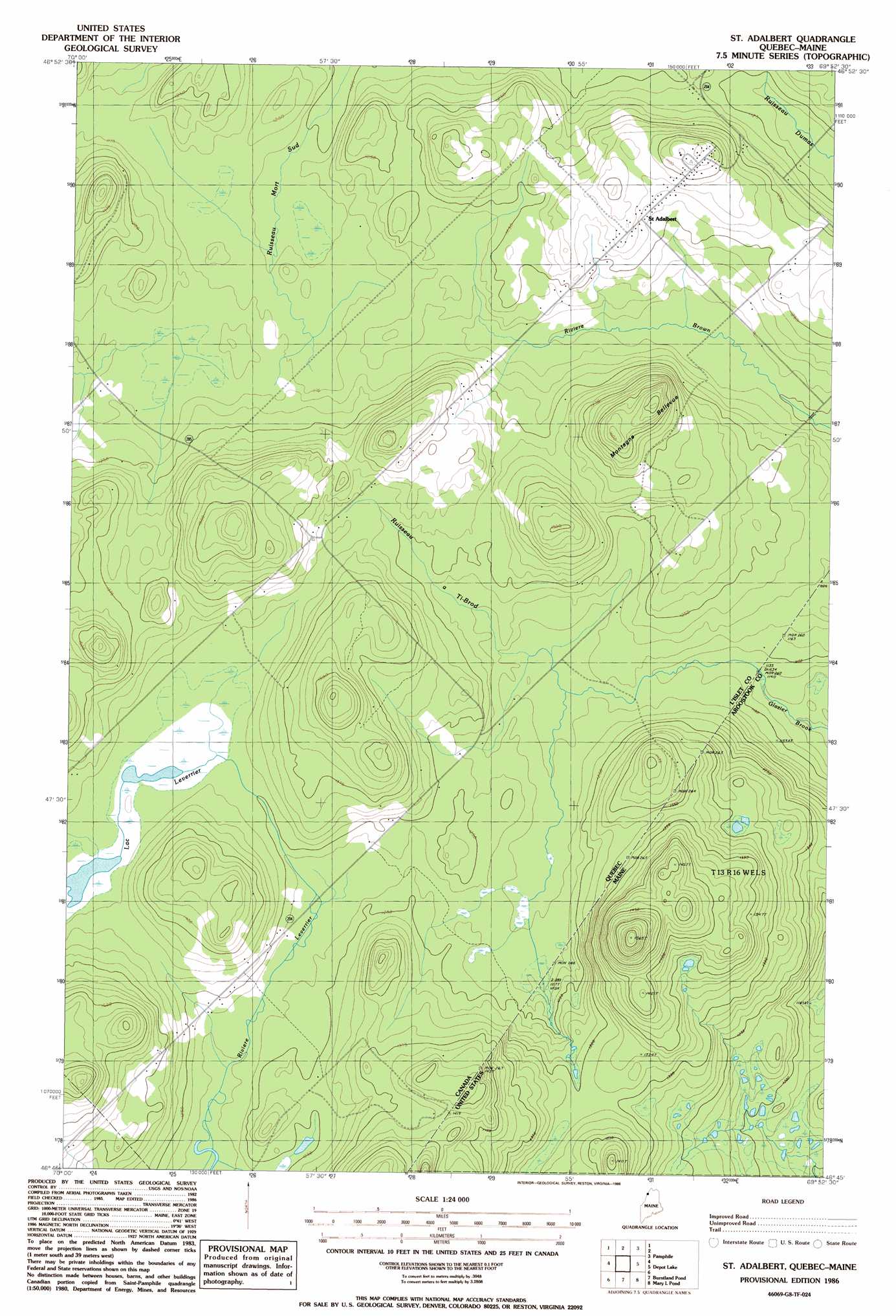
USGS Topo Quad 46069g8 - 1:24,000 scale
| Topo Map Name: | Saint Adalbert |
| USGS Topo Quad ID: | 46069g8 |
| Print Size: | ca. 21 1/4" wide x 27" high |
| Southeast Coordinates: | 46.75° N latitude / 69.875° W longitude |
| Map Center Coordinates: | 46.8125° N latitude / 69.9375° W longitude |
| U.S. State: | ME |
| Filename: | o46069g8.jpg |
| Download Map JPG Image: | Saint Adalbert topo map 1:24,000 scale |
| Map Type: | Topographic |
| Topo Series: | 7.5´ |
| Map Scale: | 1:24,000 |
| Source of Map Images: | United States Geological Survey (USGS) |
| Alternate Map Versions: |
St. Adalbert QC 1977, updated 1983 Download PDF Buy paper map Saint Adalbert QC 2011 Download PDF Buy paper map Saint Adalbert QC 2014 Download PDF Buy paper map |
1:24,000 Topo Quads surrounding Saint Adalbert
Saint Omer |
||||
Saint Pamphile |
Charles Pond |
|||
Saint Adalbert |
Depot Lake |
Houlton Pond |
||
Burntland Pond |
Maryl Pond |
Ninemile Bridge |
||
Daaquam |
Eastman Brook |
Beaver Pond Se |
Fool Brook |
> Back to 46069e1 at 1:100,000 scale
> Back to 46068a1 at 1:250,000 scale
> Back to U.S. Topo Maps home
No gazetteer data is available for the Saint Adalbert topo map sheet.
Saint Adalbert digital topo map on disk
Buy this Saint Adalbert topo map showing relief, roads, GPS coordinates and other geographical features, as a high-resolution digital map file on DVD:
Maine, New Hampshire, Rhode Island & Eastern Massachusetts
Buy digital topo maps: Maine, New Hampshire, Rhode Island & Eastern Massachusetts