Pickford Nw Topo Map Michigan
To zoom in, hover over the map of Pickford Nw
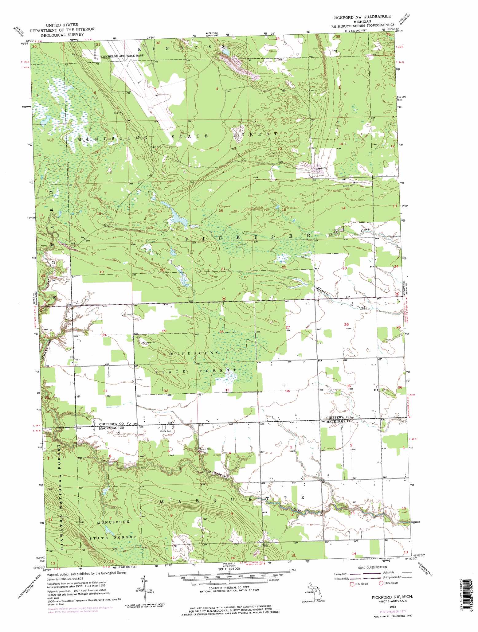
USGS Topo Quad 46084b4 - 1:24,000 scale
| Topo Map Name: | Pickford Nw |
| USGS Topo Quad ID: | 46084b4 |
| Print Size: | ca. 21 1/4" wide x 27" high |
| Southeast Coordinates: | 46.125° N latitude / 84.375° W longitude |
| Map Center Coordinates: | 46.1875° N latitude / 84.4375° W longitude |
| U.S. State: | MI |
| Filename: | o46084b4.jpg |
| Download Map JPG Image: | Pickford Nw topo map 1:24,000 scale |
| Map Type: | Topographic |
| Topo Series: | 7.5´ |
| Map Scale: | 1:24,000 |
| Source of Map Images: | United States Geological Survey (USGS) |
| Alternate Map Versions: |
Pickford NW MI 1953, updated 1955 Download PDF Buy paper map Pickford NW MI 1953, updated 1977 Download PDF Buy paper map Pickford NW MI 1953, updated 1977 Download PDF Buy paper map Pickford NW MI 2011 Download PDF Buy paper map Pickford NW MI 2014 Download PDF Buy paper map Pickford NW MI 2017 Download PDF Buy paper map |
| FStopo: | US Forest Service topo Pickford NW is available: Download FStopo PDF Download FStopo TIF |
1:24,000 Topo Quads surrounding Pickford Nw
Dollar Settlement |
Brimley |
Shallows |
Sault Sainte Marie South |
Baie De Wasai |
Raco |
Kinross |
Dafter |
Barbeau |
Oak Ridge |
Fibre |
Rudyard |
Pickford Nw |
Pickford |
Munuscong |
Charles |
Pontchartrain Shores |
Hessel |
Pickford Se |
Stalwart |
Evergreen Shores |
Saint Martin Island |
Goose Island |
Cedarville |
Prentiss Bay |
> Back to 46084a1 at 1:100,000 scale
> Back to 46084a1 at 1:250,000 scale
> Back to U.S. Topo Maps home
Pickford Nw topo map: Gazetteer
Pickford Nw: Airports
Chippewa County International Airport elevation 243m 797′Pickford Nw digital topo map on disk
Buy this Pickford Nw topo map showing relief, roads, GPS coordinates and other geographical features, as a high-resolution digital map file on DVD: