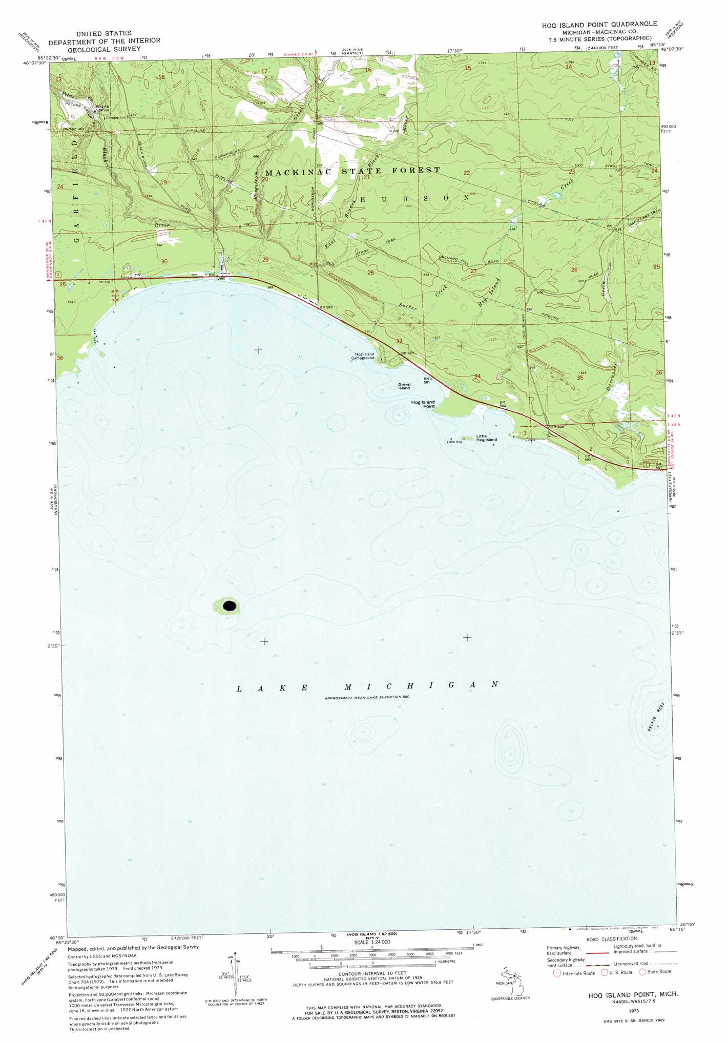
Hog Island Point Topo Map Michigan
To zoom in, hover over the map of Hog Island Point
USGS Topo Quad 46085a3 - 1:24,000 scale
| Topo Map Name: | Hog Island Point |
| USGS Topo Quad ID: | 46085a3 |
| Print Size: | ca. 21 1/4" wide x 27" high |
| Southeast Coordinates: | 46° N latitude / 85.25° W longitude |
| Map Center Coordinates: | 46.0625° N latitude / 85.3125° W longitude |
| U.S. State: | MI |
| Filename: | o46085a3.jpg |
| Download Map JPG Image: | Hog Island Point topo map 1:24,000 scale |
| Map Type: | Topographic |
| Topo Series: | 7.5´ |
| Map Scale: | 1:24,000 |
| Source of Map Images: | United States Geological Survey (USGS) |
| Alternate Map Versions: |
Hog Island Point MI 1973, updated 1977 Download PDF Buy paper map Hog Island Point MI 2011 Download PDF Buy paper map Hog Island Point MI 2014 Download PDF Buy paper map Hog Island Point MI 2017 Download PDF Buy paper map |
1:24,000 Topo Quads surrounding Hog Island Point
Newberry |
Roberts Corner |
Soo Junction |
Hulbert |
Eckerman |
Millecoquins |
Gilchrist |
Garnet |
Rexton |
Trout Lake |
Engadine |
Naubinway |
Hog Island Point |
Epoufette |
Brevort |
Garden Island West |
Hog Island West |
Hog Island East |
Waugoshance Island |
> Back to 46085a1 at 1:100,000 scale
> Back to 46084a1 at 1:250,000 scale
> Back to U.S. Topo Maps home
Hog Island Point topo map: Gazetteer
Hog Island Point: Capes
Hog Island Point elevation 180m 590′Hog Island Point: Forests
Mackinac State Forest elevation 209m 685′Hog Island Point: Islands
Gravel Island elevation 177m 580′Little Hog Island elevation 177m 580′
Hog Island Point: Streams
Black River elevation 179m 587′Borgstrom Creek elevation 180m 590′
Davenport Creek elevation 177m 580′
East Branch Black River elevation 180m 590′
Hog Island Creek elevation 177m 580′
Peters Creek elevation 195m 639′
Sucker Creek elevation 178m 583′
Hog Island Point digital topo map on disk
Buy this Hog Island Point topo map showing relief, roads, GPS coordinates and other geographical features, as a high-resolution digital map file on DVD: