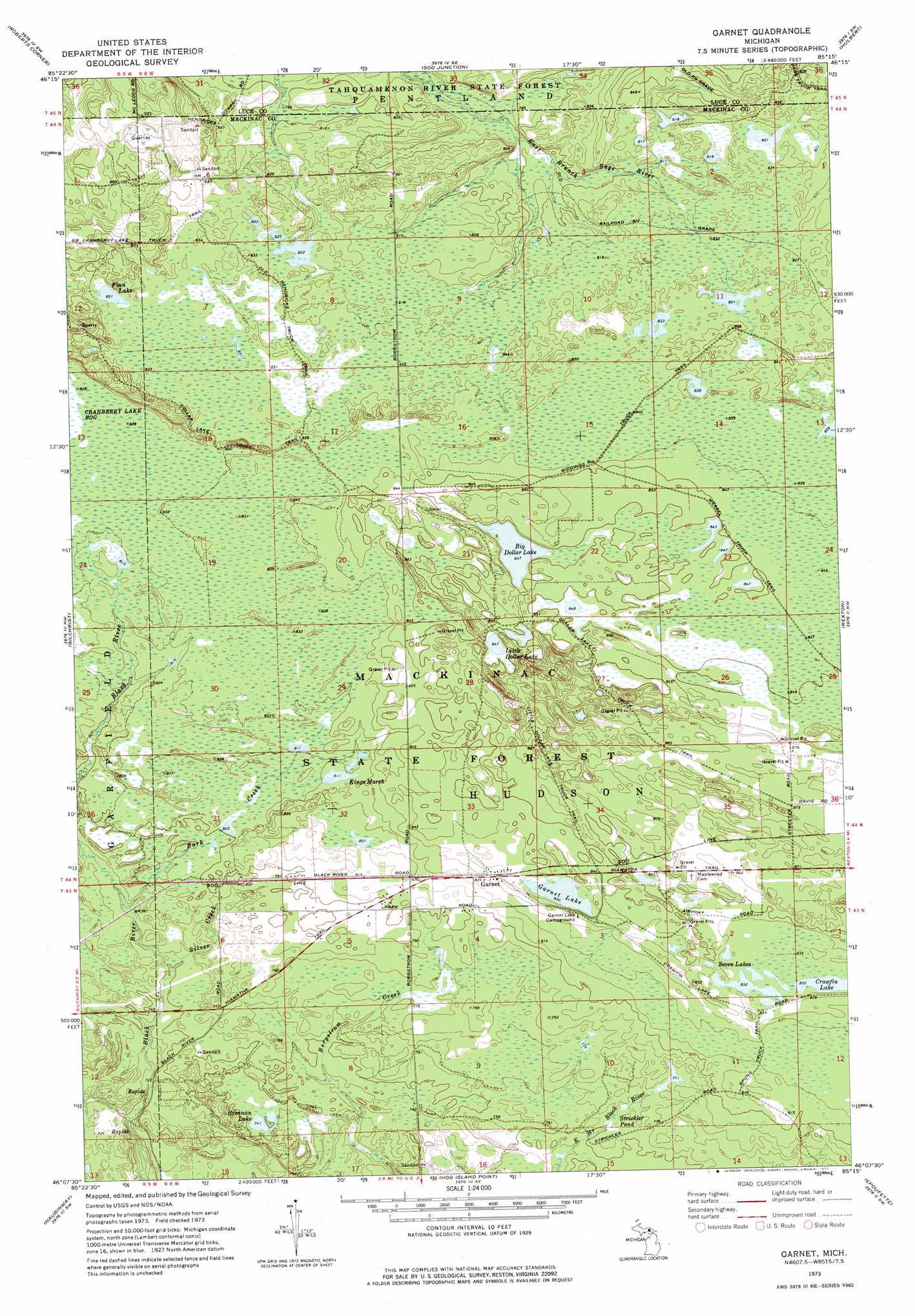
Garnet Topo Map Michigan
To zoom in, hover over the map of Garnet
USGS Topo Quad 46085b3 - 1:24,000 scale
| Topo Map Name: | Garnet |
| USGS Topo Quad ID: | 46085b3 |
| Print Size: | ca. 21 1/4" wide x 27" high |
| Southeast Coordinates: | 46.125° N latitude / 85.25° W longitude |
| Map Center Coordinates: | 46.1875° N latitude / 85.3125° W longitude |
| U.S. State: | MI |
| Filename: | o46085b3.jpg |
| Download Map JPG Image: | Garnet topo map 1:24,000 scale |
| Map Type: | Topographic |
| Topo Series: | 7.5´ |
| Map Scale: | 1:24,000 |
| Source of Map Images: | United States Geological Survey (USGS) |
| Alternate Map Versions: |
Garnet MI 1973, updated 1977 Download PDF Buy paper map Garnet MI 2011 Download PDF Buy paper map Garnet MI 2014 Download PDF Buy paper map Garnet MI 2017 Download PDF Buy paper map |
1:24,000 Topo Quads surrounding Garnet
Auger Lake |
Roy Lake |
Gimlet Creek |
Big Beaver Creek |
Piatt Lake |
Newberry |
Roberts Corner |
Soo Junction |
Hulbert |
Eckerman |
Millecoquins |
Gilchrist |
Garnet |
Rexton |
Trout Lake |
Engadine |
Naubinway |
Hog Island Point |
Epoufette |
Brevort |
> Back to 46085a1 at 1:100,000 scale
> Back to 46084a1 at 1:250,000 scale
> Back to U.S. Topo Maps home
Garnet topo map: Gazetteer
Garnet: Lakes
Big Dollar Lake elevation 258m 846′Brennan Lake elevation 228m 748′
Crawfin Lake elevation 254m 833′
Finn Lake elevation 253m 830′
Garnet Lake elevation 253m 830′
Kings Marsh elevation 247m 810′
Little Dollar Lake elevation 258m 846′
Seven Lakes elevation 254m 833′
Garnet: Parks
Hudson Township Park elevation 258m 846′Garnet: Populated Places
Garnet elevation 256m 839′Garnet: Post Offices
Garnet Post Office (historical) elevation 256m 839′Hendricks Quarry Post Office (historical) elevation 271m 889′
Garnet: Streams
Bark Creek elevation 234m 767′Silver Creek elevation 229m 751′
Garnet: Swamps
Strickler Pond elevation 230m 754′Garnet digital topo map on disk
Buy this Garnet topo map showing relief, roads, GPS coordinates and other geographical features, as a high-resolution digital map file on DVD: