Waco Lake Topo Map Michigan
To zoom in, hover over the map of Waco Lake
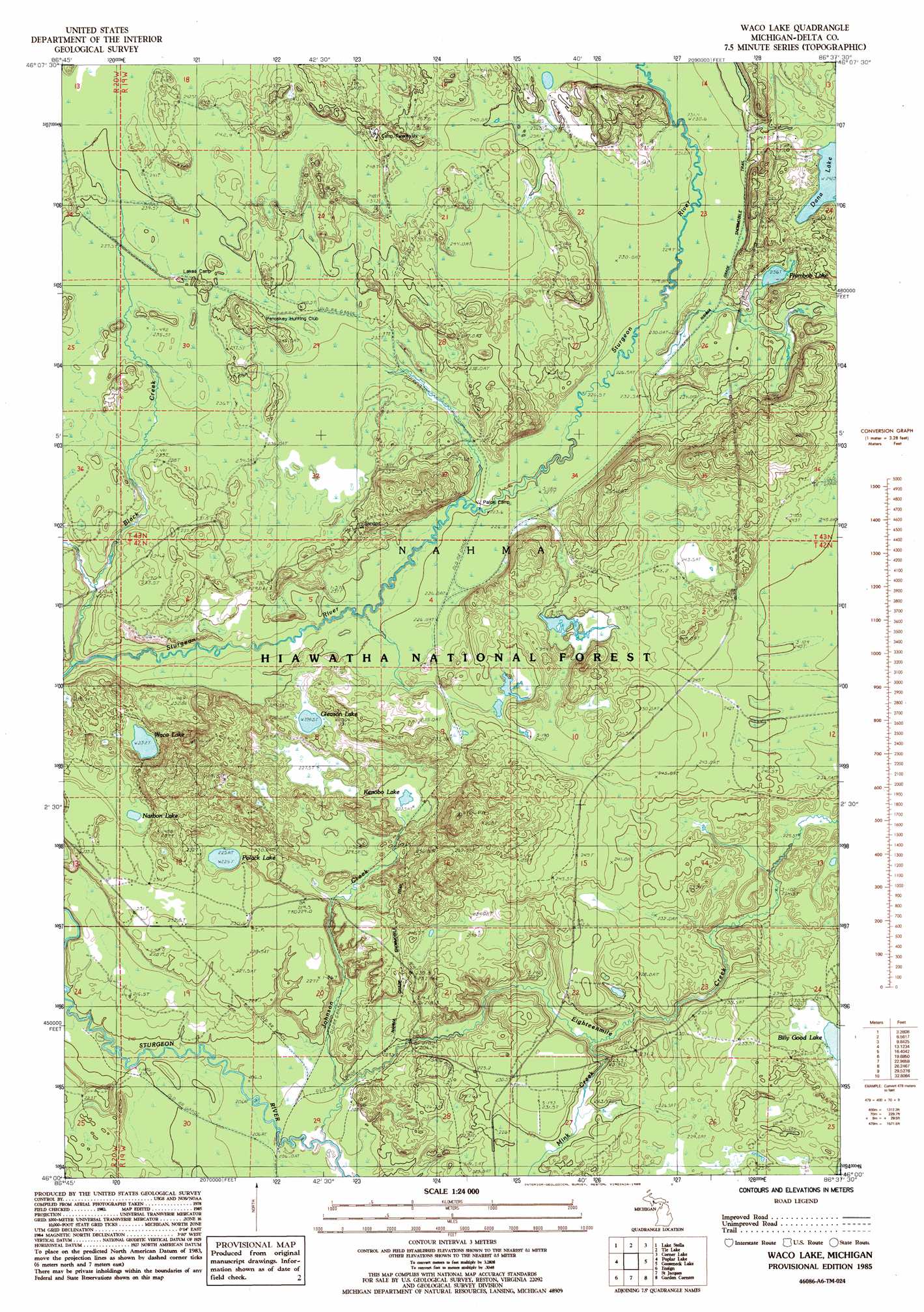
USGS Topo Quad 46086a6 - 1:24,000 scale
| Topo Map Name: | Waco Lake |
| USGS Topo Quad ID: | 46086a6 |
| Print Size: | ca. 21 1/4" wide x 27" high |
| Southeast Coordinates: | 46° N latitude / 86.625° W longitude |
| Map Center Coordinates: | 46.0625° N latitude / 86.6875° W longitude |
| U.S. State: | MI |
| Filename: | o46086a6.jpg |
| Download Map JPG Image: | Waco Lake topo map 1:24,000 scale |
| Map Type: | Topographic |
| Topo Series: | 7.5´ |
| Map Scale: | 1:24,000 |
| Source of Map Images: | United States Geological Survey (USGS) |
| Alternate Map Versions: |
Waco Lake MI 1985, updated 1985 Download PDF Buy paper map Waco Lake MI 2011 Download PDF Buy paper map Waco Lake MI 2014 Download PDF Buy paper map Waco Lake MI 2017 Download PDF Buy paper map |
| FStopo: | US Forest Service topo Waco Lake is available: Download FStopo PDF Download FStopo TIF |
1:24,000 Topo Quads surrounding Waco Lake
Chatham |
Forest Lake |
Powell Lake |
Juniper |
Shingleton |
Trenary |
Lake Stella |
The Lake |
Corner Lake |
Steuben |
Baker Creek |
Poplar Lake |
Waco Lake |
Gooseneck Lake |
Thunder Lake |
Rapid River |
Ensign |
Saint Jacques |
Garden Corners |
Cooks |
Maywood |
Ogontz |
Nahma |
Gardner |
Hiram Point |
> Back to 46086a1 at 1:100,000 scale
> Back to 46086a1 at 1:250,000 scale
> Back to U.S. Topo Maps home
Waco Lake topo map: Gazetteer
Waco Lake: Lakes
Billy Good Lake elevation 230m 754′Dana Lake elevation 242m 793′
Gleason Lake elevation 229m 751′
Kenobo Lake elevation 224m 734′
Narbon Lake elevation 229m 751′
Plumbob Lake elevation 236m 774′
Polack Lake elevation 225m 738′
Waco Lake elevation 232m 761′
Waco Lake: Streams
Black Creek elevation 215m 705′Eighteenmile Creek elevation 204m 669′
Johnson Creek elevation 207m 679′
Mink Creek elevation 218m 715′
Waco Lake digital topo map on disk
Buy this Waco Lake topo map showing relief, roads, GPS coordinates and other geographical features, as a high-resolution digital map file on DVD: