Walsh Topo Map Michigan
To zoom in, hover over the map of Walsh
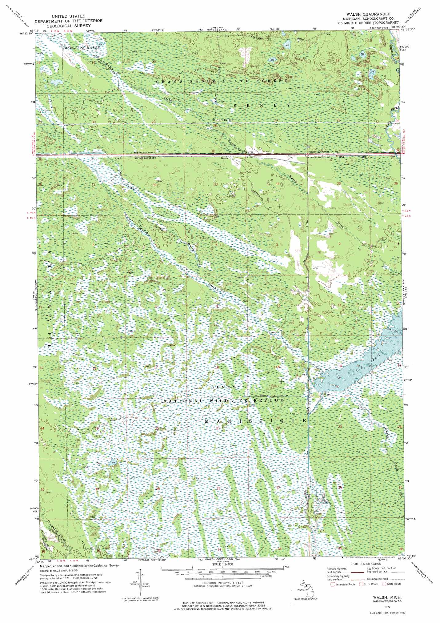
USGS Topo Quad 46086c2 - 1:24,000 scale
| Topo Map Name: | Walsh |
| USGS Topo Quad ID: | 46086c2 |
| Print Size: | ca. 21 1/4" wide x 27" high |
| Southeast Coordinates: | 46.25° N latitude / 86.125° W longitude |
| Map Center Coordinates: | 46.3125° N latitude / 86.1875° W longitude |
| U.S. State: | MI |
| Filename: | o46086c2.jpg |
| Download Map JPG Image: | Walsh topo map 1:24,000 scale |
| Map Type: | Topographic |
| Topo Series: | 7.5´ |
| Map Scale: | 1:24,000 |
| Source of Map Images: | United States Geological Survey (USGS) |
| Alternate Map Versions: |
Walsh MI 1972, updated 1975 Download PDF Buy paper map Walsh MI 2011 Download PDF Buy paper map Walsh MI 2014 Download PDF Buy paper map Walsh MI 2017 Download PDF Buy paper map |
1:24,000 Topo Quads surrounding Walsh
Grand Portal Point |
Trappers Lake |
Au Sable Point Sw |
Au Sable Point Se |
Nawakwa Lake |
Melstrand |
Cusino |
Driggs Lake |
Sunken Lake |
Seney Nw |
Shingleton |
Creighton |
Walsh |
Driggs Lake Se |
Seney |
Steuben |
Steuben Ne |
Marsh Creek Pool Nw |
Marsh Creek Pool |
Germfask |
Thunder Lake |
Hiawath |
Smith Lake |
Merwin Lake |
Blaney Park |
> Back to 46086a1 at 1:100,000 scale
> Back to 46086a1 at 1:250,000 scale
> Back to U.S. Topo Maps home
Walsh topo map: Gazetteer
Walsh: Canals
Spur Ditch elevation 226m 741′Walsh: Populated Places
Walsh elevation 238m 780′Walsh: Post Offices
Walsh Post Office (historical) elevation 238m 780′Walsh: Reservoirs
C-Three Pool elevation 224m 734′Walsh: Streams
Ducey Creek elevation 233m 764′Walsh digital topo map on disk
Buy this Walsh topo map showing relief, roads, GPS coordinates and other geographical features, as a high-resolution digital map file on DVD: