Cusino Topo Map Michigan
To zoom in, hover over the map of Cusino
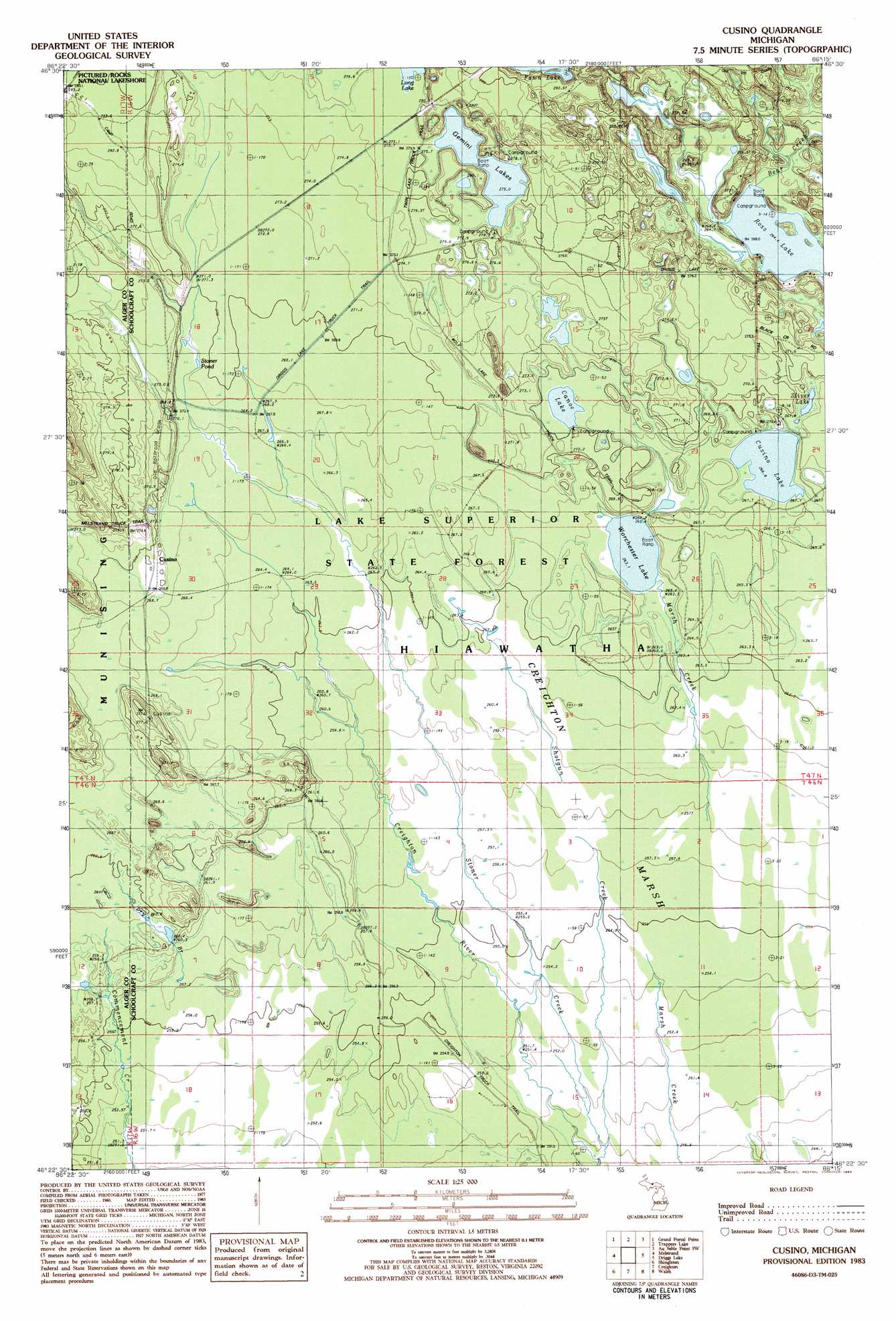
USGS Topo Quad 46086d3 - 1:25,000 scale
| Topo Map Name: | Cusino |
| USGS Topo Quad ID: | 46086d3 |
| Print Size: | ca. 21 1/4" wide x 27" high |
| Southeast Coordinates: | 46.375° N latitude / 86.25° W longitude |
| Map Center Coordinates: | 46.4375° N latitude / 86.3125° W longitude |
| U.S. State: | MI |
| Filename: | l46086d3.jpg |
| Download Map JPG Image: | Cusino topo map 1:25,000 scale |
| Map Type: | Topographic |
| Topo Series: | 7.5´ |
| Map Scale: | 1:25,000 |
| Source of Map Images: | United States Geological Survey (USGS) |
| Alternate Map Versions: |
1:24,000 Topo Quads surrounding Cusino
Au Sable Point |
Grand Sable Lake |
|||
Wood Island Se |
Grand Portal Point |
Trappers Lake |
Au Sable Point Sw |
Au Sable Point Se |
Indian Town |
Melstrand |
Cusino |
Driggs Lake |
Sunken Lake |
Juniper |
Shingleton |
Creighton |
Walsh |
Driggs Lake Se |
Corner Lake |
Steuben |
Steuben Ne |
Marsh Creek Pool Nw |
Marsh Creek Pool |
> Back to 46086a1 at 1:100,000 scale
> Back to 46086a1 at 1:250,000 scale
> Back to U.S. Topo Maps home
Cusino topo map: Gazetteer
Cusino: Lakes
Canoe Lake elevation 269m 882′Cusino Lake elevation 267m 875′
Gemini Lakes elevation 275m 902′
Ross Lake elevation 263m 862′
Silver Lake elevation 267m 875′
Stoner Pond elevation 270m 885′
Worchester Lake elevation 264m 866′
Cusino: Populated Places
Cusino elevation 268m 879′Cusino: Post Offices
Cusino Post Office (historical) elevation 268m 879′Cusino: Streams
Bear Creek elevation 264m 866′Shotgun Creek elevation 249m 816′
Stoner Creek elevation 250m 820′
Cusino: Swamps
Creighton Marsh elevation 253m 830′Cusino digital topo map on disk
Buy this Cusino topo map showing relief, roads, GPS coordinates and other geographical features, as a high-resolution digital map file on DVD: