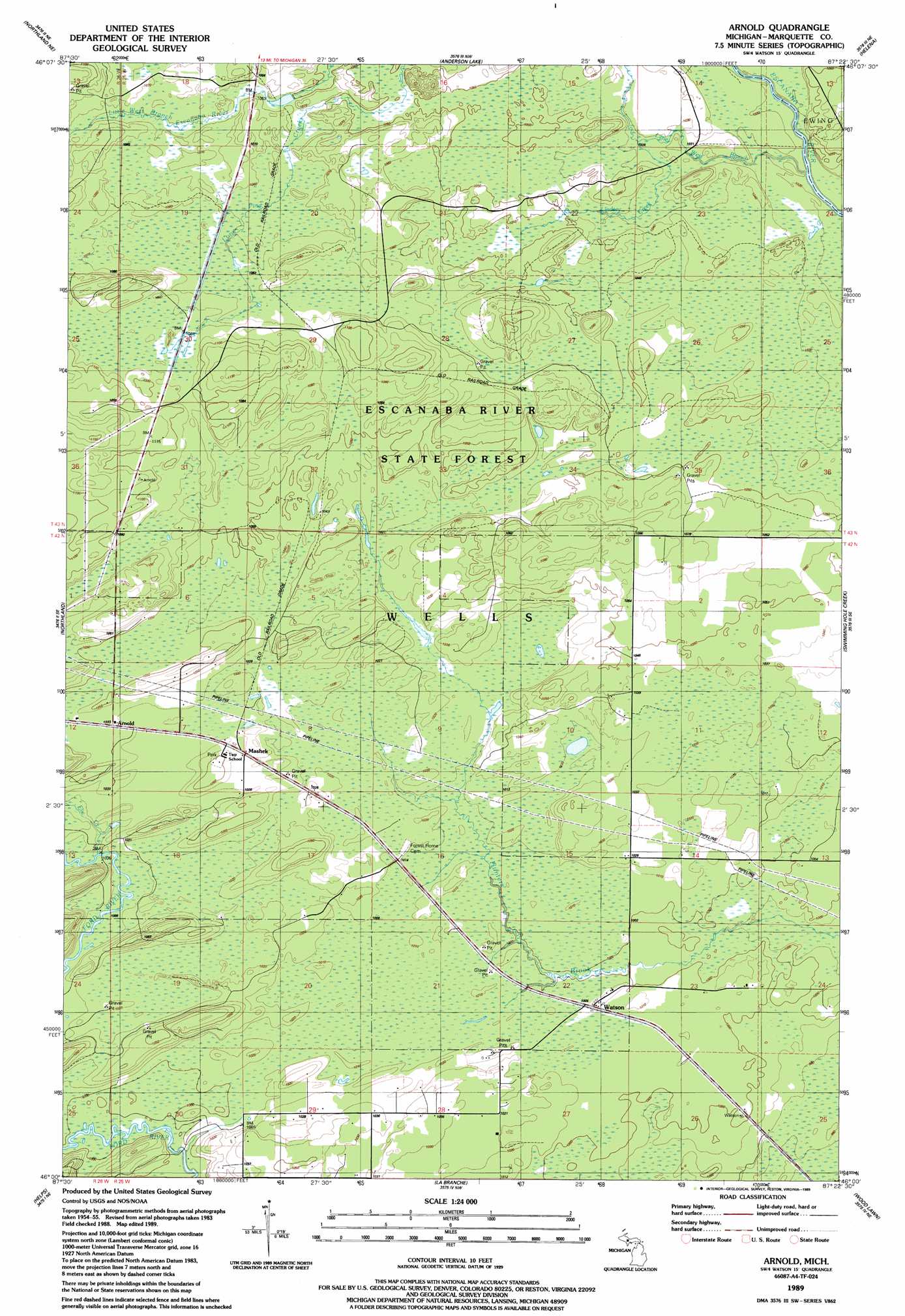
Arnold Topo Map Michigan
To zoom in, hover over the map of Arnold
USGS Topo Quad 46087a4 - 1:24,000 scale
| Topo Map Name: | Arnold |
| USGS Topo Quad ID: | 46087a4 |
| Print Size: | ca. 21 1/4" wide x 27" high |
| Southeast Coordinates: | 46° N latitude / 87.375° W longitude |
| Map Center Coordinates: | 46.0625° N latitude / 87.4375° W longitude |
| U.S. State: | MI |
| Filename: | o46087a4.jpg |
| Download Map JPG Image: | Arnold topo map 1:24,000 scale |
| Map Type: | Topographic |
| Topo Series: | 7.5´ |
| Map Scale: | 1:24,000 |
| Source of Map Images: | United States Geological Survey (USGS) |
| Alternate Map Versions: |
Arnold MI 1989, updated 1989 Download PDF Buy paper map Arnold MI 2011 Download PDF Buy paper map Arnold MI 2014 Download PDF Buy paper map Arnold MI 2017 Download PDF Buy paper map |
1:24,000 Topo Quads surrounding Arnold
Green Hills |
Cataract Basin |
Gwinn |
Little Lake |
Carlshend |
Northland Nw |
Northland Ne |
Anderson Lake |
Helena |
Mcfarland |
Alfred |
Northland |
Arnold |
Swimming Hole Creek |
Rock |
Foster City |
Helps |
La Branche |
Woodlawn |
Cornell |
Waucedah |
Vega |
Whitney |
Schaffer |
Chandler |
> Back to 46087a1 at 1:100,000 scale
> Back to 46086a1 at 1:250,000 scale
> Back to U.S. Topo Maps home
Arnold topo map: Gazetteer
Arnold: Populated Places
Arnold elevation 314m 1030′Mashek elevation 314m 1030′
Watson elevation 308m 1010′
Arnold: Post Offices
Arnold Post Office (historical) elevation 314m 1030′Arnold: Streams
Elie Creek elevation 306m 1003′Lindsey Creek elevation 313m 1026′
Little West Branch Escanaba River elevation 307m 1007′
Arnold digital topo map on disk
Buy this Arnold topo map showing relief, roads, GPS coordinates and other geographical features, as a high-resolution digital map file on DVD: