Helena Topo Map Michigan
To zoom in, hover over the map of Helena
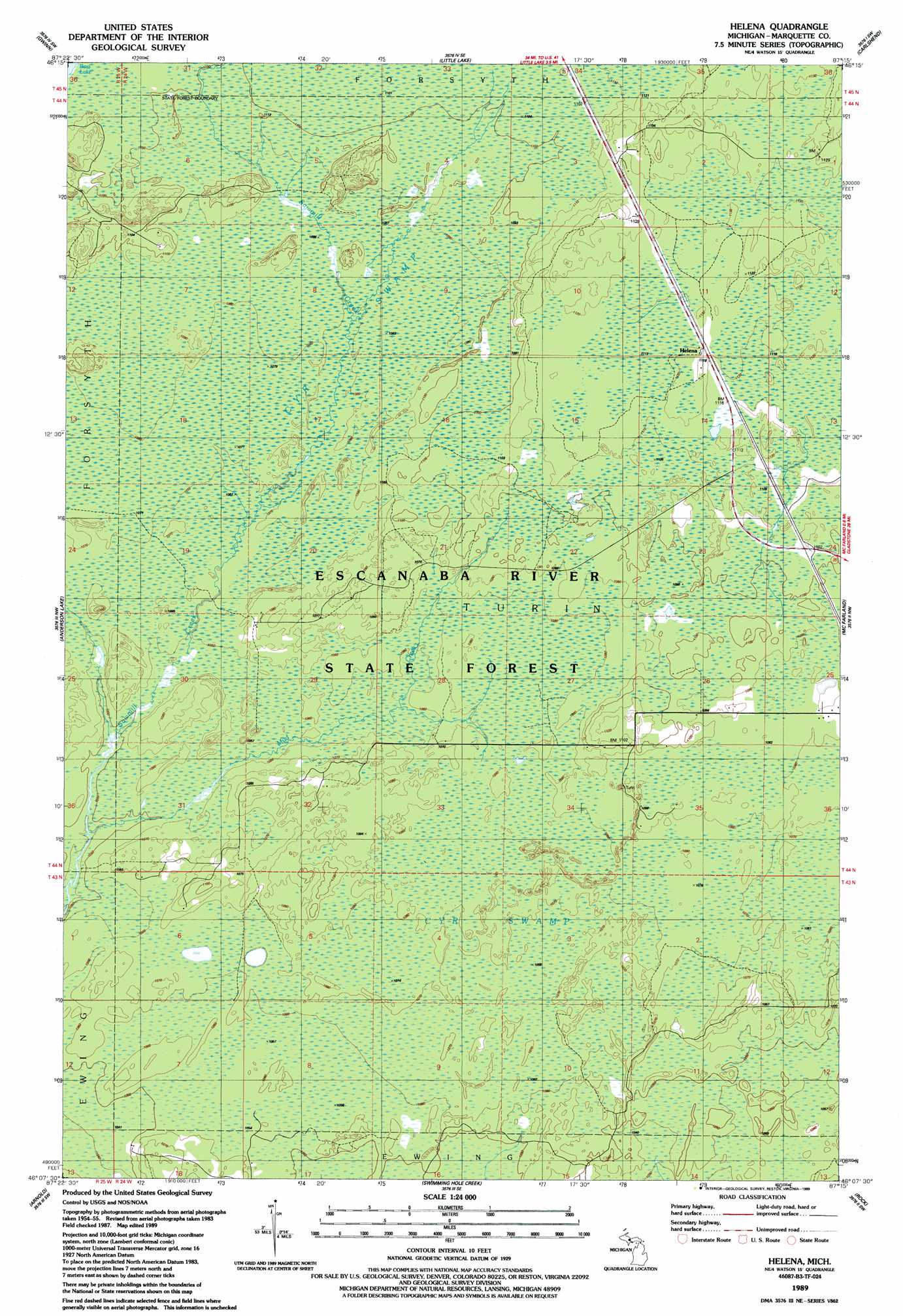
USGS Topo Quad 46087b3 - 1:24,000 scale
| Topo Map Name: | Helena |
| USGS Topo Quad ID: | 46087b3 |
| Print Size: | ca. 21 1/4" wide x 27" high |
| Southeast Coordinates: | 46.125° N latitude / 87.25° W longitude |
| Map Center Coordinates: | 46.1875° N latitude / 87.3125° W longitude |
| U.S. State: | MI |
| Filename: | o46087b3.jpg |
| Download Map JPG Image: | Helena topo map 1:24,000 scale |
| Map Type: | Topographic |
| Topo Series: | 7.5´ |
| Map Scale: | 1:24,000 |
| Source of Map Images: | United States Geological Survey (USGS) |
| Alternate Map Versions: |
Helena MI 1986, updated 1986 Download PDF Buy paper map Helena MI 1989, updated 1989 Download PDF Buy paper map Helena MI 2011 Download PDF Buy paper map Helena MI 2014 Download PDF Buy paper map Helena MI 2017 Download PDF Buy paper map |
1:24,000 Topo Quads surrounding Helena
Palmer |
Sands |
Harvey |
Skandia |
Sand River |
Cataract Basin |
Gwinn |
Little Lake |
Carlshend |
Ladoga |
Northland Ne |
Anderson Lake |
Helena |
Mcfarland |
Diffin |
Northland |
Arnold |
Swimming Hole Creek |
Rock |
Rock Se |
Helps |
La Branche |
Woodlawn |
Cornell |
Perkins |
> Back to 46087a1 at 1:100,000 scale
> Back to 46086a1 at 1:250,000 scale
> Back to U.S. Topo Maps home
Helena topo map: Gazetteer
Helena: Populated Places
Helena elevation 342m 1122′Helena: Post Offices
Stack Post Office (historical) elevation 338m 1108′Helena: Streams
Mud Creek elevation 317m 1040′Helena digital topo map on disk
Buy this Helena topo map showing relief, roads, GPS coordinates and other geographical features, as a high-resolution digital map file on DVD: