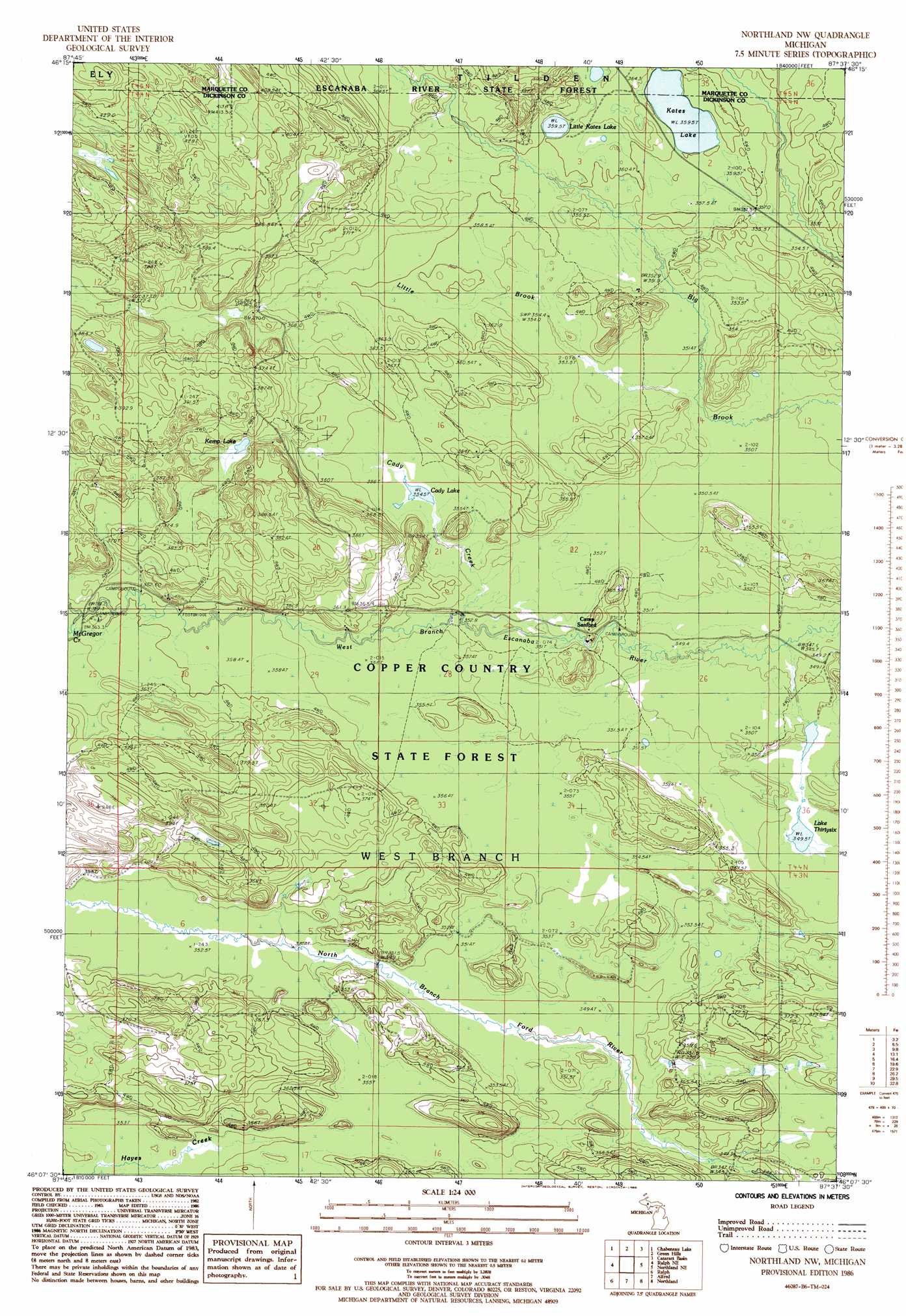
Northland Nw Topo Map Michigan
To zoom in, hover over the map of Northland Nw
USGS Topo Quad 46087b6 - 1:24,000 scale
| Topo Map Name: | Northland Nw |
| USGS Topo Quad ID: | 46087b6 |
| Print Size: | ca. 21 1/4" wide x 27" high |
| Southeast Coordinates: | 46.125° N latitude / 87.625° W longitude |
| Map Center Coordinates: | 46.1875° N latitude / 87.6875° W longitude |
| U.S. State: | MI |
| Filename: | o46087b6.jpg |
| Download Map JPG Image: | Northland Nw topo map 1:24,000 scale |
| Map Type: | Topographic |
| Topo Series: | 7.5´ |
| Map Scale: | 1:24,000 |
| Source of Map Images: | United States Geological Survey (USGS) |
| Alternate Map Versions: |
Northland NW MI 1986, updated 1986 Download PDF Buy paper map Northland NW MI 2011 Download PDF Buy paper map Northland NW MI 2014 Download PDF Buy paper map Northland NW MI 2017 Download PDF Buy paper map |
1:24,000 Topo Quads surrounding Northland Nw
Republic |
Greenwood |
Ishpeming |
Palmer |
Sands |
Republic Sw |
Chabeneau Lake |
Green Hills |
Cataract Basin |
Gwinn |
Ralph Nw |
Ralph Ne |
Northland Nw |
Northland Ne |
Anderson Lake |
Ralph Sw |
Ralph |
Alfred |
Northland |
Arnold |
Carney Lake |
Felch |
Foster City |
Helps |
La Branche |
> Back to 46087a1 at 1:100,000 scale
> Back to 46086a1 at 1:250,000 scale
> Back to U.S. Topo Maps home
Northland Nw topo map: Gazetteer
Northland Nw: Lakes
Cady Lake elevation 355m 1164′Kates Lake elevation 359m 1177′
Kemp Lake elevation 371m 1217′
Lake Thirtysix elevation 349m 1145′
Little Kates Lake elevation 359m 1177′
Northland Nw: Streams
Cady Creek elevation 351m 1151′Little Brook elevation 350m 1148′
McGregor Creek elevation 360m 1181′
Northland Nw digital topo map on disk
Buy this Northland Nw topo map showing relief, roads, GPS coordinates and other geographical features, as a high-resolution digital map file on DVD: