Cataract Basin Topo Map Michigan
To zoom in, hover over the map of Cataract Basin
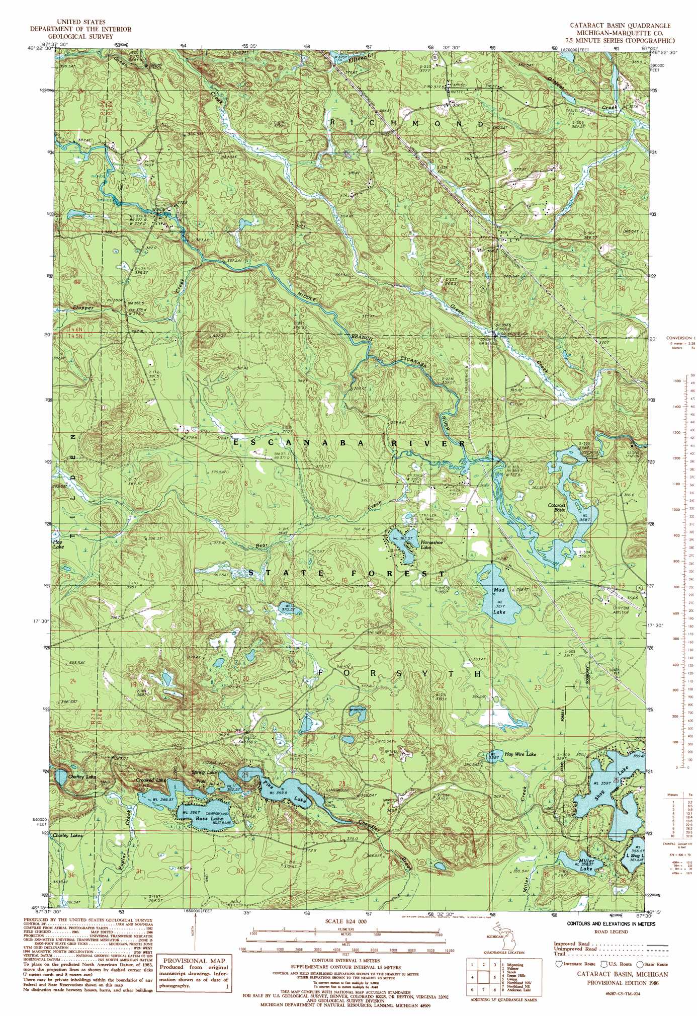
USGS Topo Quad 46087c5 - 1:24,000 scale
| Topo Map Name: | Cataract Basin |
| USGS Topo Quad ID: | 46087c5 |
| Print Size: | ca. 21 1/4" wide x 27" high |
| Southeast Coordinates: | 46.25° N latitude / 87.5° W longitude |
| Map Center Coordinates: | 46.3125° N latitude / 87.5625° W longitude |
| U.S. State: | MI |
| Filename: | o46087c5.jpg |
| Download Map JPG Image: | Cataract Basin topo map 1:24,000 scale |
| Map Type: | Topographic |
| Topo Series: | 7.5´ |
| Map Scale: | 1:24,000 |
| Source of Map Images: | United States Geological Survey (USGS) |
| Alternate Map Versions: |
Cataract Basin MI 1986, updated 1986 Download PDF Buy paper map Cataract Basin MI 2011 Download PDF Buy paper map Cataract Basin MI 2014 Download PDF Buy paper map Cataract Basin MI 2017 Download PDF Buy paper map |
1:24,000 Topo Quads surrounding Cataract Basin
Diorite |
Negaunee Sw |
Negaunee |
Marquette |
|
Greenwood |
Ishpeming |
Palmer |
Sands |
Harvey |
Chabeneau Lake |
Green Hills |
Cataract Basin |
Gwinn |
Little Lake |
Ralph Ne |
Northland Nw |
Northland Ne |
Anderson Lake |
Helena |
Ralph |
Alfred |
Northland |
Arnold |
Swimming Hole Creek |
> Back to 46087a1 at 1:100,000 scale
> Back to 46086a1 at 1:250,000 scale
> Back to U.S. Topo Maps home
Cataract Basin topo map: Gazetteer
Cataract Basin: Falls
Cataract Dam Falls elevation 352m 1154′Cataract Basin: Lakes
Bass Lake elevation 366m 1200′Cataract Basin elevation 358m 1174′
Charley Lake elevation 380m 1246′
Crooked Lake elevation 366m 1200′
Hay Wire Lake elevation 359m 1177′
Horseshoe Lake elevation 363m 1190′
Miller Lake elevation 356m 1167′
Mud Lake elevation 361m 1184′
Pike Lake elevation 359m 1177′
Shag Lake elevation 359m 1177′
Spring Lake elevation 362m 1187′
Cataract Basin: Streams
Bear Creek elevation 360m 1181′Flopper Creek elevation 364m 1194′
Cataract Basin digital topo map on disk
Buy this Cataract Basin topo map showing relief, roads, GPS coordinates and other geographical features, as a high-resolution digital map file on DVD: