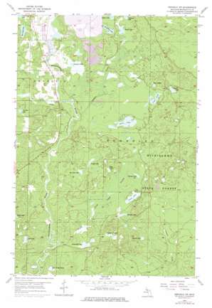
Republic Sw Topo Map Michigan
To zoom in, hover over the map of Republic Sw
USGS Topo Quad 46087c8 - 1:24,000 scale
| Topo Map Name: | Republic Sw |
| USGS Topo Quad ID: | 46087c8 |
| Print Size: | ca. 21 1/4" wide x 27" high |
| Southeast Coordinates: | 46.25° N latitude / 87.875° W longitude |
| Map Center Coordinates: | 46.3125° N latitude / 87.9375° W longitude |
| U.S. State: | MI |
| Filename: | o46087c8.jpg |
| Download Map JPG Image: | Republic Sw topo map 1:24,000 scale |
| Map Type: | Topographic |
| Topo Series: | 7.5´ |
| Map Scale: | 1:24,000 |
| Source of Map Images: | United States Geological Survey (USGS) |
| Alternate Map Versions: |
Republic SW MI 1955, updated 1957 Download PDF Buy paper map Republic SW MI 1955, updated 1977 Download PDF Buy paper map Republic SW MI 2011 Download PDF Buy paper map Republic SW MI 2014 Download PDF Buy paper map Republic SW MI 2017 Download PDF Buy paper map |
1:24,000 Topo Quads surrounding Republic Sw
> Back to 46087a1 at 1:100,000 scale
> Back to 46086a1 at 1:250,000 scale
> Back to U.S. Topo Maps home
Republic Sw topo map: Gazetteer
Republic Sw: Lakes
Beaver Lake elevation 459m 1505′Bengston Lake elevation 451m 1479′
Big Lick Lake elevation 456m 1496′
Casey Lake elevation 448m 1469′
Chain of Lakes elevation 431m 1414′
Donaldson Lake elevation 455m 1492′
Helen Lake elevation 450m 1476′
Hermit Lake elevation 431m 1414′
Hot Jack Lake elevation 451m 1479′
Just Lake elevation 437m 1433′
Lake of The Plains elevation 423m 1387′
Long Lake elevation 452m 1482′
Loon Lake elevation 455m 1492′
Lustig Lake elevation 457m 1499′
Martells Lake elevation 444m 1456′
Petcuson Lake elevation 462m 1515′
Peterson Lake elevation 451m 1479′
Porterfield Lake elevation 432m 1417′
Saint Clair Lake elevation 460m 1509′
Sunson Lake elevation 452m 1482′
Third Lake elevation 454m 1489′
Twin Lakes elevation 457m 1499′
Wahlstrom Lake elevation 449m 1473′
Republic Sw: Streams
Caps Creek elevation 441m 1446′Gambles Creek elevation 442m 1450′
Wilson Creek elevation 425m 1394′
Republic Sw: Swamps
Casey Swamp elevation 450m 1476′Republic Sw digital topo map on disk
Buy this Republic Sw topo map showing relief, roads, GPS coordinates and other geographical features, as a high-resolution digital map file on DVD:


