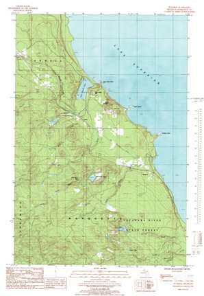
Buckroe Topo Map Michigan
To zoom in, hover over the map of Buckroe
USGS Topo Quad 46087f5 - 1:24,000 scale
| Topo Map Name: | Buckroe |
| USGS Topo Quad ID: | 46087f5 |
| Print Size: | ca. 21 1/4" wide x 27" high |
| Southeast Coordinates: | 46.625° N latitude / 87.5° W longitude |
| Map Center Coordinates: | 46.6875° N latitude / 87.5625° W longitude |
| U.S. State: | MI |
| Filename: | o46087f5.jpg |
| Download Map JPG Image: | Buckroe topo map 1:24,000 scale |
| Map Type: | Topographic |
| Topo Series: | 7.5´ |
| Map Scale: | 1:24,000 |
| Source of Map Images: | United States Geological Survey (USGS) |
| Alternate Map Versions: |
Buckroe MI 1985, updated 1985 Download PDF Buy paper map Buckroe MI 2011 Download PDF Buy paper map Buckroe MI 2014 Download PDF Buy paper map Buckroe MI 2017 Download PDF Buy paper map |
1:24,000 Topo Quads surrounding Buckroe
Huron Mountain |
||||
Ives Hill |
Big Bay |
Granite Point |
||
Silver Lake Basin |
Negaunee Nw |
Buckroe |
Marquette Nw |
|
Diorite |
Negaunee Sw |
Negaunee |
Marquette |
|
Greenwood |
Ishpeming |
Palmer |
Sands |
Harvey |
> Back to 46087e1 at 1:100,000 scale
> Back to 46086a1 at 1:250,000 scale
> Back to U.S. Topo Maps home
Buckroe topo map: Gazetteer
Buckroe: Capes
Saux Head Point elevation 184m 603′Thoneys Point elevation 187m 613′
Buckroe: Falls
Little Garlic Falls elevation 249m 816′Buckroe: Islands
Garlic Island elevation 184m 603′Buckroe: Lakes
Blemhuber Lake elevation 248m 813′Dollar Lake elevation 269m 882′
Echo Lake elevation 248m 813′
First Bass Lake elevation 259m 849′
Saux Head Lake elevation 184m 603′
Buckroe: Populated Places
Birch elevation 191m 626′Buckroe elevation 192m 629′
Buckroe: Post Offices
Birch Post Office (historical) elevation 191m 626′Buckroe: Streams
Big Garlic River elevation 184m 603′Birch Creek elevation 185m 606′
Little Garlic River elevation 184m 603′
Nash Creek elevation 193m 633′
Sawmill Creek elevation 187m 613′
Wilson Creek elevation 186m 610′
Buckroe: Summits
Garlic Mountain elevation 260m 853′Saux Head Hill elevation 229m 751′
Buckroe digital topo map on disk
Buy this Buckroe topo map showing relief, roads, GPS coordinates and other geographical features, as a high-resolution digital map file on DVD:


