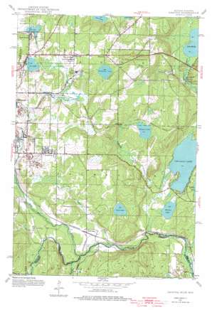
Gaastra Topo Map Michigan
To zoom in, hover over the map of Gaastra
USGS Topo Quad 46088a5 - 1:24,000 scale
| Topo Map Name: | Gaastra |
| USGS Topo Quad ID: | 46088a5 |
| Print Size: | ca. 21 1/4" wide x 27" high |
| Southeast Coordinates: | 46° N latitude / 88.5° W longitude |
| Map Center Coordinates: | 46.0625° N latitude / 88.5625° W longitude |
| U.S. States: | MI, WI |
| Filename: | o46088a5.jpg |
| Download Map JPG Image: | Gaastra topo map 1:24,000 scale |
| Map Type: | Topographic |
| Topo Series: | 7.5´ |
| Map Scale: | 1:24,000 |
| Source of Map Images: | United States Geological Survey (USGS) |
| Alternate Map Versions: |
Gaastra MI 1944, updated 1956 Download PDF Buy paper map Gaastra MI 1944, updated 1976 Download PDF Buy paper map Gaastra MI 2011 Download PDF Buy paper map Gaastra MI 2014 Download PDF Buy paper map Gaastra MI 2017 Download PDF Buy paper map |
| FStopo: | US Forest Service topo Gaastra is available: Download FStopo PDF Download FStopo TIF |
1:24,000 Topo Quads surrounding Gaastra
> Back to 46088a1 at 1:100,000 scale
> Back to 46088a1 at 1:250,000 scale
> Back to U.S. Topo Maps home
Gaastra topo map: Gazetteer
Gaastra: Lakes
Bates Lake elevation 491m 1610′Chicagon Lake elevation 436m 1430′
Ice Lake elevation 478m 1568′
Lake Emily elevation 431m 1414′
Lake Sixteen elevation 478m 1568′
Minnie Lake elevation 437m 1433′
Scott Lake elevation 454m 1489′
Wagner Lake elevation 463m 1519′
Wildwood Lake elevation 490m 1607′
Gaastra: Mines
Bates Mine elevation 495m 1624′Bengal Mine elevation 482m 1581′
Rogers Mine elevation 485m 1591′
Gaastra: Parks
Brule River Cliffs State Natural Area elevation 458m 1502′First Roadside Park Historical Marker elevation 525m 1722′
Ice Lake Park elevation 480m 1574′
Indian Village Historical Marker elevation 440m 1443′
Pentoga Park elevation 441m 1446′
Gaastra: Populated Places
Bates Junction elevation 472m 1548′Bates Location elevation 515m 1689′
Chicagon elevation 435m 1427′
Gaastra elevation 494m 1620′
Mapleton elevation 506m 1660′
Palatka elevation 446m 1463′
Rogers Location elevation 494m 1620′
Scott Lake elevation 440m 1443′
Gaastra: Post Offices
Gaastra Post Office elevation 507m 1663′Mapleton Post Office (historical) elevation 506m 1660′
Saunders Post Office (historical) elevation 440m 1443′
Gaastra: Streams
Iron River elevation 427m 1400′Olson Creek elevation 424m 1391′
Wagner Creek elevation 436m 1430′
Wisconsin Creek elevation 426m 1397′
Gaastra digital topo map on disk
Buy this Gaastra topo map showing relief, roads, GPS coordinates and other geographical features, as a high-resolution digital map file on DVD:


