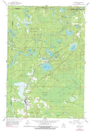
Channing Topo Map Michigan
To zoom in, hover over the map of Channing
USGS Topo Quad 46088b1 - 1:24,000 scale
| Topo Map Name: | Channing |
| USGS Topo Quad ID: | 46088b1 |
| Print Size: | ca. 21 1/4" wide x 27" high |
| Southeast Coordinates: | 46.125° N latitude / 88° W longitude |
| Map Center Coordinates: | 46.1875° N latitude / 88.0625° W longitude |
| U.S. State: | MI |
| Filename: | o46088b1.jpg |
| Download Map JPG Image: | Channing topo map 1:24,000 scale |
| Map Type: | Topographic |
| Topo Series: | 7.5´ |
| Map Scale: | 1:24,000 |
| Source of Map Images: | United States Geological Survey (USGS) |
| Alternate Map Versions: |
Channing MI 1955, updated 1957 Download PDF Buy paper map Channing MI 1955, updated 1978 Download PDF Buy paper map Channing MI 2011 Download PDF Buy paper map Channing MI 2014 Download PDF Buy paper map Channing MI 2016 Download PDF Buy paper map |
1:24,000 Topo Quads surrounding Channing
> Back to 46088a1 at 1:100,000 scale
> Back to 46088a1 at 1:250,000 scale
> Back to U.S. Topo Maps home
Channing topo map: Gazetteer
Channing: Forests
Michigamme State Forest elevation 443m 1453′Channing: Lakes
Cameron Lake elevation 426m 1397′Cassagranda Lake elevation 433m 1420′
Coy Lake elevation 433m 1420′
Crescent Pond elevation 428m 1404′
Doan Lakes elevation 424m 1391′
Edey Lake elevation 424m 1391′
Edgar Lake elevation 426m 1397′
Floodwood Lakes elevation 424m 1391′
Lake Charles elevation 439m 1440′
Long Lake elevation 424m 1391′
Parlemee Lake elevation 426m 1397′
Pickerel Lake elevation 437m 1433′
Railroad Lake elevation 425m 1394′
Round Lake elevation 426m 1397′
Sawyer Lake elevation 424m 1391′
Silver Lake elevation 427m 1400′
Weber Lake elevation 418m 1371′
Channing: Populated Places
Channing elevation 427m 1400′Floodwood elevation 437m 1433′
Golden elevation 402m 1318′
Channing: Post Offices
Channing Post Office elevation 427m 1400′Floodwood Post Office (historical) elevation 437m 1433′
Channing: Streams
Crescent Pond Outlet elevation 418m 1371′Squaw Creek elevation 426m 1397′
Channing digital topo map on disk
Buy this Channing topo map showing relief, roads, GPS coordinates and other geographical features, as a high-resolution digital map file on DVD:


