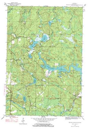
Kelso Junction Topo Map Michigan
To zoom in, hover over the map of Kelso Junction
USGS Topo Quad 46088b3 - 1:24,000 scale
| Topo Map Name: | Kelso Junction |
| USGS Topo Quad ID: | 46088b3 |
| Print Size: | ca. 21 1/4" wide x 27" high |
| Southeast Coordinates: | 46.125° N latitude / 88.25° W longitude |
| Map Center Coordinates: | 46.1875° N latitude / 88.3125° W longitude |
| U.S. State: | MI |
| Filename: | o46088b3.jpg |
| Download Map JPG Image: | Kelso Junction topo map 1:24,000 scale |
| Map Type: | Topographic |
| Topo Series: | 7.5´ |
| Map Scale: | 1:24,000 |
| Source of Map Images: | United States Geological Survey (USGS) |
| Alternate Map Versions: |
Kelso Junction MI 1945, updated 1968 Download PDF Buy paper map Kelso Junction MI 1945, updated 1979 Download PDF Buy paper map Kelso Junction MI 1947, updated 1947 Download PDF Buy paper map Kelso Junction MI 2011 Download PDF Buy paper map Kelso Junction MI 2014 Download PDF Buy paper map Kelso Junction MI 2017 Download PDF Buy paper map |
1:24,000 Topo Quads surrounding Kelso Junction
> Back to 46088a1 at 1:100,000 scale
> Back to 46088a1 at 1:250,000 scale
> Back to U.S. Topo Maps home
Kelso Junction topo map: Gazetteer
Kelso Junction: Dams
Gagnon Dam elevation 425m 1394′Kelso Junction: Lakes
Light Lake elevation 420m 1377′Liver Lake elevation 420m 1377′
Lost Lake elevation 420m 1377′
Lower Holmes Lake elevation 411m 1348′
Polliwog Lake elevation 415m 1361′
Upper Holmes Lake elevation 416m 1364′
Kelso Junction: Populated Places
Kelso Junction elevation 414m 1358′Kelso Junction: Reservoirs
McCutcheon Lake elevation 427m 1400′Kelso Junction: Streams
Deer River elevation 421m 1381′Kelso Creek elevation 421m 1381′
Kelso River elevation 409m 1341′
McCutcheon Creek elevation 420m 1377′
Premo Creek elevation 420m 1377′
Saint Paul Creek elevation 408m 1338′
Shenky Creek elevation 422m 1384′
West Branch McCutcheon Creek elevation 427m 1400′
Kelso Junction digital topo map on disk
Buy this Kelso Junction topo map showing relief, roads, GPS coordinates and other geographical features, as a high-resolution digital map file on DVD:


