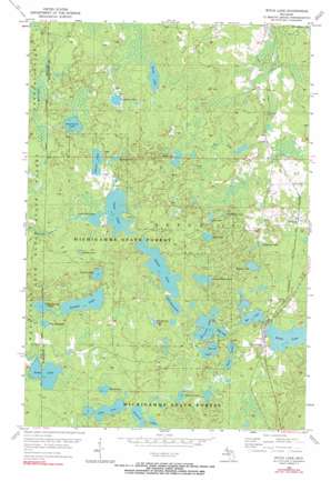
Witch Lake Topo Map Michigan
To zoom in, hover over the map of Witch Lake
USGS Topo Quad 46088c1 - 1:24,000 scale
| Topo Map Name: | Witch Lake |
| USGS Topo Quad ID: | 46088c1 |
| Print Size: | ca. 21 1/4" wide x 27" high |
| Southeast Coordinates: | 46.25° N latitude / 88° W longitude |
| Map Center Coordinates: | 46.3125° N latitude / 88.0625° W longitude |
| U.S. State: | MI |
| Filename: | o46088c1.jpg |
| Download Map JPG Image: | Witch Lake topo map 1:24,000 scale |
| Map Type: | Topographic |
| Topo Series: | 7.5´ |
| Map Scale: | 1:24,000 |
| Source of Map Images: | United States Geological Survey (USGS) |
| Alternate Map Versions: |
Witch Lake MI 1955, updated 1956 Download PDF Buy paper map Witch Lake MI 1955, updated 1974 Download PDF Buy paper map Witch Lake MI 1955, updated 1990 Download PDF Buy paper map Witch Lake MI 2011 Download PDF Buy paper map Witch Lake MI 2014 Download PDF Buy paper map Witch Lake MI 2017 Download PDF Buy paper map |
1:24,000 Topo Quads surrounding Witch Lake
> Back to 46088a1 at 1:100,000 scale
> Back to 46088a1 at 1:250,000 scale
> Back to U.S. Topo Maps home
Witch Lake topo map: Gazetteer
Witch Lake: Lakes
Bat Lake elevation 456m 1496′Bed Spring Lake elevation 462m 1515′
Berch Lake elevation 481m 1578′
Boys Lake elevation 479m 1571′
Bullhead Lake elevation 472m 1548′
Camp Fifteen Lake elevation 466m 1528′
Chief Lake elevation 464m 1522′
Cranberry Lake elevation 477m 1564′
Dollar Lake elevation 469m 1538′
Fence Lake elevation 439m 1440′
Grant Lake elevation 497m 1630′
Harris Lake elevation 443m 1453′
Haywire Lake elevation 471m 1545′
Heart Lake elevation 444m 1456′
Horseshoe Lake elevation 452m 1482′
Island Lake elevation 452m 1482′
Island Lake elevation 470m 1541′
Lake Elizabeth elevation 451m 1479′
Lily Lake elevation 471m 1545′
Little Chief Lake elevation 464m 1522′
Little Squaw Lake elevation 461m 1512′
Little Sundog Lake elevation 447m 1466′
Lotto Lake elevation 437m 1433′
Mud Lake elevation 452m 1482′
Penglase Lake elevation 491m 1610′
Pickerel Lake elevation 437m 1433′
Simons Lake elevation 476m 1561′
Spring Lake elevation 454m 1489′
Springhole Lake elevation 471m 1545′
Squaw Lake elevation 461m 1512′
Sundog Lake elevation 447m 1466′
Twin Lakes elevation 450m 1476′
Witch Lake elevation 446m 1463′
Witch Lake: Populated Places
Witbeck elevation 468m 1535′Witch Lake elevation 455m 1492′
Witch Lake: Post Offices
Witch Lake Post Office (historical) elevation 455m 1492′Witch Lake digital topo map on disk
Buy this Witch Lake topo map showing relief, roads, GPS coordinates and other geographical features, as a high-resolution digital map file on DVD:


