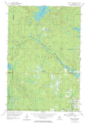
Witch Lake Ne Topo Map Michigan
To zoom in, hover over the map of Witch Lake Ne
USGS Topo Quad 46088d1 - 1:24,000 scale
| Topo Map Name: | Witch Lake Ne |
| USGS Topo Quad ID: | 46088d1 |
| Print Size: | ca. 21 1/4" wide x 27" high |
| Southeast Coordinates: | 46.375° N latitude / 88° W longitude |
| Map Center Coordinates: | 46.4375° N latitude / 88.0625° W longitude |
| U.S. State: | MI |
| Filename: | o46088d1.jpg |
| Download Map JPG Image: | Witch Lake Ne topo map 1:24,000 scale |
| Map Type: | Topographic |
| Topo Series: | 7.5´ |
| Map Scale: | 1:24,000 |
| Source of Map Images: | United States Geological Survey (USGS) |
| Alternate Map Versions: |
Witch Lake NE MI 1955, updated 1956 Download PDF Buy paper map Witch Lake NE MI 1955, updated 1974 Download PDF Buy paper map Witch Lake NE MI 2011 Download PDF Buy paper map Witch Lake NE MI 2014 Download PDF Buy paper map Witch Lake NE MI 2016 Download PDF Buy paper map |
1:24,000 Topo Quads surrounding Witch Lake Ne
> Back to 46088a1 at 1:100,000 scale
> Back to 46088a1 at 1:250,000 scale
> Back to U.S. Topo Maps home
Witch Lake Ne topo map: Gazetteer
Witch Lake Ne: Lakes
Dashwa Lake elevation 476m 1561′Goose Lake elevation 483m 1584′
Juncob Lake elevation 457m 1499′
Lake Michigamme elevation 473m 1551′
Nirish Lake elevation 489m 1604′
Northwest Lake elevation 494m 1620′
Perch Lake elevation 469m 1538′
Saint Johns Lake elevation 503m 1650′
Witch Lake Ne: Streams
Mill Creek elevation 463m 1519′Spruce River elevation 460m 1509′
Witch Lake Ne digital topo map on disk
Buy this Witch Lake Ne topo map showing relief, roads, GPS coordinates and other geographical features, as a high-resolution digital map file on DVD:


