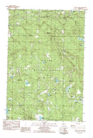
Glitter Lake Topo Map Michigan
To zoom in, hover over the map of Glitter Lake
USGS Topo Quad 46088d7 - 1:25,000 scale
| Topo Map Name: | Glitter Lake |
| USGS Topo Quad ID: | 46088d7 |
| Print Size: | ca. 21 1/4" wide x 27" high |
| Southeast Coordinates: | 46.375° N latitude / 88.75° W longitude |
| Map Center Coordinates: | 46.4375° N latitude / 88.8125° W longitude |
| U.S. State: | MI |
| Filename: | l46088d7.jpg |
| Download Map JPG Image: | Glitter Lake topo map 1:25,000 scale |
| Map Type: | Topographic |
| Topo Series: | 7.5´ |
| Map Scale: | 1:25,000 |
| Source of Map Images: | United States Geological Survey (USGS) |
| Alternate Map Versions: |
Glitter Lake MI 1982, updated 1983 Download PDF Buy paper map |
| FStopo: | US Forest Service topo Glitter Lake is available: Download FStopo PDF Download FStopo TIF |
1:24,000 Topo Quads surrounding Glitter Lake
> Back to 46088a1 at 1:100,000 scale
> Back to 46088a1 at 1:250,000 scale
> Back to U.S. Topo Maps home
Glitter Lake topo map: Gazetteer
Glitter Lake: Lakes
Beitner Lake elevation 464m 1522′Beller Pond elevation 473m 1551′
Chicken Lake elevation 467m 1532′
Dunn Lake elevation 478m 1568′
Gabbit Lake elevation 472m 1548′
Gasley Lake elevation 477m 1564′
Glare Lake elevation 457m 1499′
Glitter Lake elevation 457m 1499′
LaCrosse Lake elevation 472m 1548′
Lake Thirteen elevation 449m 1473′
Muffle Lake elevation 470m 1541′
Papoose Lake elevation 482m 1581′
Pathic Lake elevation 469m 1538′
Syrup Lake elevation 492m 1614′
Thomas Lake elevation 452m 1482′
Three-On Lake elevation 461m 1512′
Glitter Lake: Post Offices
Kitchi Post Office (historical) elevation 384m 1259′Glitter Lake: Reservoirs
Lower Dam Lake elevation 407m 1335′Glitter Lake: Springs
Passmore Springs elevation 490m 1607′Glitter Lake: Streams
Antoine Creek elevation 463m 1519′Dunn Creek elevation 459m 1505′
Glitter Creek elevation 417m 1368′
Johns Creek elevation 400m 1312′
Lake Thirteen Creek elevation 388m 1272′
Passmore Creek elevation 470m 1541′
Smith Creek elevation 368m 1207′
Spargo Creek elevation 370m 1213′
Stony Creek elevation 363m 1190′
Glitter Lake: Summits
Haystack Mountain elevation 441m 1446′Glitter Lake digital topo map on disk
Buy this Glitter Lake topo map showing relief, roads, GPS coordinates and other geographical features, as a high-resolution digital map file on DVD:


